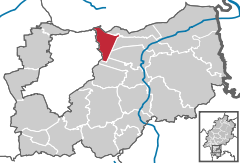
- Messel
-
Messel 
Coordinates 49°56′N 8°44′E / 49.93333°N 8.73333°ECoordinates: 49°56′N 8°44′E / 49.93333°N 8.73333°E Administration Country Germany State Hesse Admin. region Darmstadt District Darmstadt-Dieburg Mayor Udo Henke Basic statistics Area 14.82 km2 (5.72 sq mi) Elevation 172 m (564 ft) Population 3,792 (31 December 2010)[1] - Density 256 /km2 (663 /sq mi) Other information Time zone CET/CEST (UTC+1/+2) Licence plate DA Postal code 64409 Area code 06159 Website www.messel.de Messel is a municipality in the district of Darmstadt-Dieburg in Hesse near Frankfurt am Main in Germany.
The village is first mentioned, as Masilla, in the Lorsch codex. Messel was the property of the lords of Groschlag from ca. 1400 to 1799. After the extinction of the Groschlag male lineage, the village would have passed to the Archbishopric of Mainz but the population refused to accept this transition and paid homage to the daughters of the Groschlag family instead. The minister of the archbishopric, von Albini, consequently occupied the village with a force of 50 hussars. In 1806, the village fell to the Grand Duchy of Hesse.
The nearby Messel pit is an important site for Eocene fossils.
References
- ^ "Die Bevölkerung der hessischen Gemeinden" (in German). Hessisches Statistisches Landesamt. 31 December 2010. http://www.statistik-hessen.de/static/publikationen/A/AI2_AII_AIII_AV_10-1hj_pdf.zip.
Alsbach-Hähnlein | Babenhausen | Bickenbach | Dieburg | Eppertshausen | Erzhausen | Fischbachtal | Griesheim | Groß-Bieberau | Groß-Umstadt | Groß-Zimmern | Messel | Modautal | Mühltal | Münster | Ober-Ramstadt | Otzberg | Pfungstadt | Reinheim | Roßdorf | Schaafheim | Seeheim-Jugenheim | WeiterstadtCategories:- Municipalities in Hesse
- Darmstadt-Dieburg
- Hesse geography stubs
Wikimedia Foundation. 2010.


