- Manihari
-
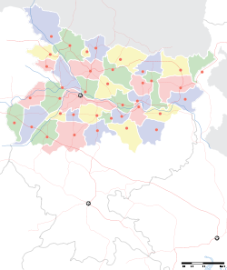
Manihari — town — Coordinates 25°21′N 87°38′E / 25.35°N 87.63°ECoordinates: 25°21′N 87°38′E / 25.35°N 87.63°E Country India State Bihar District(s) Katihar Parliamentary constituency Katihar Assembly constituency Manihari Population 21,783 (2001[update]) Time zone IST (UTC+05:30) Area
• 31 metres (102 ft)
Website katihar.bih.nic.in/ Manihari is a town and a notified area in Katihar district in the Indian state of Bihar.
Contents
Geography
Manihari is located at 25°21′N 87°38′E / 25.35°N 87.63°E[1]. It has an average elevation of 31 metres (101 feet). This place is well known for the Manihari ghat, which connects it to Sahibganj, which is also situated on the bank of the river Gangaes.
Demographics
As of 2001[update] India census[2], Manihari had a population of 21,783. Males constitute 53% of the population and females 47%. Manihari has an average literacy rate of 44%, lower than the national average of 59.5%: male literacy is 52%, and female literacy is 35%. In Manihari, 19% of the population is under 6 years of age.
Geography
The town is located on the banks of the river Ganges where it meets the river Koshi, thus making the town prone to flooding every year. Manihari is a small border town between the stateBihar and Jharkhand. Sahebganj is the district town of Jharkhand which is 9 km from Manihari (Nautical mile distance), there is regular ferry service between Manihari and Sahibganj. Manihari is connected by railway link on metre gauge (MG). There are few local trains which run between Manihari and Katihar.
Manihari Ghat
Before Farakka Barrage was constructed, people going to the Darjeeling Hills or North Bengal from Kolkata, used to travel by a Broad Gauge train to Sakrigali Ghat and then cross the Ganges by steamer. On the other side of the river at Manihari Ghat, they used to take a metre gauge train to Siliguri.[3]Once Farakka Barrage was constructed, this route became redundant. There still is a ferry service linking Manihari Ghat with Sahebganj.
Education
There are two high schools and few gov schools, and private school.or college. 1.B.P.S.P.Senior Secondary School 2.P.L.S.N. Girls Senior Secondary School Principal-Md.Sayeedur Rahaman Teachers-Chandrabali Prasad(Sosc),Surendra prasad(Sosc),Bijay Mandal(Eng),Rashmi Nisha(Hin),Anjana Kumari(Snk),Kamlesh choudhary(Math),Rajesh Kumar(Sosc),Rijwanul Haque(Urd),Tauwab Ahmad(sc) 3.s.s.s.mandir school(p) 4.national public school(P) 5.s.j.pandey sanskrit vidaylaye 6.rameshwer yadav manihari college manihari.(gov and pvt) 7.b.m.s.(p) 8.grukul puplic school.(p) 9.n.p.s(p)
References
- ^ Falling Rain Genomics, Inc - Manihari
- ^ "Census of India 2001: Data from the 2001 Census, including cities, villages and towns (Provisional)". Census Commission of India. Archived from the original on 2004-06-16. http://web.archive.org/web/20040616075334/http://www.censusindia.net/results/town.php?stad=A&state5=999. Retrieved 2008-11-01.
- ^ "my school i wish". Madhyamgram Re-visited after 15 years. http://goethals1907-2007.blogspot.com/2007_10_01_archive.html. Retrieved 2011-01-23.
Cities and towns in Purnia Division Araria district Katihar district Kishanganj district Bahadurganj • Kishanganj • ThakurganjPurnia district See also Purnia division topicsCities and towns
in other DivisionsCategories:- Railway stations in Bihar
- Cities and towns in Katihar district
- Bihar geography stubs
Wikimedia Foundation. 2010.


