- Goose Hollow, Portland, Oregon
Infobox Neighborhood Portland OR
neighborhood_name = Goose Hollow
association_name = Goose Hollow Foothills League
association_website = http://www.cascadelink.org/neigh/ghfl
coalition_name = Neighbors West/Northwest
coalition_website = http://www.nwnw.org/
area = 1.17
censusyear = 2000
map_url = http://www.portlandonline.com/oni/index.cfm?&a=58379
portlandmaps_x = 7640077.965
portlandmaps_y = 683173.038
pop_total = 5433
pop_density = 4644
households_total = 3792
occupancy = 91
households_owned = 540
households_owned_pct = 14
households_rented = 3252
households_rented_pct = 86
household_size = 1.43
footnotes =Goose Hollow is a
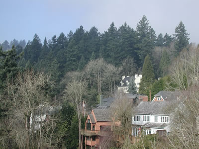
neighborhood in southwestPortland, Oregon . It acquired its distinctive name through early residents’ practice of letting their geese run free throughout the wooded hollow in theTualatin Mountains . It is adjacent toDowntown Portland , thePearl District , the Hillside neighborhood, and Washington Park.PGE Park and Lincoln High School (oldest in thePacific Northwest ) are in Goose Hollow. Former MayorBud Clark 's Goose Hollow Inn is a long-time neighborhood hang out.The
MAX Light Rail system travels through the neighborhood, stopping at the PGE Park, Kings Hill/SW Salmon and Goose Hollow/SW Jefferson St stations. Goose Hollow is also served by two major freeways: Interstate 405 (which divides it from Downtown Portland) and U.S. Route 26 (which passes under part of the neighborhood through theVista Ridge Tunnels ).The Railway features in the opening seconds of the new age movie "What the Bleep Do We Know!? "External links
* [http://www.portlandneighborhood.com/goosehollow.html Guide to Goose Hollow Neighborhood] (PortlandNeighborhood.com)
* [http://www.portlandonline.com/parks/finder/index.cfm?action=ViewPark&PropertyID=900 Jefferson Street Property] - 1.6 acre natural area, acquired by Portland Parks and Recreation in 1995
* [http://www.portlandonline.com/shared/cfm/image.cfm?id=89750 Goose Hollow Light Rail Station Community: Urban Design Plan and Comprehensive Plan] (PDF maps, 1996)
*Mapit-US-cityscale|45.51963|-122.69299
Wikimedia Foundation. 2010.