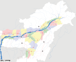
- Doom Dooma
-
Doom Dooma — city — Coordinates 27°34′N 95°34′E / 27.57°N 95.57°ECoordinates: 27°34′N 95°34′E / 27.57°N 95.57°E Country India State Assam District(s) Tinsukia Population 19,822 (2001[update]) Time zone IST (UTC+05:30) Area
• 114 metres (374 ft)
Codes-
• Pincode • 786151
DoomDooma (also spelt as DumDuma) is a town and a town area committee in Tinsukia district in the state of Assam, India.
Contents
Demographics
As of 2001[update] India census,[1] DoomDooma had a population of 19,822. Males constitute 55% of the population and females 45%. DoomDooma has an average literacy rate of 70%, higher than the national average of 59.5%: male literacy is 75% and, female literacy is 63%. In DoomDooma, 12% of the population is under 6 years of age.
Etymology
Once the city was covered with jungle, mainly populated by elephants. The name, Doom Dooma, sounds like the footfalls of elephants running: "dumdum"[citation needed].
History
It was under the Ahom Dynasty before the impact of the British on Assam. But Doom Dooma was an underdeveloped city during the rule of the Ahom Dynasty, in fact it can be said that the place was almost nameless during the period of the Ahoms. So we can say that it were the British who gave a proper name to the city. British had noticed Assam, especially Doom Dooma as an excellent place for the cultivation of tea. Now, Doom Dooma has the largest tea gardens in Asia. Hence it is right to say that Doom Dooma generates a sizable amount of currency for the Indian government from its tea exports.
Geography and climate
DoomDooma is located at 27°34′N 95°34′E / 27.57°N 95.57°E.[2] It has an average elevation of 114 m (374 ft). It is situated on the bank of Doomdooma river, a tributary of River Brahmaputra. The place is also popular for its great rain fall and during some year it breaks all the records of rainfall. In the season of summer, the temperature varies from 35 to 40 degree Celsius. On account of the heavy rainfall in all the areas of Assam, Doom Dooma is prone to flood with almost half the city submerging under flood waters every year.
DoomDooma is a circle of Tinisukia. The town itself is surrounded by tea gardens and is known as the Tea City of Assam. The scenic beauty of the place and surroundings easily captivates the mind of a stranger.
Education
Doom Dooma has many schools and colleges like Don Bosco School, Hoonlal Higher Secondary School, Jawahar Hindi high English school, Learners' High School, Saint Mary's School, Doom Dooma girls school, Bongiya vidyalya, Middle school, L.P. school, Doomdooma college, Don Bosco College, Kendriya Vidyalaya(ARC).Hoonlall High School is the oldest Assamese Medium High School.
Transport
The main transportation use by public is bus but it also has train facilities (running between Tinsukia and Dangri). Nowadays autos are becoming a popular means of transportation here and it has a private airport under A.R.C.
Economy
Due to the region's fertility in tea its economy is better than the surrounding areas. Hindustan Unilever Group (HLL) is situated near the area and hence the unemployment problem of the city also reduced. There is also an aviation base of the Indian government, known as ARC (Aviation Research Centre), where government officials also can board.
Culture
People following different religions resides peacefully in Doom Dooma which includes Hindus (40%) Christians (5%) Muslims (30%) and Sikhs (10%)[citation needed]. It also has many Namghars (Assamese Prayer Temple), Temples, Mosques, Gurudwaras, Churches, Bodh temple.
Recent activities
In the year 2006 a riot took place in Assam, which also affected Doomdooma but to a negligible extent. The company HLL got threats from the extremist group ULFA, and within two years ULFA also damaged a part of the company by a rocket attack[citation needed].
Politics
Doom Dooma is part of Lakhimpur (Lok Sabha constituency).[3]
References
- ^ "Census of India 2001: Data from the 2001 Census, including cities, villages and towns (Provisional)". Census Commission of India. Archived from the original on 2004-06-16. http://web.archive.org/web/20040616075334/http://www.censusindia.net/results/town.php?stad=A&state5=999. Retrieved 2008-11-01.
- ^ Falling Rain Genomics, Inc - DoomDooma
- ^ "List of Parliamentary & Assembly Constituencies". Assam. Election Commission of India. http://archive.eci.gov.in/se2001/background/S03/AS_ACPC.pdf. Retrieved 2008-10-06.
Categories:- Cities and towns in Tinsukia district
- Tinsukia
-
Wikimedia Foundation. 2010.


