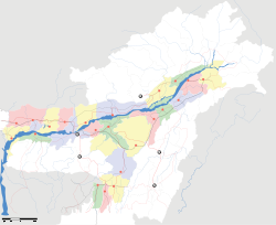
- Dhekiajuli
-
Dhekiajuli — city — Coordinates 26°42′N 92°30′E / 26.7°N 92.5°ECoordinates: 26°42′N 92°30′E / 26.7°N 92.5°E Country India State Assam District(s) Sonitpur Population 19,743 (2001[update]) Time zone IST (UTC+05:30) Area
• 100 metres (330 ft)
Dhekiajuli is a city and a municipal board in Sonitpur district in the state of Assam, India.
Contents
Geography
Dhekiajuli is located at 26°42′N 92°30′E / 26.7°N 92.5°E.[1] It has an average elevation of 100 metres (328 feet). There are several tea estates in its vicinity. Some of the major ones include Sapoi, Julia, Dibrudarrang, Tinkhuria and Dhekiajuli TE, Panbari TE (Kanoi Groups of Co.)etc. It is also very close to the Orang National Park.
Demographics
As of 2001[update] India census,[2] Dhekiajuli had a population of 19,743. Males constitute 53% of the population and females 47%. Dhekiajuli has an average literacy rate of 74%, higher than the national average of 59.5%: male literacy is 79% and, female literacy is 69%. In Dhekiajuli, 10% of the population is under 6 years of age. The town is a fairly active commercial place, thanks largely to the presence of several tea estates in its vicinity.
Politics
Dhekiajuli is part of Tezpur (Lok Sabha constituency).[3]
References
- ^ Falling Rain Genomics, Inc - Dhekiajuli
- ^ "Census of India 2001: Data from the 2001 Census, including cities, villages and towns (Provisional)". Census Commission of India. Archived from the original on 2004-06-16. http://web.archive.org/web/20040616075334/http://www.censusindia.net/results/town.php?stad=A&state5=999. Retrieved 2008-11-01.
- ^ "List of Parliamentary & Assembly Constituencies". Assam. Election Commission of India. http://archive.eci.gov.in/se2001/background/S03/AS_ACPC.pdf. Retrieved 2008-10-06.
Categories:- Cities and towns in Sonitpur district
- Sonitpur district
- Assam geography stubs
Wikimedia Foundation. 2010.


