- Cumalıkızık
-
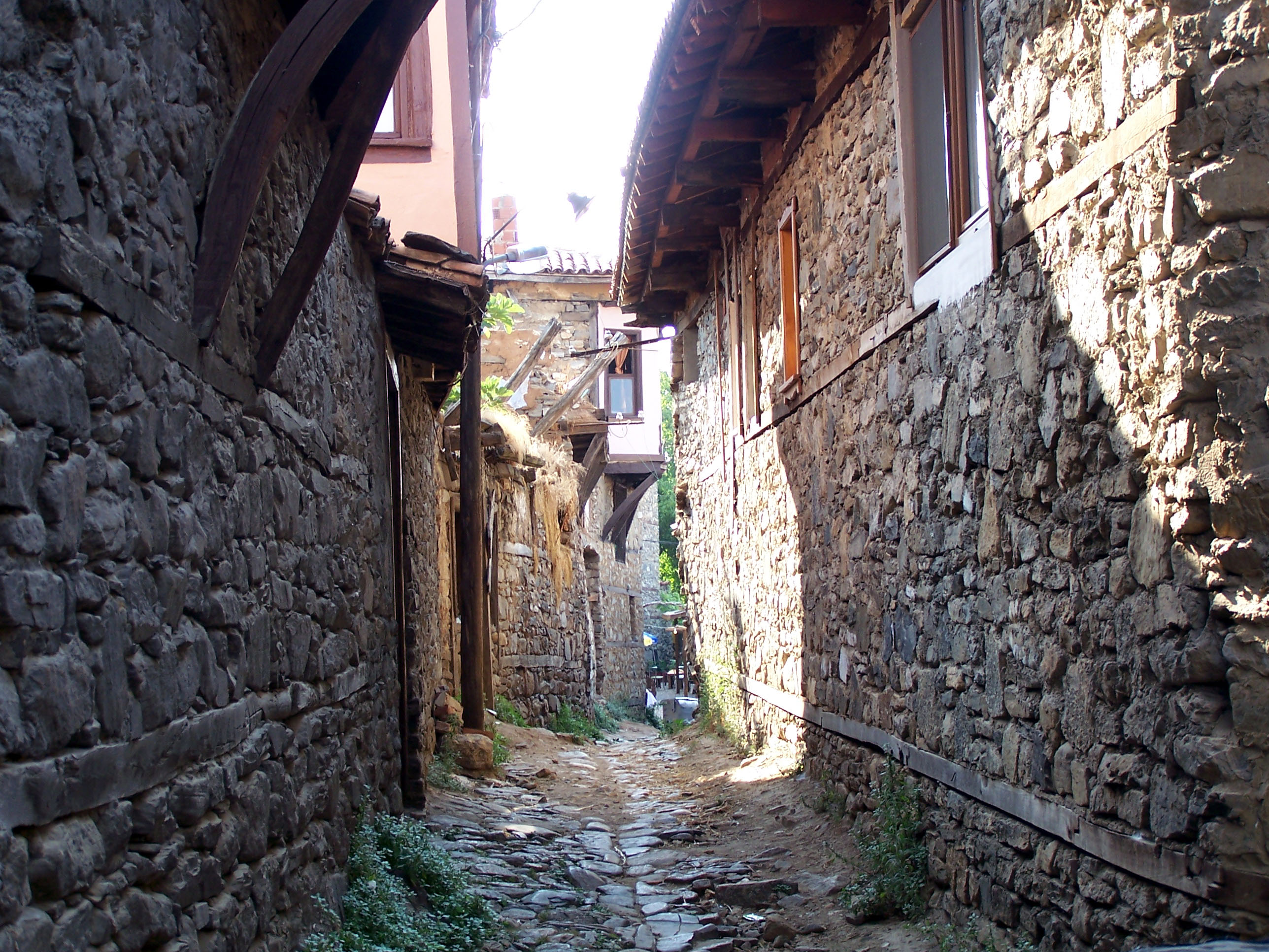
 Typical street in the village
Cumalıkızık is a village located 10 kilometers east of Bursa, at the foot of Mount Uludağ. Its history goes back to the Ottoman Empire's foundation period. The village is within the border of the Yıldırım county. Cumalıkızık was founded by a waqf village. The historical texture of the village has been well protected and the civilian countryside architectural structures of the early Ottoman period are still intact. Because of this, Cumalıkızık has become a popular but still unspoiled center for tourists.
A group of similar villages which are placed close together between the foot of mount Uludağ and the valleys have been called kızık in Turkish. The name stands for one of the twenty-four clans of the Oghuz Turks and the people from the villages also called kızık. Similar villages, less well preserved, are Değirmenlikızık, Derekızık, and Hamamlıkızık. Hamamlıkızık was the village of the local baths (hamamli), and Cumalıkızık was named because people gathered there on Friday (Cuma, in Turkish)for worship.
The Cumalıkızık ethnography museum in the village's square displays historical objects from the village. Every June there is a raspberry festival. The famous Cumalıkızık houses are made out of wood, adobe, rubblestones. Most of them are triplex houses. The windows upstairs are generally latticed and with a bay window. The handles and knockers on the main entry doors are made of wrought iron. Cobblestone streets are very narrow with no sidewalks, but a typical medieval gutter in the center for rain and waste water. A mosque, the fountain of 'Zekiye Hatun' next to the mosque and a bath with one dome are original from the Ottoman Empire. Also there is a ruin of a church built by Byzantines.
Cumalıkızık holds 270 historical houses. Some of these houses are in process of restoration and maintenance, and 180 of them are still being used as dwellings.
In 1969, the remains of a Byzantine church were unearthed southeast of the village in the foothills of Mt. Uludağ. Some architectural works are on display in the Archeological Museum of Bursa. Movies and television programs with historical settings have often been recorded in Cumalıkızık.
Aegean Black Sea Central Anatolia East Anatolia Ishak Pasha Palace · The Tombstones of Ahlat the Urartian and Ottoman citadelMarmara Mediterranean Alahan Monastery · Alanya · Ancient Cities of Lycian Civilization · Archaeological Site of Perge · Archaeological Site of Sagalassos · Güllük Dagi-Termessos National Park · Hatay, St. Pierre Church · Karain Cave · Kekova · St. Nicholas Church · St.Paul Church, St.Paul's Well and surrounding historic quarters (Tarsus)Southeastern Anatolia Harran and Sanliurfa · Mardin Cultural Landscape · The Archaeological Site of Göbeklitepe · The Citadel and the Walls of DiyarbakirAll over Turkey Seljuk Caravanserais on the route from Denizli to Dogubeyazit
Coordinates: 40°10′36″N 29°10′20″E / 40.176599°N 29.172109°E
Categories:- World Heritage Sites in Turkey
- Populated places in Bursa Province
- Marmara Region geography stubs
Wikimedia Foundation. 2010.