- Northwest Heights, Portland, Oregon
-
 Northwest Heights, Portland, Oregon
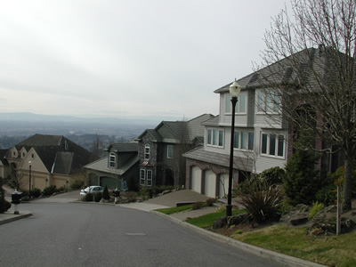
Coordinates: 45°32′28″N 122°46′12″W / 45.5411°N 122.77°W Northwest Heights is a neighborhood on the west side of Portland's West Hills. The neighborhood’s main thoroughfare is NW Skyline Boulevard, which snakes along the spine of the hills, with pockets of residential development cascading down the slopes. The neighborhood is close to the dining, shopping, and entertainment of Northwest. A short distance in the other direction is Forest Park, a vast tract of urban wilderness.
Contents
Schools
School district boundaries do not necessarily correspond to neighborhood boundaries.[1]
- Elementary
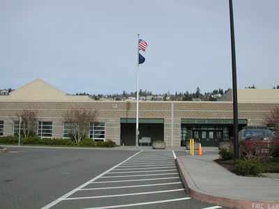
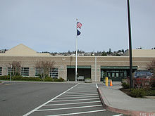 Forest Park Elementary School
- Forest Park Elementary School, 9935 NW Durrett St.
- Middle
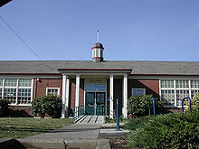 East Sylvan Middle School
- West Sylvan Middle School, 8111 SW West Slope Dr.
- East Sylvan Middle School, 1849 SW 58th Ave.
- High
- Lincoln High School, 1600 SW Salmon St.
Parks
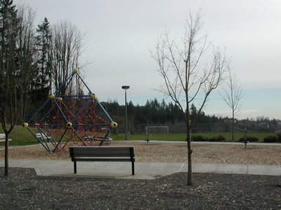
 Forest Heights Park
Forest Heights Park 2999 NW Miller Rd.
Forest Park NW 29th Ave. & NW Upshur St. to Newberry Rd.
Neighborhood organizations
Northwest Heights Neighborhood Association meets on the third Wednesday of each month at 7:00PM at Cornell Road Fire Station (8585 NW Johnson St.)
Northwest Heights Neighborhood Association is a member of Neighbors West/Northwest.
References
- ^ http://www.pps.k12.or.us/schools-c/boundaries/index0506.php pps.k12.or.us
External links
- PortlandConnected - A community site, including information about Portland neighborhoods, schools, restaurants, arts and culture
- PDF map
- Crime
Categories:- Neighborhoods in Portland, Oregon

Wikimedia Foundation. 2010.