- National Route 9 (Argentina)
-
 National Route 9
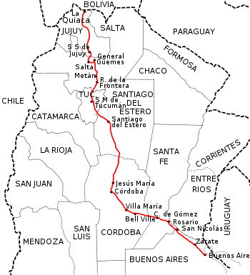
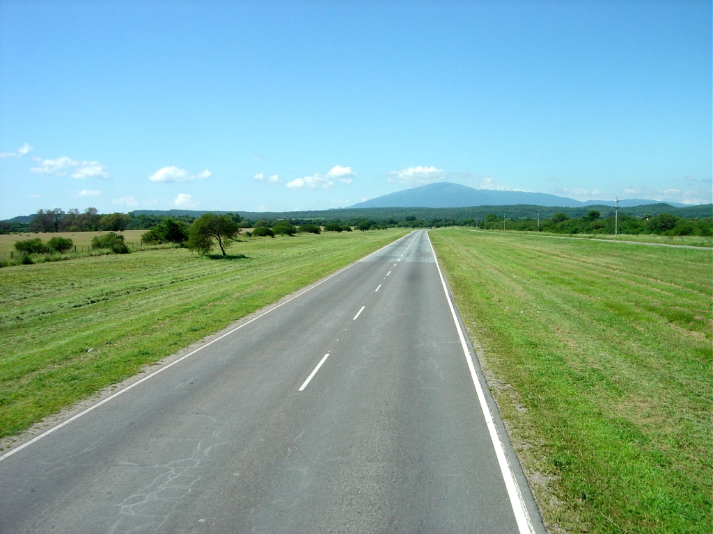
National Route 9 (in Spanish, Ruta Nacional 9) is a major road in Argentina, which runs from the center-east to the northwest of the country, crossing the provinces of Buenos Aires, Santa Fe, Córdoba, Santiago del Estero, Tucumán, Salta and Jujuy. It starts on Avenida General Paz, which marks the border between the Autonomous City of Buenos Aires and the surrounding province of the same name, and ends at the Horacio Guzmán International Bridge, on the La Quiaca river, traversing 1,967 km (1,222 mi). The road is a limited access motorway from Buenos Aires to Rosario.
Between the cities of San Nicolás de los Arroyos and Rosario (distant about 65 km (40 mi) from each other), the road is named Teniente General Pedro Eugenio Aramburu.
Contents
History
Beginnings
The route originated as the "Camino Real del Perú" (Royal Road of Peru), used since colonial times to travel from Buenos Aires, through Córdoba, Santiago del Estero, San Miguel de Tucumán, Salta, San Salvador de Jujuy, and Potosí, continuing to Perú. The section between Buenos Aires and the south of what it is today Cordoba Province, was shared with the "Camino Real del Oeste" (Royal Road of the West) which branched towards San Luis, Mendoza and Santiago (Chile). The road had a system of small inns and establishments every 30–50 km where travellers could rest.
After the coming of the railroad, in the second half of the 19th Century, this road lost relevance, as the railroad provided faster service on any type of weather. The first train from Buenos Aires arrived in the town of La Quiaca in Argentina's northern border with Bolivia on 30 December, 1907.[1]
With the advent of the automobile, the Federal Government decided to build roads throughout the Republic. In 1936 the road from Buenos Aires to La Quiaca was named Ruta Nacional 9 (National Route 9). In 1943 the road was open to traffic in its full length, even though most of it was unpaved.
The road started competing against the railroad, taking passengers and cargo. The last passenger train to La Quiaca arrived on December 1993, and the last cargo train in July 1994.[1]
Pavement
The Buenos Aires to Rosario section was paved by 27 December 1936. The work reached Córdoba on 5 June 1937.[2] It should be mentioned that National Route 9 had a different layout in those days, as the road traversed through Pilar to Pergamino on the roadbed of today's National Route 8 and then it turned north going to Rosario.
The road between Congress Square (Plaza Congreso) in Buenos Aires and San Martín Square in Córdoba was 768 km (477 mi) long, with 42 bridges, 1,412 sewer covers and 17 level crossings, with a cost of 41,000,000 pesos moneda nacional, equivalent to 12,000,000 US dollars at the time.[3] In 1939 access to Buenos Aires from Pilar was completed, passing through Campo de Mayo and San Martín.
 Change of road layout for National Route 9 in 1943.
In those days, the Buenos Aires - General Pacheco - Campana - Zárate section was part of National Route 12. In 1943 Buenos Aires Province transferred the road section Campana - San Nicolás under construction to the national government, making it part of National Route 9, along with the Buenos Aires - Campana section of Route 12. This way they shortened the road distance between the two most populous cities in Argentina. You can see in the map the new road layout of National Route 9 in red, and the old one in green.
In 1950 the Dirección Nacional de Vialidad (Public Works Dept) paved the Ramallo to San Nicolás de los Arroyos section, and between 1952 and 1953 they finished the Campana to Atucha section and in 1956 the road was fully paved from Buenos Aires to Rosario.[2]
After the change of layout in 1979, the route was fully paved except for a short piece north of Humahuaca, in Jujuy Province, which was an improved road.[4] Works to finalize the route started in 1997 and were extended until 30 April 2004,[5] opening to the public on 21 January 2005.[6]
Divided lanes
 Highway 9 leading north from Buenos Aires.
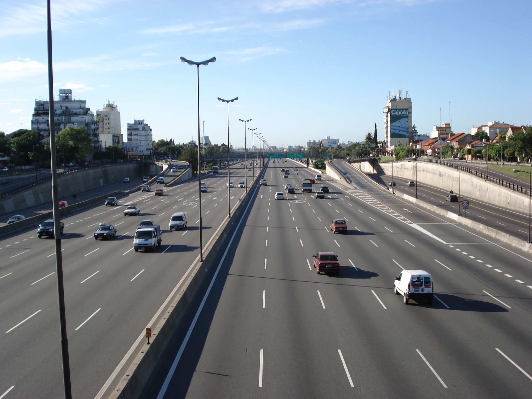
Buenos Aires - Rosario Highway
The section passing through Greater Buenos Aires to the Port of Campana access road is part of Acceso Norte. The section between Avenida General Paz (Buenos Aires city border) to the start of National Route 8 is named Autopista Pascual Palazzo (by Decree 17/1981).[7]
In 1943 the Dirección Nacional de Vialidad presented a plan for access to the city of Buenos Aires.[8] Based on this plan, by the end of the forties work was started in what is known today as "Acceso Norte" (North Access) to Buenos Aires, reaching the town of Garín in 1959. In 1971 the section Garín-Campana was opened. In 1977 the Campana-Zárate highway was opened, allowing access to the Zárate-Brazo Largo Bridge inaugurated that same year. In the year 1978 the section from San Nicolás de los Arroyos to Rosario was opened. This section is called "Teniente General Pedro Eugenio Aramburu". (Decree 2,146/1979).[7] In 1987 the last section of this highway was completed, between Campana and the Tala River.
Rosario – Córdoba Highway
The Rosario – Córdoba highway project dates from 1970.[9] On this project they would build a highway between these two cities over a new road, leaving the original road with one lane each way for local traffic, as it lies next to the Ferrocarril General Bartolomé Mitre railroad, and traverses through the center of the different towns along its path.
On 12 November 1986, construction of the new highway between Córdoba and Villa María was bid, but the project never came to fruition.[10] The highway was started by two of the contractor companies on this route in the 90s as part of the concession contracts. The agreement only included the sections from Avenida de Circunvalación de Córdoba to Pilar and from Avenida de Circunvalación de Rosario to Armstrong. On this last section, the Covicentro company only built the road to Carcarañá.
In the year 2000 the national government opened a bid for the 109 km (68 mi) between Pilar and Villa María, with the contract only covering one lane in the section from Oliva to Villa María, with the winning bid from Benito Roggio e Hijos.[11] In February 2006 the same group secured the contract from Oliva to Villa María and the 36 km (22 mi) from Villa María to Ballesteros, while the works on the 62 km (39 mi) between Ballesteros and Leones was given to the IECSA company, belonging to Grupo Macri.[12]
On 3 May 2006, the national government opened the bidding process for the remaining sections of the highway in Santa Fe Province. The DYCASA company took charge of the section between Carcarañá and Armstrong, while a joint venture of Esuco and Chediack obtained the contracts for the highway between Armstrong and Tortugas...[13][14]
The highway was fully inaugurated on 22 December 2010.
Salta Province
In the decade of the 2000s the section shared with National Route 34 in Salta Province became a four-lane road (two on each way).
Right of way changes of 1979
The National Government by Decree 1595 in 1979 where several routes changed to provincial jurisdiction and viceversa, also changed the layout and right-of-way of some of them.[15]
Greater Buenos Aires
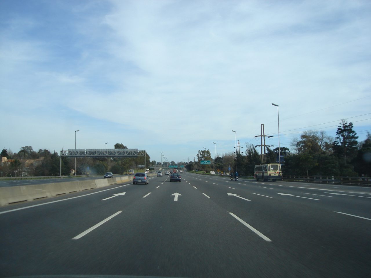
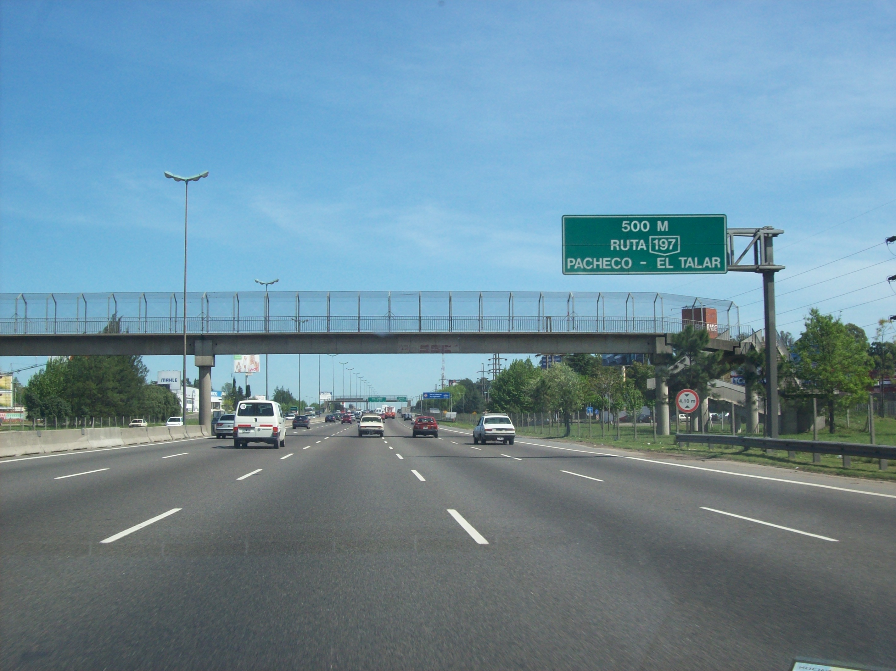
 National Route 9, San Isidro, north of Buenos Aires.
 Approaching the National Route 8 junction, El Talar.
In Greater Buenos Aires, before the completion of the Accesso Norte, Route 9 ran through the present streets Boulogne Sur Mer, Presidente Sarmiento and Constituyentes Ave. in Tigre Partido. This 15 km (9 mi) section from Don Torcuato and the border between Benavídez and Garín left national jurisdiction by the aforementioned decree. Nowadays it is part of Provincial Route 9.[16]
Buenos Aires - Santa Fe Province limits
Between San Nicolás de los Arroyos (Buenos Aires Province) and Rosario (Santa Fe Province), the road run closer to the Paraná River, northwest of the Ferrocarril General Bartolomé Mitre railway. After construction of the San Nicolás de los Arroyos - Rosario highway southeast of said railway line at the end of the 1970s, this road changed to provincial control by the aforementioned decree. The transferred sections were 16.5 km (10.3 mi) in Buenos Aires Province (how secondary Provincial Route 098-06, also known as Presidente Illia access)[17] and 68.8 km (42.8 mi) in Santa Fe Province (now Provincial Route 21).
Tucumán - Salta Province Limits
 Change of right of way in Salta Province
 Route 9, Tucumán Province.
In Salta Province, 1 km (0.6 mi) north of the Salta-Tucumán border, the road turned to the west then north, turning into a mountain road, 104 km (65 mi) packed dirt until the town of La Viña.[4] This section was transferred to Salta Province, changing its name to Provincial Route 6. Between the aforementioned town and the city of Salta, the road ran for 79 km (49 mi). This section remained under national jurisdiction, with the new name of National Route 68.
As of 2007 Provincial Route 6 is still unpaved and in some sections it is almost impassable.[18]
On 30 October 1980 the Dirección Nacional de Vialidad and its provincial counterpart signed and agreement to transfer National Route 9 inside the city of Salta between the bridge over the Arenales river and Vidt street to provincial control. The agreement was ratified by de-facto provincial law.[19]
The old road is shown in green and the new one in red in the map.
Distances and important cities
The following table shows the distances traversed by National Route 9 in each different province, and important cities that it passes by (or near).
Province From To Length Passes by Buenos Aires km 12 km 237 225 km Campana, Zárate, San Nicolás de los Arroyos Santa Fe km 237 km 419 182 km Villa Constitución, Rosario, Cañada de Gómez Córdoba km 419 km 910 491 km Bell Ville, Villa María, Córdoba Santiago del Estero km 910 km 1223 313 km Santiago del Estero, Termas de Río Hondo Tucumán km 1223 km 1371 148 km San Miguel de Tucumán Salta km 1371 km 1648 277 km Rosario de la Frontera, General Güemes, Salta Jujuy km 1648 km 1979 318 km San Salvador de Jujuy, Humahuaca, La Quiaca References
- ^ a b (Spanish) Redacción Crónica Ferroviaria (2008). "Boletín informativo número 140". Crónica Ferroviaria. Archived from the original on 2008-02-21. http://web.archive.org/web/20080221010851/http://www.cronicaferroviaria.com/boletines/boletin16012008/boletin.html. Retrieved 2008-03-22.
- ^ a b (Spanish) Dirección Nacional de Vialidad (2001). "Sabía que?". Internet Archive. Archived from the original on 2001-10-31. http://web.archive.org/web/20011031212347/http://www.vialidad.gov.ar/Biblioteca/sabiaque.html. Retrieved 2008-03-22.
- ^ (Spanish) Guía Peuser de Turismo. Buenos Aires: Editorial Peuser - Buenos Aires. 1950.
- ^ a b (Spanish) Rutas Nacionales. Centro Cartográfico Buenos Aires. c. 1975.
- ^ (Spanish) Contaduría General de la Nación (2005). "Dirección Nacional de Vialidad, informe por programa, ejercicio 2004". http://www.mecon.gov.ar/hacienda/cgn/cuenta/2004/tomoii/anexoiii1.xls. Retrieved 2008-03-22.
- ^ (Spanish) Dirección Provincial de prensa de Jujuy (2005). "Partes de prensa del 21 de enero de 2005". Internet Archive. Archived from the original on 2007-02-18. http://web.archive.org/web/20070218045254/http://www.jujuy.gov.ar/prensa/2005/enero/pp015/index.html. Retrieved 2008-03-22.
- ^ a b (Spanish) Dirección Nacional de Vialidad (2007). "Nuestras Rutas". http://www.vialidad.gov.ar/nuestrasrutas/nuestrasrutas.htm. Retrieved 2008-03-22.[dead link]
- ^ (Spanish) Domínguez Roca, Luis J. (2005). "Planes urbanos y transporte en la Ciudad de Buenos Aires". ISSN 1138-9788. http://www.ub.es/geocrit/sn/sn-194-112.htm. Retrieved 2008-03-22.
- ^ (Spanish) Revista Vial número 42 (2005). "Autopista Rosario-Córdoba: obra que se abre camino". http://www.editorialrevistas.com.ar/articulo.php?id=140. Retrieved 2008-03-22.
- ^ (Spanish) Diario La Voz del Interior (2007-8-26). "Las mismas rutas para 40% más de tránsito". http://www2.lavoz.com.ar/nota.asp?nota_id=108310. Retrieved 2008-03-22.
- ^ (Spanish) Contaduría General de la Nación (2001). "Cuenta de Inversión 2000, Ministerio de Infraestructura y Vivienda". http://www.mecon.gov.ar/hacienda/cgn/cuenta/2000/tomo_ii/13-55_ac.htm. Retrieved 2008-03-22.
- ^ (Spanish) Zysman, Guillermo (2006-2-26). "Dos tramos de la autopista a Córdoba para Macri y Benito Roggio". http://www.pagina12.com.ar/imprimir/diario/suplementos/rosario/23-2376-2006-03-03.html. Retrieved 2008-03-22.
- ^ (Spanish) Diario digital RosarioNet (25 de junio de 2007). "Prosiguen las tasaciones de terrenos incluidos en la traza de la Autopista Rosario-Córdoba". http://www.rosarionet.com.ar/rnet/regionales/notas.vsp?nid=33887. Retrieved 2008-03-22.
- ^ (Spanish) Diario La Capital (3 de mayo de 2006). "Abrieron los sobres de la licitación de la autopista Rosario-Córdoba". http://archivo.lacapital.com.ar/2006/05/03/ciudad/noticia_290512.shtml. Retrieved 2008-03-22.
- ^ (Spanish) Dirección Nacional de Vialidad (2000). "Decreto Nacional 1595/79 con comentarios" (PDF). Archived from the original on 2007-09-27. http://web.archive.org/web/20070927030116/http://www.vialidad.gov.ar/legislacion_vial/documentos/doc+pdf/Decreto+Nacional+1595+79+Aprueba+remodel+red+nacional+cami%85.pdf. Retrieved 2008-03-22.
- ^ (Spanish) Dirección de Vialidad de la Provincia de Buenos Aires (2007). "Nuestras Rutas". http://www.vialidad.gba.gov.ar/datos/nuestras_rutas/nuestras_index.htm. Retrieved 2008-03-22.
- ^ (Spanish) Instituto de Planeamiento Urbano de San Nicolás (2004). "Bases para el Desarrollo del Plan Urbano Ambiental" (PDF). http://www.ipusannicolas.gov.ar/documentos/docpua.pdf. Retrieved 2008-03-22.[dead link]
- ^ (Spanish) Curti, Pablo Alejandro (2007). Atlas de rutas Firestone Argentina, sur de Brasil, Chile, Paraguay, Uruguay. Buenos Aires: Megamapa. ISBN 987-21490-8-9.
- ^ (Spanish) Gobierno de la Provincia de Salta (1981). "Ley 5872 promulgada el 17 de diciembre de 1981". http://www.camdipsalta.gov.ar/LEYES/leyes8083/5872.htm. Retrieved 2008-03-22.
See also
National Roads in Argentina 1 · 3 · 5 · 7 · 8 · 9 · 11 · 12 · 14 · 16 · 18 · 19 · 20 · 22 · 23 · 25 · 26 · 33 · 34 · 35 · 36 · 38 · 40 · 50 · 51 · 52 · 60 · 64 · 65 · 66 · 68 · 74 · 75 · 76 · 77 · 78 · 79 · 81 · 86 · 89 · 95 · 98 · 101 · 105 · 117 · 118 · 119 · 120 · 121 · 122 · 123 · 127 · 130 · 131 · 135 · 136 · 141 · 142 · 143 · 144 · 145 · 146 · 147 · 148 · 149 · 150 · 151 · 152 · 153 · 154 · 157 · 158 · 168 · 173 · 174 · 175 · 177 · 178 · 188 · 193 · 205 · 226 · 228 · 229 · 231 · 232 · 234 · 237 · 242 · 249 · 250 · 251 · 252 · 259 · 260 · 281 · 288 · 293

- This article draws heavily on the May 2008 version of the corresponding article in the Spanish-language Wikipedia.
Categories:- Roads in Argentina


Wikimedia Foundation. 2010.