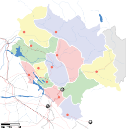
- Chail, Himachal Pradesh
-
Chail — town — Coordinates 30°58′11″N 77°11′51″E / 30.9697°N 77.1975°ECoordinates: 30°58′11″N 77°11′51″E / 30.9697°N 77.1975°E Country India State Himachal Pradesh District(s) Shimla Time zone IST (UTC+05:30) Area
• 1,833 metres (6,014 ft)
Codes-
• Vehicle • HP-51 & HP-52
 Chail palace
Chail is a hill station in Himachal Pradesh, India. It once served as the summer capital of His Highness Maharaja Adhiraj Bhupinder Singh of Patiala .
Contents
Overview
Chail is 49 km from Shimla. The Chail Palace is well known for its architecture. The cricket ground and a polo ground which is there at an altitude of 2,444 m was owned by erstwhile royal family of Patiala. The ground has the world's highest cricket ground.
Chail is also considered as the hiker's paradise. The area is away from the bustling life of the state capital Shimla.
In 1891, Maharaja Bhupinder Singh of Patiala incurred the rage of Lord Kitchener. It led to the restriction of his entry into the summer capital, Shimla. This incensed the Maharaja and he vowed to build a new summer capital for himself. So he rebuilt the place (Chail) as per his requirements.
After accession to the Indian Union, Maharaja of Patiala donated most of his buildings to Chail Military School and Government of India
Geography
Chail is situated at an altitude of - 2,250 m, higher than Shimla. The place is surrounded by the forests of chir pine and gigantic deodars. Shimla and Kasauli can also be viewed at night from here by overlooking Satluj river. Chail is pleasant in summers and cold in winter. Average annual rainfall is about 150 mm.
Chail Climate chart (explanation) J F M A M J J A S O N D 611−3693−26194531511662314175231642422154341715160161433151113532821Average max. and min. temperatures in °C Precipitation totals in mm Source: [1] Imperial conversion J F M A M J J A S O N D 2.434272.737282.448392.159522.673576.973611772591763596.361571.359520.541371.13634Average max. and min. temperatures in °F Precipitation totals in inches Attractions
- Chail Sanctuary, Sadhupul (3 km)- The sanctuary was notified on 21 March 1976 near the town in district Shimla and covers an area of about 10,854.36 hectares. The Chail sanctuary has 'ghoral', 'kakkar', 'sambhar', 'red jungle fowl' and 'khalij' and 'cheer' pheasants. Machan like sighting posts have been built at Khuruin.
- Cricket Ground- Surrounded by thick forests of deodar, a well maintained Chail Cricket ground is the highest cricket ground in the world. It was built in 1893. This ground located at an altitude of 2,444 m. It is used as the school playground by Chail Military School. During school vacations it is also used as polo ground. There is a well maintained Basket Ball court and the same cricket ground is used for playing football as the ground also has goal posts.In one corner of the ground there is a historic tree on which the Military School has constructed a beautiful tree house.[1]
- Chail Military School, situated in ancient buildings made by Maharaja of Patiala.
Access
Chail is connected by road. From Shimla via Kufri the distance is 45 km and via Kandaghat is 49 km. Kalka is 86 km away. Regular buses for Chail leave from Shimla, Chandigarh and Delhi. The closest airports are at Chandigarh (120 km) and Shimla (63 km).
- Airways- Jubbarhati airport in Shimla.
- Railways- Kalka-Shimla railways.
- Roadways- Chail has well connectivity by road.
Places To Stay
Chail has many offerings for tourists. Owing to the serene Himalayan environs, the tourist focus is now shifting from the more congested and polluted erstwhile Summer Capital of the British, Shimla to Chail.
References
External links
Categories:- Hill stations in India
- Shimla
- Cities and towns in Shimla district
- Tourism in Himachal Pradesh
-
Wikimedia Foundation. 2010.


