- Kalkandere
Infobox Settlement
settlement_type = Town
subdivision_type = Country
subdivision_name = TUR
timezone=EET
utc_offset=+2
map_caption =Location of PAGENAME within Turkey.
timezone_DST=EEST
utc_offset_DST=+3official_name = Kalkandere
image_caption =
image_blank_emblem =
blank_emblem_type =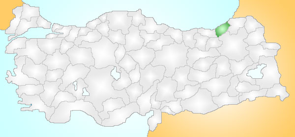
subdivision_type1=Region
subdivision_name1 = Black Sea
subdivision_type2=Province
subdivision_name2 = Rize| population_total = 19131|population_footnotes=
population_as_of =| 2000
population_density_km2 = 151|area_total_km2 = 95|elevation_m = - 1000
latd =
latm =
latNS = N
longd =
longm =
longEW = E
postal_code_type=Postal code
postal_code = 53
area_code = (0090)+ 464
leader_name =
blank_info = 53|blank_name=Licence plate
website =Kalkandere is a town and district of
Rize Province in the Black Sea region ofTurkey , west of the city ofRize .Formerly known as "Karadere", this is a hilly, forested, rural area of scattered villages, inland from the
Black Sea coast. There is little flat land and this is an impoverished area losing its population as they migrate away to jobs in other parts of Turkey or abroad. The local economy depends on growing tea on the hillsides. 90% of the agricultural land is tea plantations and there are tea processing plants in the town. Tea was planted in the 1950s and has brought new life to the area. Other activities include bee-keeping.Kalkandere itself is a small town providing public services to the surrounding area. There are primary schools in the villages but children must come into town for high school.
History
See "
Rize Province " for the history of this area.Places of interest
There is a picnic area on the road between Kalkandere and
İkizdere .External links
* [http://www.kalkandere.gov.tr/ District governor's official website] tr icon
Wikimedia Foundation. 2010.