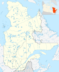
- New Carlisle, Quebec
-
 New Carlisle
New Carlisle, Quebec is a small town in the Gaspé region of Quebec, best known as the boyhood home of René Lévesque; although he was born at Campbellton, New Brunswick. The population is approximately 1430, half English-speaking and half French-speaking. New Carlisle is the seat of Bonaventure Regional County Municipality.
The site of the town was selected in 1784 by the Lieutenant-Governor of the jurisdictional District of Gaspe, Nicholas Cox, named Cox Township. The town as is thought to have been named after Cox's home town, possibly Carlisle in England, soon after, the name was changed from "Carlisle" to "New Carlisle". The original settlers of 1784 were discharged soldiers of British Army regiments and Loyalists claimants.
The town was the scene of the capture of German spy Werner von Janowski, who was dropped from a U-boat nearby in May, 1942.
New Carlisle is the seat of the judicial district of Bonaventure.[1]
Demographics
According to the Canada 2001 Census:
- Population: 1,431
- % Change (1996–2001): -7.0
- Dwellings: 611
- Area (km².): 67.55 km²
- Density (persons per km²): 21.2
Home Language(Canada 2006 Census)
- English: 65%
- French: 35%
Climate
Climate data for New Carlisle Month Jan Feb Mar Apr May Jun Jul Aug Sep Oct Nov Dec Year Record high °C (°F) 8.9
(48.0)9.5
(49.1)15
(59)27
(81)30.6
(87.1)31.1
(88.0)33
(91)32.2
(90.0)29
(84)22.2
(72.0)16.5
(61.7)10.5
(50.9)33
(91)Average high °C (°F) −6.4
(20.5)−5
(23)0.4
(32.7)5.8
(42.4)13
(55)19.2
(66.6)22.6
(72.7)21.8
(71.2)16.6
(61.9)10.3
(50.5)3.8
(38.8)−3.1
(26.4)8.3 Daily mean °C (°F) −11.3
(11.7)−10
(14)−4.3
(24.3)1.6
(34.9)8.1
(46.6)14
(57)17.6
(63.7)17.2
(63.0)12
(54)6
(43)0.3
(32.5)−7.3
(18.9)3.7 Average low °C (°F) −16.1
(3.0)−15
(5)−9
(16)−2.6
(27.3)3.1
(37.6)8.8
(47.8)12.6
(54.7)12.5
(54.5)7.3
(45.1)1.7
(35.1)−3.2
(26.2)−11.6
(11.1)−1 Record low °C (°F) −31.5
(−24.7)−29
(−20)−25
(−13)−17
(1)−6.1
(21.0)−2.5
(27.5)5
(41)3.3
(37.9)−1.7
(28.9)−9.4
(15.1)−18.3
(−0.9)−27
(−17)−31.5
(−24.7)Precipitation mm (inches) 89.5
(3.524)56.5
(2.224)80.8
(3.181)83.5
(3.287)96.1
(3.783)99.2
(3.906)97.8
(3.85)108.2
(4.26)88.4
(3.48)105.5
(4.154)91.3
(3.594)99.5
(3.917)1,096.2
(43.157)Source: Environment Canada[2] References
- ^ Territorial Division Act. Revised Statutes of Quebec D-11.
- ^ Environment Canada Canadian Climate Normals 1971–2000, accessed 23 July 2010
 Administrative divisions of Quebec
Subdivisions Communities Major cities Montreal · Quebec · Laval · Gatineau · Longueuil · Sherbrooke · Saguenay · Lévis · Trois-Rivières
Coordinates: 48°00′30″N 65°20′50″W / 48.00833°N 65.34722°W
Categories:- Incorporated places in Gaspésie–Îles-de-la-Madeleine
- Municipalities in Quebec
- Populated coastal places in Canada
- Quebec communities with significant anglophone populations
- Quebec geography stubs

Wikimedia Foundation. 2010.