- Meewasin Valley Authority
-
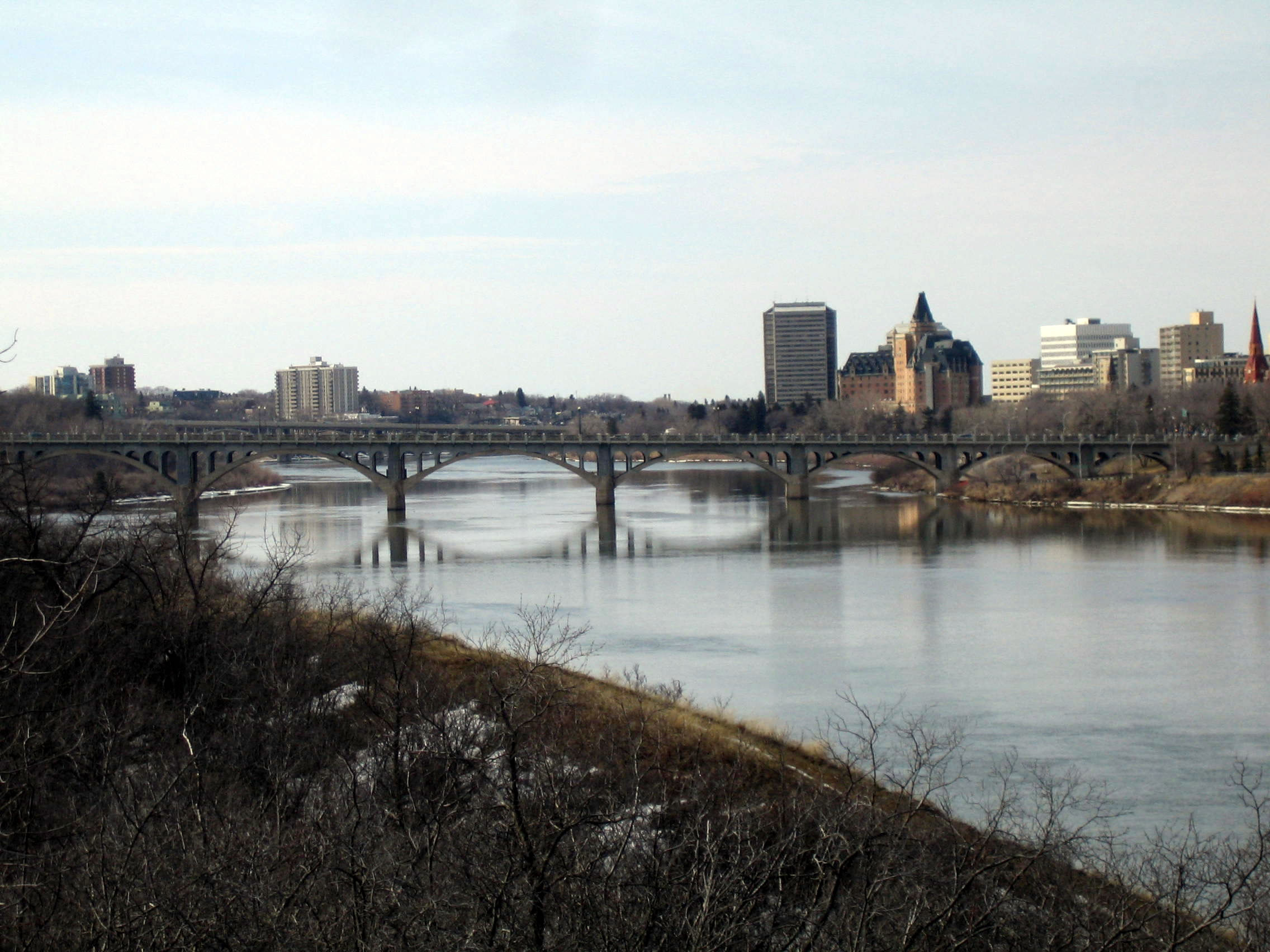
 The University Bridge over the South Saskatchewan River at Saskatoon
The Meewasin Valley Authority is a conservation organization created by the Provincial Government of Saskatchewan in Canada and is dedicated to conserving the cultural and natural resources of the South Saskatchewan River Valley. [1] The authorities activities include education, development and conservation. Centered in Saskatoon, the Conservation Zone of Meewasin runs 60 km along the river valley from the eastern edge of the municipality of Corman Park through Saskatoon to the western edge of Corman Park (Pike Lake to Clarke’s Crossing). The authority is actively involved in the River Landing redevelopment.
It is made up of numerous conservation areas, canoe launches, interpretive centres (Meewasin Valley Centre, Beaver Creek Conservation Area and Saskatoon Natural Grasslands), Yorath Island, the university lands, the best outdoor skating rink in Canada (Readers Digest June 2006) and over 60 km of Meewasin Valley Trail, 22.5 km of which are paved.
Contents
Governance
 Peturrson's Ravine
Meewasin is governed by a 12 member board with four representatives each from the three participating parties: City of Saskatoon, Province of Saskatchewan and University of Saskatchewan
The Conservation Zone covers approximately 25 square miles (65 km2). Meewasin is the means by which the three participating parties (City of Saskatoon, Province of Saskatchewan and University of Saskatchewan) have chosen to manage their lands, through one common authority.
Meewasin is a unique conservation organization as it has statutory authority to control development in the Conservation Zone along the river valley, and does so through public committees.
Meewasin Mandates
Meewasin has three mandates that focus on conservation development and education
Conservation:
Protection of natural and heritage resources in the valley is one of Meewasin's primary goals. The goal of the Resource Conservation Department is to protect, conserve and restore natural habitat that has been changed or altered. Projects include improving biodiversity in natural grasslands through sheep grazing; erosion control and re-vegetation of areas along the river bank; afforestation (greening the valley); working with steward groups to restore important natural sites throughout the valley; preservation of remaining natural areas in the valley, and enhancing, restoring and/or creating wildlife habitat areas.
Development:
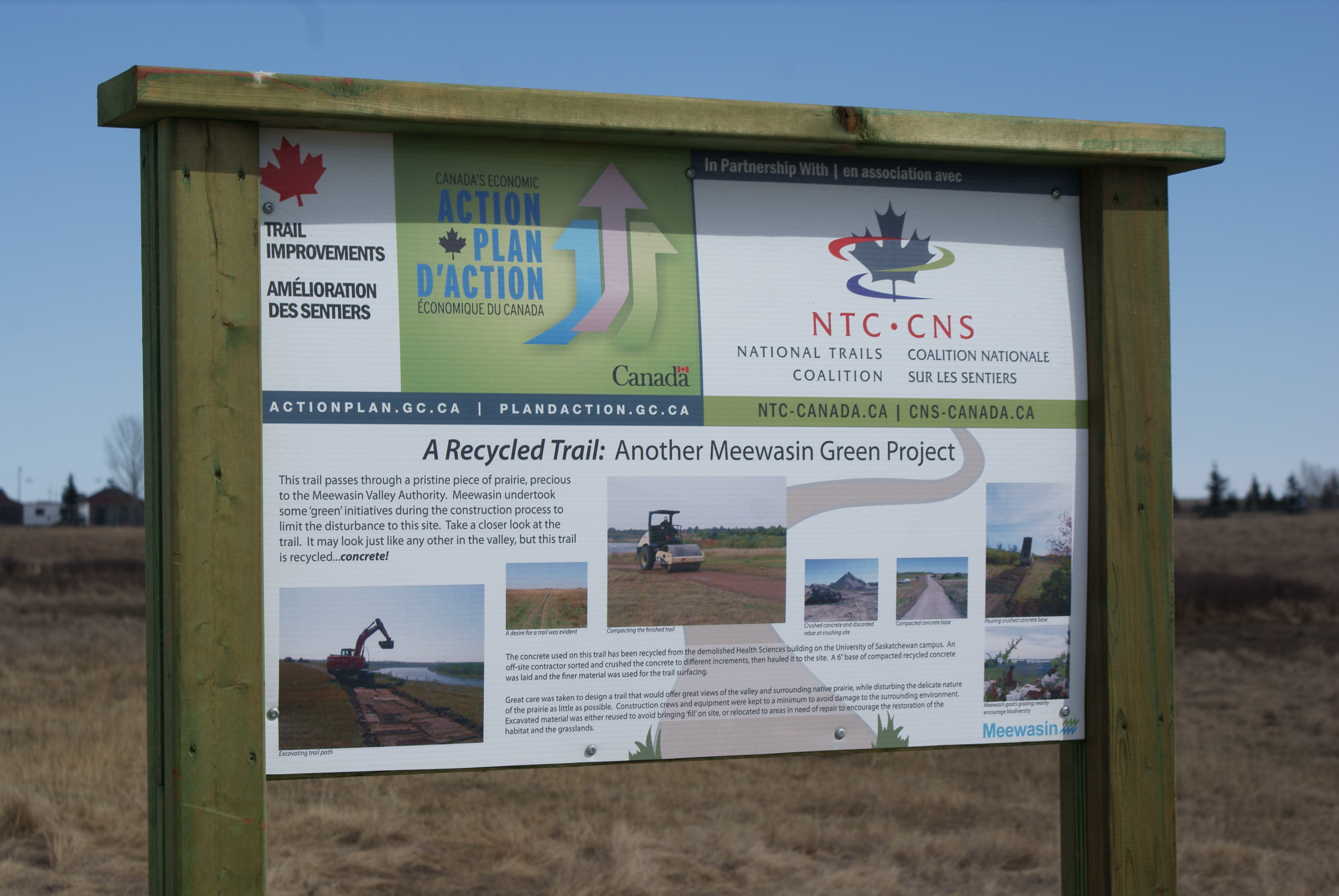
The Meewasin Valley Trail follows the South Saskatchewan River through the heart of Saskatoon, offering year-round recreation and sightseeing opportunities for everyone. Cycle, jog or enjoy a casual stroll through beautifully landscaped parks and natural areas. Cross-country skiing is popular during the winter months, along with skating in Kiwanis Memorial Park. Access points are found throughout the city with interpretive signage and washrooms located along the route. Throughout the Meewasin Valley, there are parks where you can picnic, barbecue or simply enjoy the view of the river. Several parks have washroom facilities and lookout points along the river bank. All are accessible by the Meewasin Valley Trail. In the winter the Meewasin Skating Rink is open free to the public; it is located in Kiwanis Memorial Park beside the Delta Bessborough hotel. The rink has been open since 1980 and has been said to be one of the best outdoor skating rinks in the country.
Education:
Meewasin offers a number of education programs that promote conservation of the natural and cultural heritage resources of the valley, that facilitate the appropriate use and enjoyment of those resources, and that allow the public to experience and learn about them. These programs include stewardship and celebrations, river festivals, in-services, Trail Ambassadors, canoe tours, and partnering with other education and conservation organizations who have similar goals. Meewasin accomplishes this through its two interpretive Centres, publications, audio-visual resources, web site, media commercials and appearances, and as speakers.
Meewasin Valley Centre Open Monday to Friday, 9 am to 5 pm Weekends and Holidays, 12:00 Noon to 5 pm The Meewasin Valley Centre is a place to learn about Saskatoon's history, the South Saskatchewan River, and the future of the Meewasin Valley through fun, interactive displays. The Centre also provides tourist information and a unique gift shop. The MVC staff delivers a cultural history program to most grade 3 students in Saskatoon. The Centre partnered with other organizations to host such events as the annual Heritage Festival of Saskatoon, National Rivers Day, and Seasonal programs at the historic Marr Residence. The Meewasin Valley Center is located along the riverbank in Friendship Park. After you visit the interpretive centre, have a picnic or hike along the trail.
Beaver Creek Conservation Area Open Monday to Friday, 9-5 Weekends and Holidays varies throughout the year call for more information Beaver Creek Conservation Area is located 13 km south of Saskatoon. A sheltered creek, river valley, and prairie habitat offer a diversity of flora and fauna for visitors. It is the microcosm of the Meewasin Valley, and contains one of the few uncultivated short grass prairie sites in Saskatchewan. An interpretive centre and staff provide opportunities to discover nature during the four seasons along a selection of five nature trails. Public programs to enjoy are Moon Hikes, Perseid Meteor Showers, Heritage Hoopla… for more information see the events calendar.
Meewasin Registered Charity
Meewasin is a registered charity. Approximately 54% of its budget for 2006-07 came from non statutory sources to support conservation, development and education initiatives. Some reasons to support Meewasin include:
-If you wanted a pill to cure 70% of ills in today’s society it would be exercise in a clean nurturing environment.
-95% of the general public in Saskatoon and area support the work of Meewasin and want it to continue;
-one million visits are made to the Meewasin Trail annually
-of the $83 million that Meewasin has spent in the valley in the last 27 years, $16 million has come from the local tax payer;
-The Meewasin Valley concept is known and studied around the world as a model of what a community can do to conserve a river valley for the purpose of public health and enjoyment;
-Meewasin has been recognized nationally and internationally on numerous occasions, in 2006 being one of four finalists for the prestigious Thiess Riverprize awarded in Brisbane, Australia.
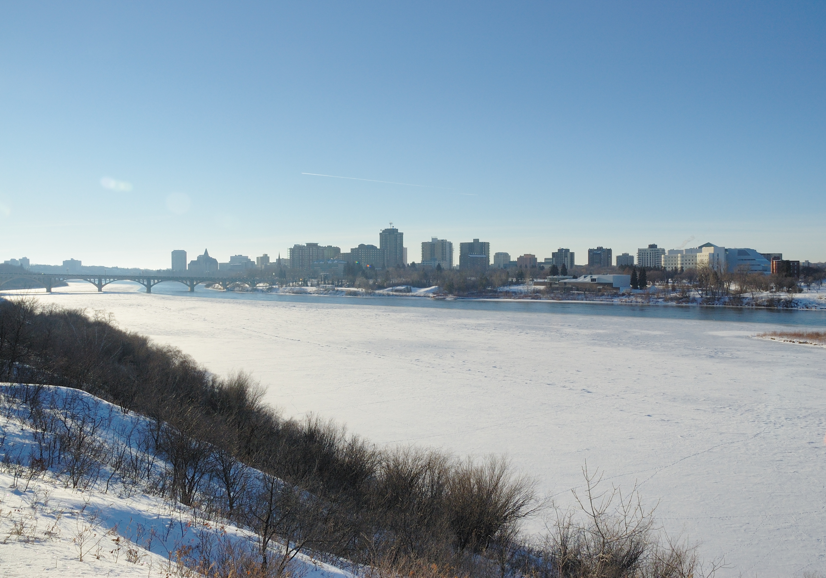
 View on Saskatoon's Downtown from the Meewasin Trail during Winter.
The jurisdiction of the authority runs for approximately 60 km along the river from Pike Lake in the southwest to Clarke's Crossing in the northeast in the City of Saskatoon, Rural Municipality of Corman Park and University of Saskatchewan.
References
- ^ {{cite web |url =http://www.qp.gov.sk.ca/documents/English/Statutes/Statutes/M11-1.pdf |title =The Meewasin Valley Authority Act |work =Chapter M-11.1 of the Statutes of Saskatchewan, |publisher =Queen's Printer |accessdate = 2011-04-02}
External links
Categories:- Saskatoon
- Non-profit organizations based in Canada
- Conservation authorities in Saskatchewan
Wikimedia Foundation. 2010.