- Conon Bridge
-
Coordinates: 57°34′00″N 4°26′00″W / 57.56667°N 4.43333°W
Conon Bridge Scottish Gaelic: Drochaid Sguideil 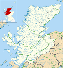
 Conon Bridge
Conon Bridge shown within the Highland council areaOS grid reference NH545555 Council area Highland Country Scotland Sovereign state United Kingdom Postcode district IV7 8 Police Northern Fire Highlands and Islands Ambulance Scottish EU Parliament Scotland List of places: UK • Scotland • Conon Bridge (Scottish Gaelic: Drochaid Sguideil, pronounced [d̪̊ɾɔxɪd̊ʲ s̪ɡ̊ud̊ʲal]) is a small village in the Highland region of Scotland. The current Gaelic name is likely a neologism: the bridge wasn't built until the early 19th century[citation needed] and some early gravestones show the name sgudal or scuddle[citation needed]. One suggested source is the Old Norse "sku dal", valley of the fine views.
Situated near the market town of Dingwall, on the southern bank of the River Conon, in Ross-shire, it is at the western end of the Cromarty Firth. The village of Maryburgh is on the other side of the river.
Conon Bridge formerly had a railway station on the line between Dingwall (the nearest town) and Inverness (the nearest city), which has been proposed as a candidate for reopening, after the success of doing so with nearby Beauly railway station[1]
Given its excellent location, stunning scenery and that it is within commuting distance of Inverness, Conon Bridge has become an attractive and desirable place to live. Amenities at present are a small fraction of what they once were, hosting only a Spar shop, Post Office, two hairdressing salons, a bar and separate hotel. It also has its own primary school, which the pupils then go on to Dingwall Academy. There is also a recently opened pharmacy. Private housing in the village is complemented by council estates. Future plans for the village include more exclusive, private housing schemes, a new primary school, a doctors' surgery and more shopping facilities for residents.[citation needed]
Conon also has the highlands best fish and chip shop 2007
Footnotes
- ^ "Railway link proposed for airport". BBC. 2006-07-17. http://news.bbc.co.uk/1/hi/scotland/highlands_and_islands/5187370.stm. Retrieved 2007-12-16.
Categories:- Populated places in Ross and Cromarty
- Highland geography stubs

Wikimedia Foundation. 2010.