- New York State Route 177
-
NYS Route 177
Route information Maintained by NYSDOT Length: 25.71 mi[2] (41.38 km) Existed: 1930[1] – present Major junctions West end:  I-81 in Adams
East end:  NY 12 near Lowville village
Location Counties: Jefferson, Lewis Highway system Numbered highways in New York
Interstate • U.S. • N.Y. (former) • Reference • County←  NY 176
NY 178  →
→New York State Route 177 (NY 177) is an east–west state highway in the North Country of New York, United States. It extends from Interstate 81 exit 42 in the town of Adams, Jefferson County, to NY 12 west of the village of Lowville, Lewis County. NY 177 intersects U.S. Route 11 in Adams Center and meets Lewis County's County Route 194, formerly NY 194, at Barnes Corners.
Contents
History
NY 177 was assigned as part of the 1930 renumbering of state highways in New York. It originally extended from U.S. Route 11 in Adams Center to NY 12 west of the village of Lowville.[1] When the portion of Interstate 81 near Adams Center was completed in the late 1950s,[3][4] NY 177 was extended westward over a county-maintained highway to meet the new expressway at exit 42.[5] On August 1, 1979, ownership and maintenance of NY 177 between I-81 and US 11 was transferred from Jefferson County to the state of New York as part of a highway maintenance swap between the two levels of government.[6]
Major intersections
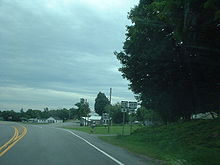 NY 177 at the intersection with NY 12
County Location Mile[2] Destinations Notes Jefferson Town of Adams 0.00 I-81Exit 42 (I-81) 0.83  US 11
US 11Hamlet of Adams Center Lewis Pinckney 11.69  CR 21
CR 21Hamlet of Barnes Corners; former western terminus of NY 194 Town of Lowville 25.71 NY 12Hamlet of West Lowville 1.000 mi = 1.609 km; 1.000 km = 0.621 mi References
- ^ a b Dickinson, Leon A. (January 12, 1930). "New Signs for State Highways". The New York Times: p. 136.
- ^ a b "2008 Traffic Volume Report for New York State" (PDF). New York State Department of Transportation. June 16, 2009. p. 179. https://www.nysdot.gov/divisions/engineering/technical-services/hds-respository/NYSDOT%20TVR%202008%20by%20Route.pdf. Retrieved February 1, 2010.
- ^ Esso (1958). New York with Special Maps of Putnam–Rockland–Westchester Counties and Finger Lakes Region (Map). Cartography by General Drafting (1958 ed.).
- ^ Gulf (1960). New York and New Jersey Tourgide Map (Map). Cartography by Rand McNally and Company.
- ^ State of New York Department of Transportation (January 1, 1970) (PDF). Official Description of Touring Routes in New York State. http://www.greaternyroads.info/pdfs/state70.pdf. Retrieved June 20, 2009.
- ^ New York State Legislature. "New York State Highway Law § 341". http://public.leginfo.state.ny.us/menugetf.cgi?COMMONQUERY=LAWS. Retrieved June 20, 2009.
External links
Categories:- State highways in New York
- Transportation in Lewis County, New York
- Transportation in Jefferson County, New York


Wikimedia Foundation. 2010.