- Helions Bumpstead
-
Coordinates: 52°01′25″N 0°14′30″E / 52.0236°N 0.2418°E
Helions Bumpstead 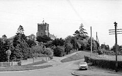
Helions Bumpstead in 1960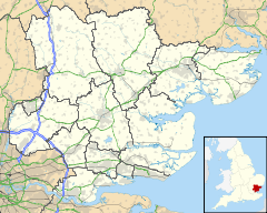
 Helions Bumpstead
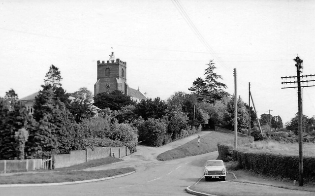
Helions Bumpstead shown within EssexPopulation c. 440 OS grid reference TL650415 Parish Helions Bumpstead District Braintree Shire county Essex Region East Country England Sovereign state United Kingdom Post town HAVERHILL Postcode district CB9 7 Dialling code 01440 Police Essex Fire Essex Ambulance East of England EU Parliament East of England UK Parliament Saffron Walden Website www.helionsbumpsteadparishcouncil.gov.uk List of places: UK • England • Essex Helions Bumpstead is a small village in Essex located near Haverhill and the Essex/Suffolk/Cambridgeshire borders. It is 2 miles from Steeple Bumpstead. Helions Bumpstead has "the greens"; Pale Green (grid reference TL655421), Wiggens Green (TL663424), and Drapers Green (TL644425). There are four roads into and out of the village they are; Mill Road, Water Lane, Sages End Road and Camps Road. The centre of the village is marked by the crossroads and village green. There is also a meadow with a pond in the centre of the village.
The main defining features of the village are the Three Horseshoes public house, the village post office, the village hall, and St Andrew's Church; the village is in the Diocese of Chelmsford and shares its priest with St Mary's, Steeple Bumpstead.[1] There is also a Gospel Hall in the village. The village hall has recently been undergoing refurbishment with money raised over the years from events and grants given to the village. The hall has had the interior stage removed to increase the space for functions; been given a knew slate tile pitched roof; been repainted; and, more recently, had an extension to the storage area.
Every year Helions Bumpstead has its own Summer Fête including a Dog Show and evening party, and Christmas Bazaar. A harvest supper is organised every year to raise funds for the up-keep of St. Andrew's church. A Farmer's Market is held every 3rd Saturday of the month in the village hall which brings in a collection of people from various surrounding towns and villages. A village magazine is printed quarterly, compiled of news articles and pieces of writing by villagers. It is subsidised by the sale of advertising space, which also adds to funds for the village hall.
One of the most famous WW2 planes called the mosquito was tested on the airfield near Castle Camps. Many of the hangers that the planes were built in can still be found today.
There is a Boxing Day walk every year, people meet at the Three Horseshoes pub and walk different routes each year around the village.
On the year of her majesty Elizabeth II's Golden Jubilee, there was a large fair in the honour of her. Pictures of the event were taken and a board was put up inside the hall to commemorate it. These pictures are no longer on display. Also, the Silver Jubilee was when Helions Bumpstead was presented with its village sign, including the village symbol (a red badge with a white diagonal cross).
There is an Equestrian Centre on Camps Road, on the edge of the village.
History
From Portrait of Helions Bumpstead by Roy Brazier
Helions Bumpstead was well known to historians in the time of Edward the Confessor, before the Norman Conquest. Then the whole area of which we know now as Steeple and Helions Bumpstead, was called collectively Bumsteda, or variations of this earliest way of spelling. As more people drifted into this area, two distinct centres developed, with the Helions part taking on the title of Bumpstead Magna (Great) and the Steeple district Bumpstead Parva (Little).Bumsteda is not an easy name to sort out. History books tell us it means `a place where flax or hemp grows'. This could well be true, as several osier beds were discovered in parts of the village, such as Bumpstead Hall and Drapers Green. It is in the Sages End area where a spring, called the `Dropping Well', was the source of the best water in the village. It was noted as running at four gallons a minute in a report by Dr. Hubert Airy in 1871 when he visited the village to investigate the poor sanitary state that existed there. Even in the summer months the spring ran nearly two gallons each minute, enticing the inhabitants of Castle Camps to walk there when really hot weather dried up their watering holes. `Dropping Well' was the source of much of Helions Bumpstead's water, as it made its way down Sages End road to join the main rivulet near the Three Horse Shoes public house, thence to flow eastward into the River Stour and to the sea at Harwich.
The village history seems to take off from William the Conqueror and the compiling of the Domesday Book. The new King of England rewarded an officer of his invading army by granting him the Manor of Bumstead. The officer by the name of Tihell, came from a village in France named Hellean, in the Morhihan district of Brittany. It was here in England that he built a Manor House on a hill facing due east, and then on a small mound not half a mile away, he built his Church. In the seventeenth and eighteenth century the Lords of the Manor were the Reynolds family, which produced several distinguished politicians and judges.
References
- ^ "Village Information: Church". Helions Bumpstead Parish Council. Retrieved: 2011-03-06
External links
Categories:- Villages in Essex
- Braintree

Wikimedia Foundation. 2010.