- Chatham Island/Rekohu
-
Chatham Island Rekohu (Moriori)
Wharekauri (Māori)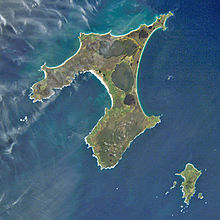
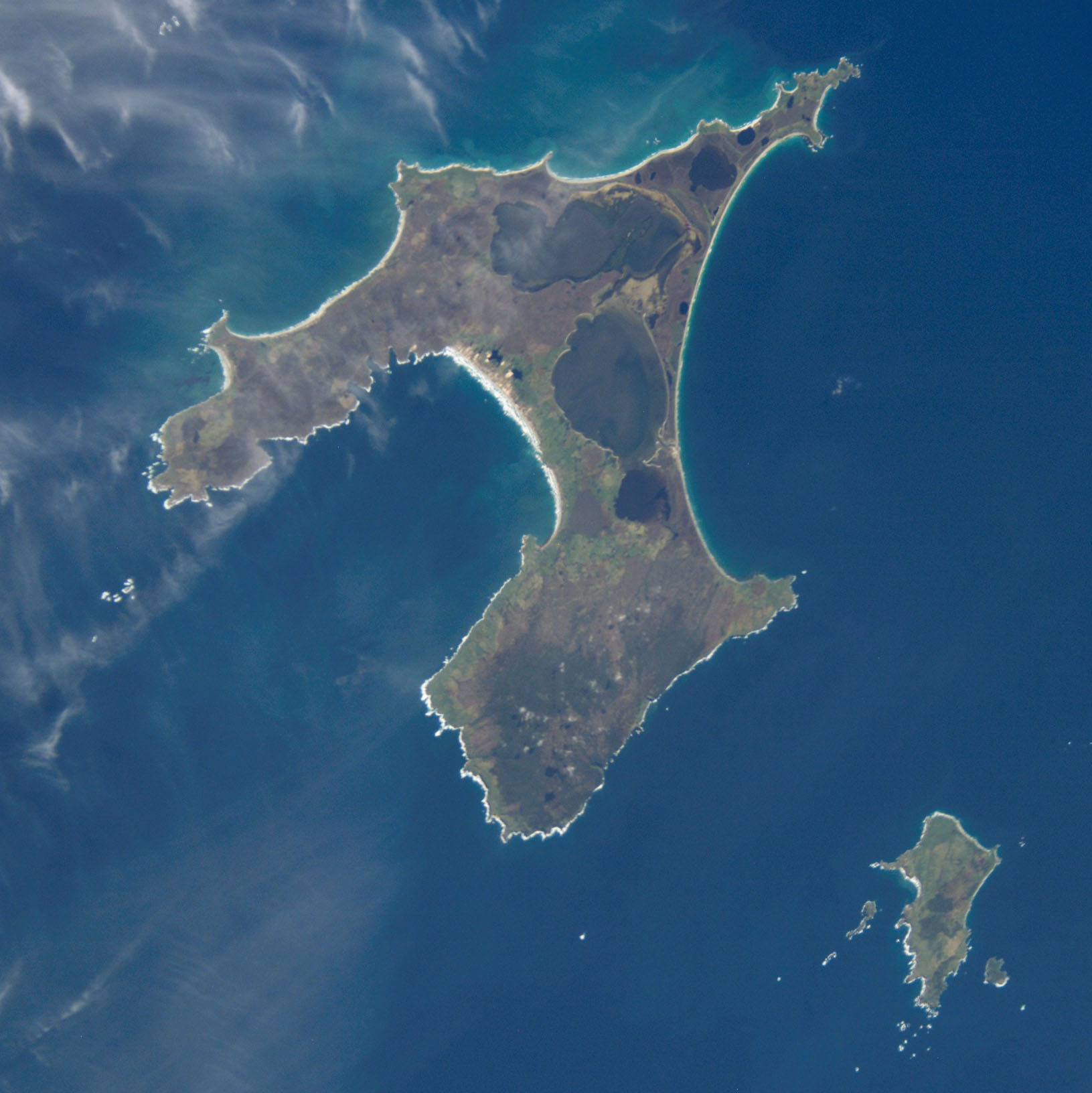
Chatham Island from space.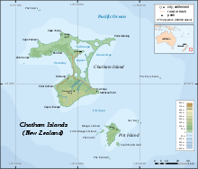
Map showing location of Chatham IslandGeography Coordinates 43°54′S 176°29′W / 43.9°S 176.483°WCoordinates: 43°54′S 176°29′W / 43.9°S 176.483°W Archipelago Chatham Islands Area 347 sq mi (899 km2) Country Demographics Population about 300 Chatham Island is by far the largest island of the Chatham Islands group, in the south Pacific Ocean off the eastern coast of New Zealand, — not exactly "halfway between the equator and the pole, and right on the International Date Line" but close enough for tourism marketing purposes. Chatham Island was named after the survey ship HMS Chatham which was the first European ship to locate the island in 1791 [citation needed]. It covers an area of 347 square miles (899 km2).
The island is also known by two other names, the Maori name of Wharekauri and the Moriori name of Rekohu (meaning misty skies).
The geography of the roughly T-shaped island is dominated by three features: two bays and a lagoon.
 Flag of Chatham Islands
More than half of the west coast of Chatham is taken up by the deep indentation of Petre Bay. The island's main settlement of Waitangi is located in a small indentation in Petre Bay's southern sage.
On the east coast is the even larger Hanson Bay, which stretches for the entire 22 miles (35.4 km) length of the island.
The ten kilometre width of the island, between these two bays, is entirely illusory. Much of it is taken up by the large Te Whanga Lagoon, which drains to the sea in the southern half of Hanson Bay. This lagoon covers about 69 square miles (179 km2), and drains several small rivers that rise in the hills at the south end of the island.
Chatham Islands date their anniversary on November 29, and observe it November 30.
See also
- Chatham Standard Time Zone
- List of sub-Antarctic islands
- List of Antarctic islands north of 60° S
- List of islands of New Zealand
Chatham Islands Chatham Island/Rekohu/Wharekauri · Pitt Island/Rangiauria · Little Mangere Island · Star Keys/Motuhope · Forty-Fours/Motuhara · Mangere Island · South East Island/Rangatira · The Sisters/Rangitatahi · The Pyramid
 Categories:
- Islands of the Chatham Islands
- New Zealand outlying island geography stubs


Wikimedia Foundation. 2010.