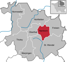
- Namborn
-
Namborn 
Coordinates 49°31′N 7°8′E / 49.51667°N 7.13333°ECoordinates: 49°31′N 7°8′E / 49.51667°N 7.13333°E Administration Country Germany State Saarland District Sankt Wendel Local subdivisions 8 Mayor Theo Staub (SPD) Basic statistics Area 26.00 km2 (10.04 sq mi) Elevation 288-509 m Population 7,295 (31 December 2010)[1] - Density 281 /km2 (727 /sq mi) Other information Time zone CET/CEST (UTC+1/+2) Licence plate WND Postal code 66640 Area codes 06857 (Namborn: 06854, Baltersweiler: 06851) Website www.namborn.de Namborn is a municipality in the district of Sankt Wendel, in Saarland, Germany. It is situated approx. 7 km north of Sankt Wendel, and 25 km southwest of Idar-Oberstein.
References
- ^ "Fläche, Bevölkerung in den Gemeinden am 31.12.2010 nach Geschlecht, Einwohner je km² und Anteil an der Gesamtbevölkerung" (in German). Statistisches Amt des Saarlandes. 31 December 2010. http://www.saarland.de/dokumente/thema_statistik/staa_FB311209.pdf.
Categories:- Municipalities in Saarland
- Saarland geography stubs
Wikimedia Foundation. 2010.


