- Novarupta
-
Novarupta 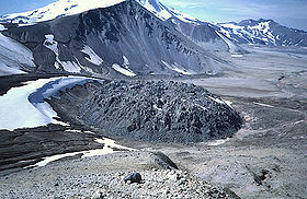
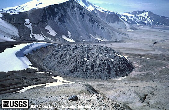
Novarupta lava dome in July 1987Elevation 2,759 ft (841 m) [1] Location Location Katmai National Park and Preserve, Alaska, USA Range Aleutian Range Coordinates 58°16′0″N 155°9′24″W / 58.266667°N 155.15667°WCoordinates: 58°16′0″N 155°9′24″W / 58.266667°N 155.15667°W[1] Topo map USGS Mount Katmai B-4 Geology Type Caldera[1] Volcanic arc/belt Aleutian Arc Last eruption 1912 [1] Novarupta, meaning "new eruption", is a volcano located on the Alaska Peninsula in Katmai National Park and Preserve, about 290 miles (470 km) southwest of Anchorage. Formed in 1912 during the largest volcanic eruption of the 20th century, Novarupta released 30 times the volume of magma as the 1980 eruption of Mount St. Helens.
 Map showing volcanoes of Alaska.
Contents
Eruption of 1912
1912 eruption of Novarupta Date June 6-8, 1912 Type Plinian VEI 6 The largest eruption of the 20th century occurred in 1912, from June 6 to June 8, to form Novarupta. Rated a 6 on the volcanic explosivity index,[2] the 60 hour long eruption expelled 13 to 15 cubic kilometers (3.1 to 3.6 cu mi) of magma, 30 times as much as the 1980 eruption of Mount St. Helens.[3][4][5] The erupted magma resulted in more than 17 cubic kilometers (4.1 cu mi) of air fall and approximately 11 cubic kilometers (2.6 cu mi) of ash-flow tuff[6] Only the 1991 eruption of Mt. Pinatubo in the Philippines was of a similar magnitude during the 20th century, ejecting 11 cubic kilometers (2.6 cu mi) of tephra.[7] At least two larger eruptions occurred in the 19th century: the 1815 eruption of Tambora (150 km3 (36.0 cu mi) of tephra)[8] and the 1883 eruption of Indonesia's Krakatoa (20 km3 (4.8 cu mi) of tephra).[9]
Eruption of such a large quantity of magma from underneath the Mount Katmai area resulted in the formation of a 2-kilometer (1.2 mi) wide funnel shaped vent and the collapse of the summit of Mount Katmai creating a 600-meter (2,000 ft) deep,[3] 3 by 4 km (1.9 by 2.5 mi) caldera.[10]
The eruption ended with the extrusion of a lava dome that plugged the vent. The 295 feet (90 m) high and 1,180 feet (360 m) wide dome and the caldera it created is what is now referred to as Novarupta.[11]
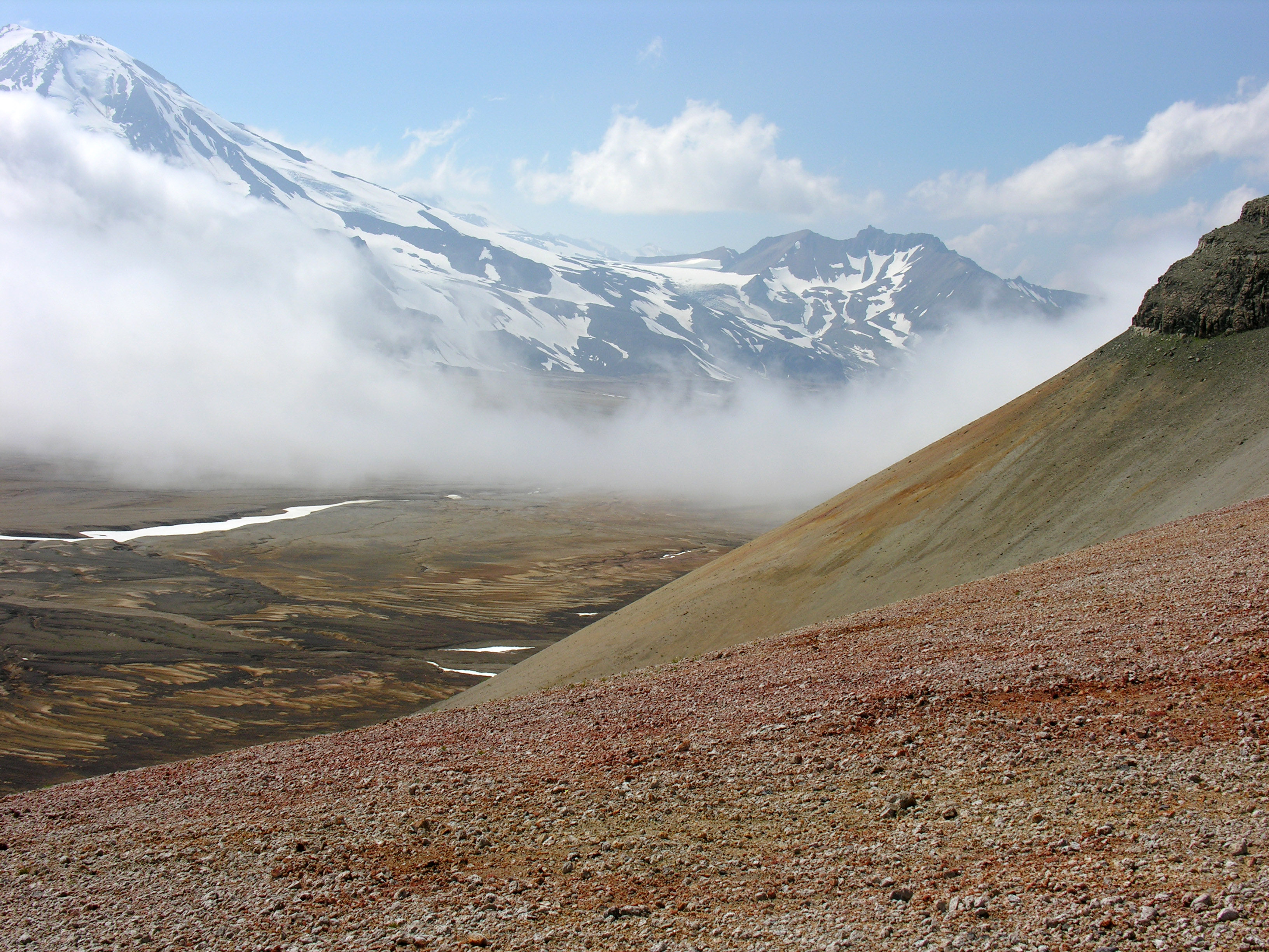
Valley of Ten Thousand Smokes
Main article: Valley of Ten Thousand Smokes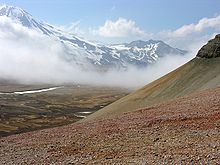 Colorful ash in the Valley of Ten Thousand Smokes
Pyroclastic ash flow from the eruption formed what was named the Valley of Ten Thousand Smokes by botanist Robert F. Griggs, who explored the volcano's aftermath for the National Geographic Society in 1916.[12][13]
The eruption forming of the Valley of Ten Thousand Smokes is one of the few in recorded history to have produced welded tuff, producing numerous fumaroles that persisted for 15 years.[14]
Katmai National Park
Main article: Katmai National Park and PreserveEstablished as a National Park & Preserve in 1980, Katmai is located on the Alaska Peninsula, across from Kodiak Island, with headquarters in nearby King Salmon, about 290 miles southwest of Anchorage. The area was originally designated a National Monument in 1918 to protect the area around the major 1912 volcanic eruption of Novarupta and the 40-square-mile (104 km2), 100-to-700-foot (30 to 210 m) deep, pyroclastic flow of the Valley of Ten Thousand Smokes.[15]
See also
- List of volcanoes in the United States of America
- Timetable of major worldwide volcanic eruptions
References
- ^ a b c d "Novarupta". Global Volcanism Program, Smithsonian Institution. http://www.volcano.si.edu/world/volcano.cfm?vnum=1102-18-. Retrieved 2009-01-01.
- ^ Simkin, Tom; Lee Siebert (1994). Volcanoes of the World. Tucson, Arizona: Geoscience Press, Inc.. pp. 117. ISBN 0-945005-12-1.
- ^ a b Brantley, Steven R. (1999-01-04). Volcanoes of the United States. United States Geological Survey. pp. 30. ISBN 0160450543. OCLC 30835169 44858915 156941033 30835169 44858915. http://pubs.usgs.gov/gip/volcus/index.html. Retrieved 2008-09-12.
- ^ Judy Fierstein; Wes Hildreth, James W. Hendley II, and Peter H. Stauffer (1998). Can Another Great Volcanic Eruption Happen in Alaska? - U.S. Geological Survey Fact Sheet 075-98. Version 1.0. United States Geological Survey. http://pubs.usgs.gov/fs/fs075-98/. Retrieved 2008-09-10.
- ^ Fierstein, Judy; Wes Hildreth (2004-12-11). "The plinian eruptions of 1912 at Novarupta, Katmai National Park, Alaska". Bulletin of Volcanology (Springer) 54 (8): 646–684. Bibcode 1992BVol...54..646F. doi:10.1007/BF00430778.
- ^ Judy Fierstein; Wes Hildreth (2001) (PDF). Preliminary volcano-hazard assessment for the Katmai volcanic cluster, Alaska: U.S. Geological Survey Open-File Report OF 00-0489. United States Geological Survey. http://geopubs.wr.usgs.gov/open-file/of00-489/. Retrieved 2008-09-09.
- ^ "Pinatubo: Eruptive History". Global Volcanism Program, Smithsonian Institution. http://www.volcano.si.edu/world/volcano.cfm?vnum=0703-083&volpage=erupt. Retrieved 2009-01-01.
- ^ "Tambora". Global Volcanism Program, Smithsonian Institution. http://www.volcano.si.edu/world/volcano.cfm?vnum=0604-04=. Retrieved 2009-01-01.
- ^ "Krakatau: Eruptive History". Global Volcanism Program, Smithsonian Institution. http://www.volcano.si.edu/world/volcano.cfm?vnum=0602-00=&volpage=erupt. Retrieved 2009-01-01.
- ^ "Katmai". Global Volcanism Program, Smithsonian Institution. http://www.volcano.si.edu/world/volcano.cfm?vnum=1102-17-. Retrieved 2009-01-01.
- ^ Rosi, Mauro; Paolo Papale, Luca Lupi, and Marco Stoppato (2003-03-01). Volcanoes. Firefly Books. pp. 219. ISBN 978-1552976838. OCLC 53901499. http://books.google.com/?id=A60sif56pb8C&pg=PT226&lpg=PT226&dq=novarupta+lavadome.
- ^ Clemens, Janet; Frank Norris (1999). Building in an Ashen Land - Historic Resource Study of Katmai National Park and Preserve. Anchorage, Alaska: National Park Service, Alaska Support Office. Chapter 4. http://www.nps.gov/archive/katm/hrs/hrs4.htm.
- ^ Griggs, Robert F. (1922). The Valley of Ten Thousand Smokes. National Geographic Society. pp. 192.
- ^ Hildreth, Wes (1983-10). "The compositionally zoned eruption of 1912 in the Valley of Ten Thousand smokes, Katmai National Park, Alaska". Journal of Volcanology and Geothermal Research (Elsevier) 18 (1–4): 1–56. doi:10.1016/0377-0273(83)90003-3. http://www.sciencedirect.com/science?_ob=ArticleURL&_udi=B6VCS-489YNWN-17&_user=10&_rdoc=1&_fmt=&_orig=search&_sort=d&view=c&_acct=C000050221&_version=1&_urlVersion=0&_userid=10&md5=735346a19b48b8505e59485b9e40748d. Retrieved 2008-09-24.
- ^ "Katmai National Park & Preserve". Katmai National Park & Preserve. National Park Service. 2008-06-29. http://www.nps.gov/katm/. Retrieved 2008-09-14.
External links
- USGS collection of descriptions of Novarupta
- USGS QuickTime video clip on Novarupta (36 seconds/0.8 MB)
- geology.com, Novarupta - topographic maps, annotated satellite images
- Alaska Volcano Observatory: Novarupta
- USGS Photographic Library - novarupta
Categories:- 1912 in Alaska
- 1912 natural disasters
- 20th-century volcanic events
- Aleutian Range
- Katmai National Park and Preserve
- Landforms of Lake and Peninsula Borough, Alaska
- Lava domes
- Mountains of Alaska
- Natural disasters in Alaska
- Subduction volcanoes
- VEI-6 volcanoes
- Volcanic calderas of Alaska
- Volcanic events
- Volcanoes of Alaska

Wikimedia Foundation. 2010.