- City Hall (BMT Broadway Line)
-
Not to be confused with City Hall (IRT Lexington Avenue Line).
City Hall


New York City Subway rapid transit station 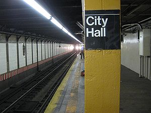
Station statistics Address Murray Street & Broadway
New York, NY 10007Borough Manhattan Locale Lower Manhattan Coordinates 40°42′48″N 74°00′25″W / 40.71324°N 74.007082°WCoordinates: 40°42′48″N 74°00′25″W / 40.71324°N 74.007082°W Division B (BMT) Line BMT Broadway Line Services N  (late nights)
R (all except late nights)
Connection - New York City Bus: M5, M9, M22, M103, X27, X28
Structure Underground Levels 2 Platforms 1 island platform (upper level)
2 island platforms (unused lower level)Tracks 5 (2 on upper level, 3 on lower level) Other information Opened January 5, 1918[1] Traffic Passengers (2010) 2,790,204[2]  6.2%
6.2%Rank 168 out of 422 Station succession Next north Canal Street: N R Next south Cortlandt Street: N R Station service legend Symbol Description 
Stops in station at all times 
Stops all times except late nights 
Stops late nights only 
Stops late nights and weekends only 
Stops weekdays only 
Stops all times except rush hours in the peak direction Stops all times except weekdays 
Stops rush hours only 
Stops rush hours in the peak direction only 
Station is closed (Details about time periods) City Hall is a local station on the BMT Broadway Line of the New York City Subway. It is served by the R train at all times except late nights and by the N train during late night hours. The fare control is located in the center of the island platform, with exits on either end leading to Warren Street and Murray Street.
Contents
Layout
The station's configuration is unique, in that passengers enter from the sidewalk adjacent to City Hall Park directly onto the station's wide island platform. The northbound track is located under City Hall Park, while the southbound track is under the east side of Broadway. The fare control area is fenced off from the platform. There is also an active tower at the north end, with a window that lets any waiting passengers observe Transit Authority goings-on. The platform tapers off towards the southern end, where the northbound and southbound platforms join.
The station's configuration, and the wide-open staircases to the sky above, is responsible for another distinguishing feature: the number of birds that fly into and around the station.
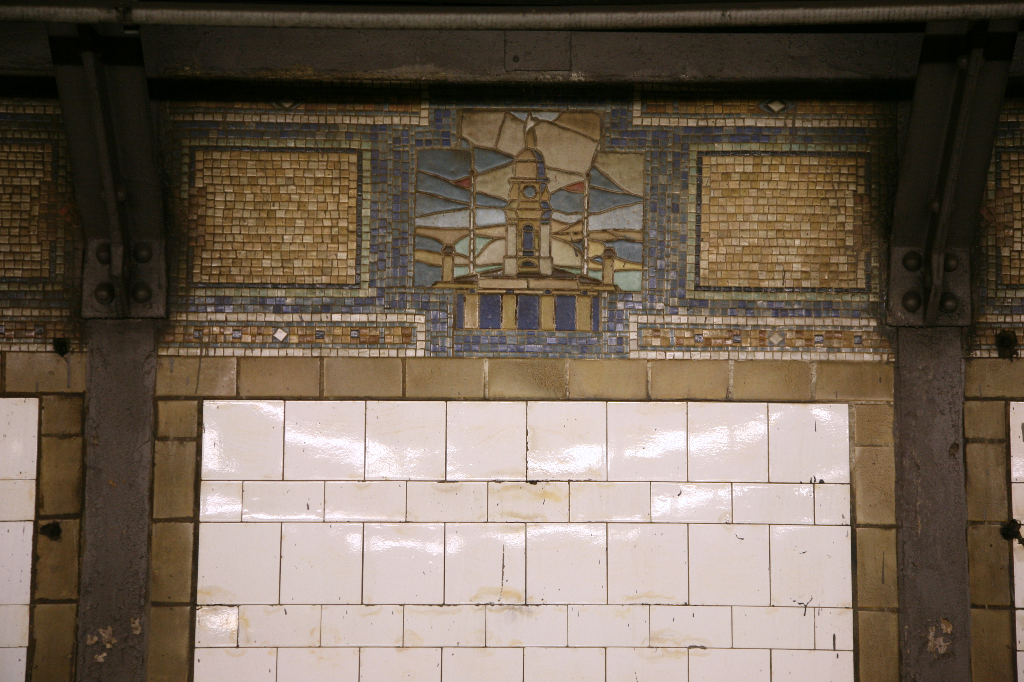
This station was overhauled in the late 1970s, changing the station's structure and overall appearance. It replaced the original wall tiles, old signs, and incandescent lighting with more modern wall tiles, signs and fluorescent lights, as well as fixing staircases and platform edges.
Before the new City Hall master tower was built, there was a provision at the north end of the upper level level for a diamond crossover (which dates back to construction of this station, when the upper level platform was to be a terminal) which is now occupied by a relay room.
Strangely, at the south end of the station, the track curves away from the wall, on the uptown side. It may date from the original construction when the upper level was converted from a terminal with presumably a straight line to end of the tracks here.[3]
City Hall Lower Level
 Staircase to the lower level
The City Hall station is a bi-level station, with an unused lower level reachable from stairs from about the center of the platform. It was initially intended that the local trains were to terminate on the upper level, while the express trains using the lower level would continue on through lower Manhattan and then through the Montague Street Tunnel. However, plans were changed before construction ended. As a result, the lower level of the station which was to have served the express trains is unused (except for non-rush hour storage of trains), as are the center express tracks at Canal Street on its upper level. Another effect of this change is that the southern end of the upper level station slopes downward. This is a result of platform lengthening and rerouting the upper level down to continue into lower Manhattan. The lower level floor continues south of the station until it disappears under the increasingly low ceiling under the ramps carrying the upper level downgrade. The lower level was never used for passenger service or even finished with tiles and signage.
The middle track in the lower level station was to be used for short turns from either direction depending on the service pattern.
The lower level is only long enough to platform 8-car (60 ft) trains like the platforms in the BMT Eastern Division. All three tracks are usable, but in the normal practice the "southbound" and the middle tracks are only used for storage. The "southbound" island platform on the lower level is the only one with a stairway to the upper level. The eastern-most track on the lower level has no third rail. It's unknown whether the third rail was installed and later removed or never installed.
Image gallery
References
- ^ New York Times, Open New Subway to Times Square, January 6, 1918
- ^ "Facts and Figures: Annual Subway Ridership". New York Metropolitan Transportation Authority. http://mta.info/nyct/facts/ridership/ridership_sub_annual.htm. Retrieved 2011-06-02.
- ^ http://images.nycsubway.org/i1000/img_1228.jpg
Further reading
- Lee Stokey. Subway Ceramics : A History and Iconography. 1994. ISBN 978-0-9635486-1-0
External links
- nycsubway.org — BMT Broadway Subway: City Hall
- Station Reporter — N Train
- Station Reporter — R Train
- Abandoned Stations — City Hall (BMT) lower level
- Broadway and Murray Street entrance from Google Maps Street View
- Broadway and Warren Street entrance from Google Maps Street View
Categories:- BMT Broadway Line stations
- New York City Subway stations in Manhattan
- Railway stations opened in 1918


Wikimedia Foundation. 2010.