- Mount Watatic
-
Mount Watatic 
Summit of Mount Watatic.Elevation 558 m (1,831 ft) Location Location Ashburnham and Ashby,
Massachusetts, USARange The Wapack Range Coordinates 42°41′48″N 71°53′33″W / 42.69667°N 71.8925°WCoordinates: 42°41′48″N 71°53′33″W / 42.69667°N 71.8925°W Geology Type monadnock; metamorphic rock Age of rock 400 million years Mount Watatic is a 1,832 foot (558 m) monadnock located on the Massachusetts-New Hampshire border, at the southern end of the Wapack Range of mountains. It lies within Ashburnham, Massachusetts, Ashby, Massachusetts, and New Ipswich, New Hampshire; the 22 miles (35 km) Wapack Trail and the 92 miles (148 km) Midstate Trail both cross the mountain. The Yellow Arrow trail is 1.1 miles.
The east and south side of the mountain drains into the Souhegan River watershed, to the Merrimack River thence the Atlantic Ocean; the west and north sides drain into the Millers River watershed, to the Connecticut River, thence into Long Island Sound.
Mount Watatic was the site of a ski area that operated from 1965 until closing in 1984. An attempt to reopen the ski area in 1988 failed. The bald summit of the mountain featured a fire tower, open to the public, until its removal in 1997.
Conservation
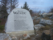 An engraved stone at the summit of Mount Watatic.
In 2000, the summit of the mountain was sold to Industrial Communications and Electronics for the development of a 150-foot (46 m) cellular telephone tower and a road to the summit. In 2002, prior to development of the communications tower, the mountain was purchased for $2,500,000 by the Ashby Land Trust, the Town of Ashby, the Ashburnham Conservation Trust, the Town of Ashburnham, Mass Dept of Fish and Wildlife and Mass Dept of Conservation and Recreation. Unfortunately by this point a road had already been blasted into the ski area (back) side of the mountain, making several of the still maintained ski trails unusable. The purchase resulted in the permanent protection of approximately 281 acres (1.14 km2) of the mountain, including the summit, as conservation land. In July 2010, Mount Watatic was named one of the "1000 Great Places in Massachusetts" by the State Commission of Massachusetts.
References
- Southern New Hampshire Trail Guide (1999). Boston: The Appalachian Mountain Club.
- Flanders, John ( 1991) Wapack Trail Guide. West Peterborough, New Hampshire: Friends of the Wapack.
- Mount Watatic State Reservation – The Massachusetts Department of Conservation and Recreation. Retrieved February 20, 2008.
- Davis, Jeremy (31 January, 2005). "Mount Watatic Ski Area, Ashby, MA". New England Lost Ski Areas. NELSAP. http://www.nelsap.org/ma/watatic.html. Retrieved 17 September, 2010.
- [1] – State Commission of Massachusetts. Retrieved July, 2010.]
External links
Categories:- Mountains of Massachusetts
- Defunct ski areas and resorts in Massachusetts
- Landforms of Middlesex County, Massachusetts
- Landforms of Worcester County, Massachusetts
- Buildings and structures in Worcester County, Massachusetts
- Visitor attractions in Worcester County, Massachusetts


Wikimedia Foundation. 2010.