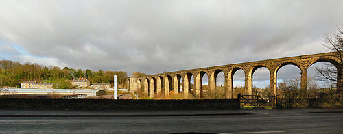
- Dearne Valley
-
Coordinates: 53°30′N 1°13′W / 53.5°N 1.217°W The Dearne Valley is an area of South Yorkshire along the River Dearne. It encompasses the towns of Wombwell, Wath-upon-Dearne, Swinton, Conisbrough and Mexborough, the large villages of Ardsley, Bolton on Dearne, Goldthorpe, Thurnscoe, Darfield, Stairfoot and Brampton Bierlow, and many other smaller villages and hamlets.
In 1995 the area became a regeneration area, as it had suffered much from the sudden decline of the deep coal mining industry in the 1980s. In the 2001 census the ONS-identified Dearne Valley urban area had a population of 207,726, however this region includes Barnsley and certain other smaller towns and villages that might not historically have considered themselves a part of the Dearne Valley.
Contents
History
Many high-grade coal seams, including the prolific Barnsley seam, lie close to the surface in this area. This meant that by far the most prevalent industry in the area was deep coal mining, indeed much of the economic activity of the region was either directly related to, or reliant on this industry. It was home to the Oaks viaduct, the largest man-made rail bridge in Britain until its demolition in 1965.
In the latter half of the 20th century the industry was declining and becoming deeply unprofitable, but was kept alive by government subsidy. As early as the 1960s local politicians voiced concerns about the high level of reliance of the economy of the area on one single industry. In the 1980s there was a marked change of government economic policy: unprofitable heavy industry was no longer to be subsidised. This caused the collapse of the mining industry, with a knock-on effect in many other local industries, leading to much local hardship.
The valley today
Strong feelings regarding the collapse of the mining industry still remain in many communities; these feelings are diminishing with the passing of years, and the return of jobs and economic growth that the new industries in the area have brought, but have not completely gone away.
For years locals found themselves forced to move out of the area to find work: this caused whole generations of locals to move away from the area never to return. This is apparent in local populations, which have declined somewhat. These days the settlements in the area are becoming more dormitory in nature, as those who remained have found the need to commute further afield to the larger towns and cities in the region to find work.
Outside the settlements, primary land use is agricultural: a by product of the death of the mining industry is that the area looks more rural and green than it once did. Business parks in the area have sprung up on some brown-field land once used by the mining industry, the most notable and largest is at Manvers.
Although much of the infrastructure related to the mining industry was demolished in the 1980s and early 1990s and the land changed to other uses, remnants of the coal mining heritage remain: large spoil heaps adorn the villages of Great Houghton and Thurnscoe very notably; although landscaping has been attempted, no cosmetic alteration can disguise their size.
The road and rail links to the villages of the area also were implemented mostly to ferry coal out of collieries and although the rails to the now demolished collieries have long since been removed, the embankments and cuttings remain as well as the various bridges. Several of these former railways are now part of the Trans Pennine Trail between Penistone and Doncaster. The Dearne Valley is at the centre of the trail with the main West/East and North/South routes crossing over in the area.
See also
References
External links
Categories:- Geography of Barnsley
- Geography of Doncaster
- Geography of Rotherham
- Urban areas of England
Wikimedia Foundation. 2010.

