Dalecarlia Tunnel

Dalecarlia Tunnel
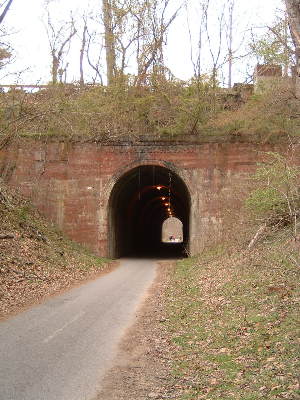
The Dalecarlia Tunnel, part of the Capital Crescent Trail

Coordinates: 38°56′37″N 77°06′57″W / 38.943548°N 77.115794°W / 38.943548; -77.115794 The Dalecarlia Tunnel is an abandoned railroad tunnel in Brookmont, Maryland, near Washington, D.C., that carries the Capital Crescent Trail underneath MacArthur Boulevard and the Washington Aqueduct.

It was built in 1910 as part of the Georgetown Branch of the Baltimore and Ohio Railroad. It is a Roman arch tunnel, measuring 18 feet (5.5 m) wide by 340 feet (100 m) long. It features decorative brick facings on both ends and is lined with brick throughout its length.

CSX Transportation, the successor to the B&O Railroad, ceased train operations through the tunnel in 1985 and officially abandoned the rail line in 1986.

See also

References

  • Harwood, Jr., Herbert H. (1979). Impossible Challenge: The Baltimore & Ohio Railroad in Maryland. Baltimore, MD: Barnard, Roberts. ISBN 0-934118-17-5. 

External links


Wikimedia Foundation. 2010.

Игры ⚽ Поможем написать реферат

Look at other dictionaries:

  • Túnel Dalecarlia — El túnel Dalecarlia, parte del sendero de Capital Crescent El Túnel Dalecarlia (o en inglés Dalecarlia Tunnel) es un túnel para ferrocarriles que llevaba la rama de trenes Georgetown Branch de la compañía Baltimore and Ohio Railroad por debajo… …   Wikipedia Español

  • Capital Crescent Trail — It is the most heavily used rail trail in the United States and is used by more than 1 million walkers, joggers, bikers, and rollerbladers each year. In 2005, it was named one of the 21 great places that show how transportation can enliven a… …   Wikipedia

  • List of tunnels in the United States — The following is a list of tunnels in the United States of America.See: List of tunnelsAlabama*Bankhead Tunnel, US 98, Mobile *George Wallace Tunnel, Interstate 10, Mobile *5th Avenue North Tunnel, Birmingham The tunnel runs beneath the site of… …   Wikipedia

  • Baltimore and Ohio Railroad — Infobox SG rail railroad name=Baltimore and Ohio Railroad logo filename=Baltimore and Ohio Herald.png logo size=100 system map size =260 map caption =1876 B O map old gauge= marks=BO locale=New York City, New York via Philadelphia, Pennsylvania,… …   Wikipedia

  • Metropolitan Subdivision — Rockville station in 1978, before relocation away from tracks …   Wikipedia

  • McMillan Reservoir — Location Washington, D.C. Coordinates …   Wikipedia

  • Washington Aqueduct — Infobox nrhp name = Washington Aqueduct nrhp type = nhl caption = The Union Arch Bridge carries the Washington Aqueduct across Cabin John Creek. location = 5900 MacArthur Blvd., NW Washington, D.C. nearest city = lat degrees = lat minutes = lat… …   Wikipedia

  • Chesapeake Bay — Coordinates: 36°59′45″N 75°57′34″W / 36.99583°N 75.95944°W / 36.99583; 75.95944 …   Wikipedia

  • Streetcars in Washington, D.C. — This article refers to the streetcars that existed in Washington prior to 1962. For information on the proposed new streetcar lines, see DC Streetcar. Washington Streetcars 15th Street NW in the early 20th century Info …   Wikipedia

  • Georgetown Reservoir — Infobox lake lake name = Georgetown Reservoir image lake = Georgetown pumping station castle.jpg caption lake = Georgetown pumping station castle. The castle is modeled after the U.S. Army Corps of Engineers insignia image bathymetry = caption… …   Wikipedia

Share the article and excerpts

Direct link
Do a right-click on the link above
and select “Copy Link”