- Bad Münster am Stein-Ebernburg
-
Bad Münster am Stein-Ebernburg 
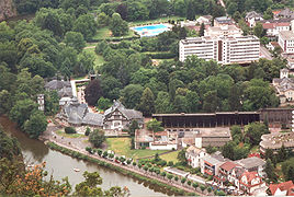
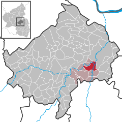
Coordinates 49°48′33″N 7°50′38″E / 49.80917°N 7.84389°ECoordinates: 49°48′33″N 7°50′38″E / 49.80917°N 7.84389°E Administration Country Germany State Rhineland-Palatinate District Bad Kreuznach Municipal assoc. Bad Münster am Stein-Ebernburg Mayor Michael Fries (SPD) Basic statistics Area 9.53 km2 (3.68 sq mi) Elevation 282 m (925 ft) Population 3,882 (31 December 2010)[1] - Density 407 /km2 (1,055 /sq mi) Other information Time zone CET/CEST (UTC+1/+2) Licence plate KH Postal code 55583 Area code 06708 Bad Münster am Stein-Ebernburg is a municipality in Germany in the state of Rhineland-Palatinate, district of Bad Kreuznach. The town has about 4000 inhabitants as of 2004 and covers an area of 9.53 square km and lies on the Nahe.
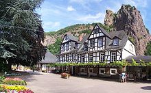
The town is first mentioned around the year 1200. It grew up beside the Rheingrafenstein, a castle built in 1050 that was the seat of the count palatine of the Rhine, which was destroyed in 1689 by the French, but the ruins remain. Ebernburg Castle was residence of famous German knight Franz von Sickingen.
Bad Münster am Stein-Ebernburg is the seat of the Verbandsgemeinde ("collective municipality") Bad Münster am Stein-Ebernburg.
Notable residents
- Rudolf Eickemeyer, (1831–1895), born in Altenbamberg, noted inventor with several innovations to hat manufacturing, patent for first symmetrical drum armature and iron clad dynamo, and first employer of Charles Proteus Steinmetz [2]
References
 Chisholm, Hugh, ed (1911). "Münster am Stein". Encyclopædia Britannica (11th ed.). Cambridge University Press.
Notes
- ^ "Bevölkerung der Gemeinden am 31.12.2010" (in German). Statistisches Landesamt Rheinland-Pfalz. 31 December 2010. http://www.statistik.rlp.de/fileadmin/dokumente/berichte/A1033_201022_hj_G.pdf.
- ^ Who Was Who in America, Historical Volume, 1607-1896. Chicago: Marquis Who's Who. 1963.
Categories:- Towns in Rhineland-Palatinate
- Bad Kreuznach district geography stubs
Wikimedia Foundation. 2010.


