- Dorsheim
-
Dorsheim 

 DorsheimLocation of Dorsheim within Bad Kreuznach district
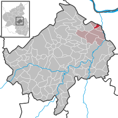
Coordinates 49°55′31″N 7°52′24″E / 49.92528°N 7.87333°ECoordinates: 49°55′31″N 7°52′24″E / 49.92528°N 7.87333°E Administration Country Germany State Rhineland-Palatinate District Bad Kreuznach Municipal assoc. Langenlonsheim Mayor Marlene Hölz Basic statistics Area 2.22 km2 (0.86 sq mi) Elevation 200 m (656 ft) Population 691 (31 December 2010)[1] - Density 311 /km2 (806 /sq mi) Other information Time zone CET/CEST (UTC+1/+2) Licence plate KH Postal code 55452 Area code 06721 Website www.dorsheim.de Dorsheim is a municipality in the district of Bad Kreuznach in Rhineland-Palatinate, in western Germany. The village of Dorsheim is situated on one of the higher western flanks of the Trollbach valley, just 4 km up from Münster Sarmsheim, which is where the valley ends abruptly in the form of a steep almost cliff-like hill (45m high). There is a popular view-point at the top called the 'Nahe-View' (Nahe-Blick) and it is a favourite jumping point for hang-gliders. if you travel up the Trollback Valley you will see some remarkable rock formations jutting out of the slopes. From the uppermost part of Dorsheim you can see as far away as Wiesbaden, Mainz, Ingelheim and down locally through the mouth of the valley to the more local outer districts of Bingen-Dietersheim. Bingen itself, and the nearby Rhein river are cut off from view, yet they are only a few minutes away with a car. The A61 motorway runs up/down the narrow valley and the Dorsheim exit is just 500m from the village. The steep inclination of the motorway leading down to the mouth of the valley is often a cause for accidents with heavy transporters. The two neihbouring villages of Burg Layen and Rümmelsheim are just 2 km further up the valley on the other side of the motorway.
Dorsheim is primarily a wine village and is surrounded by fields of grape veins. The ground is rich in natural minerals and there is a high rate of sunshine which makes the location ideal for wine production. Several of the world's most popular wines are produced in this area.
References
- ^ "Bevölkerung der Gemeinden am 31.12.2010" (in German). Statistisches Landesamt Rheinland-Pfalz. 31 December 2010. http://www.statistik.rlp.de/fileadmin/dokumente/berichte/A1033_201022_hj_G.pdf.
Categories:- Municipalities in Rhineland-Palatinate
- Bad Kreuznach district geography stubs


Wikimedia Foundation. 2010.