- Lake Moogerah
-
Lake Moogerah 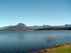
Lake Moogerah at 99.5% capacity Location Fassifern Valley, Queensland Coordinates 28°01′48″S 152°32′56″E / 28.0301°S 152.549°ECoordinates: 28°01′48″S 152°32′56″E / 28.0301°S 152.549°E Lake type reservoir Primary inflows Reynolds Creek Primary outflows Reynolds Creek Catchment area 227 km² [1] Basin countries Australia Surface area 827 ha Water volume 83 700 ML[2][3] Surface elevation 154.91 m AHD References [1][2][3] Lake Moogerah, formed by Moogerah Dam, is a water supply and irrigation dam on Reynolds Creek, a tributary of the Bremer River in Southeast Queensland's Fassifern Valley. The lake is used for recreation, fishing and camping. "Moogerah" comes from the aboriginal word Moojirah meaning home of the thunderstorm.
The lake is located around 60 km southwest of Ipswich and about 90 minutes drive from Brisbane. Aratula is the nearest town, about 11 km from the lake.
The dam supplies drinking water to the towns of Boonah and Ipswich, although the main user is the Swanbank Power Station. It also supplies irrigation water to small crop farms in the Fassifern Valley. SunWater is undertaking a dam spillway capacity upgrade program to ensure the continued safety of the dam.[4]
Contents
History
Construction on the dam began in 1959, although land for the project was resumed as early as 1916.[5] Moogerah Dam was completed in 1961 as the central catchment of the Warrill Valley Water Supply Scheme. The dam wall at Lake Moogerah allows access to Mount Edwards in Moogerah Peaks National Park.
During the 1995 drought dam levels declined to a low of 1% total capacity.[6] The dam reached 100% capacity due to rainfall associated with the 2010–2011 Queensland floods, with water flowing over the spillway for the first time since 1991 on 6 December 2010.[7][8]
Recreation
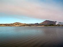 Looking east from picnic area, 2011
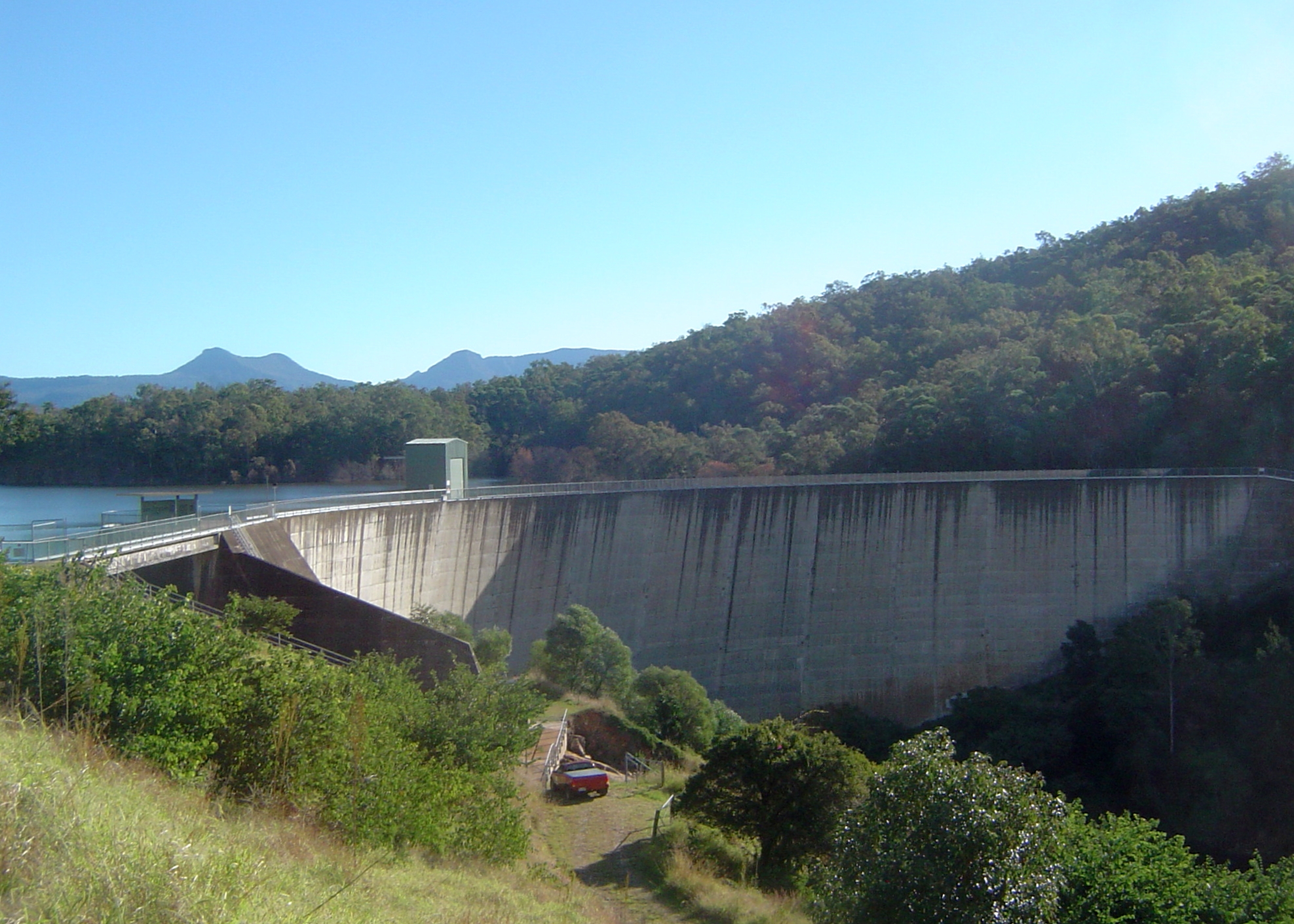
 Dam wall, 2011
There is a caravan park at Moogerah Dam. Camp Moogerah is on the eastern shore of the lake, offering cabin accommodation and outdoor activity camps for schools, churches, youth groups, sports clubs etc.[9]. On the western shore are Camp Mallon and Camp Laurence which offer group accommodation camps with educational and adventure activities for school students, family and church groups. On the southern shore is the privately owned and used, Brisbane Grammar School Pepperina Hill Campsite, which is primarily used for grade 8-10 camps.
As well as the barbecues and picnic areas available at Lake Moogerah Caravan Park there are a number of barbecues, covered picnic tables, toilet facilities and playgrounds on the opposite side of the lake at Haig Park. This side also provides access to the dam wall. Across the wall is Mount Edwards - a walking trail and hike. The road uphill behind the old kiosk (now a house) leads to a lookout and downhill to a further picnic area and playground at the bottom of the wall on the banks of Reynolds Creek.
Camping
Scenic Rim Regional Council operate a caravan park at the end of Muller Park road. It offers a variety of accommodation (powered, unpowered tent and caravan sites, overnight cabin and house and permanent cabins). Other site facilities include electric and wood barbecues, two boat ramps, kiosk (bread, milk, ice, firewood and sundries), kayak hire and children's playground. Lake Moogerah Caravan Park is located near many of the areas attractions and activities, including wineries, national parks and Lake Moogerah.
Boating
Lake Moogerah is extremely popular for waterskiing and plays host to jetski and waterskiing events throughout the year.
Fishing
A Stocked Impoundment Permit is required to fish in the dam.[10] Permits are available from the manager at Lake Moogerah Caravan Park.
Events
The Moogerah Passion Play is an open-air theatre production on the shores of Lake Moogerah. It is held every Easter, with a cast of up to 80.[11]
See also
References
- ^ a b Department of Natural Resources and Water
- ^ a b Sunwater Current Water Storage Information
- ^ a b Seqwater rainfall and dam level update
- ^ Spillway Capacity Upgrade Program
- ^ Queensland Environmental Protection Agency, Heritage Trails of the Great South East, State of Queensland, 2000 p 32. ISBN 0-7345-1008-X.
- ^ Collie, Gordon. Worst drought of century cripples farmers. The Courier Mail. 26 August 1995.
- ^ Queensland Seqwater Dam Level listing
- ^ News Page of the Lake Moogerah Caravan Park
- ^ Camp Moogerah, Outdoor Education, Sports Centre, School Camps And Youth Camps
- ^ Fishing in Queensland dams? You may need a permit.
- ^ Moogerah Passion Play
External links
Categories:- Lakes of Queensland
- Reservoirs and dams in Australia


Wikimedia Foundation. 2010.