- List of storms in the 2005 Atlantic hurricane season
The 2005 Atlantic hurricane season officially began June 1, 2005 and officially ended on November 30, 2005. These dates conventionally delimit the period of each year when mosttropical cyclone s form in theAtlantic basin , although effectively the season persisted into January 2006 due to continued storm activity.Tropical Storm Arlene
Infobox Hurricane Small
Basin=Atl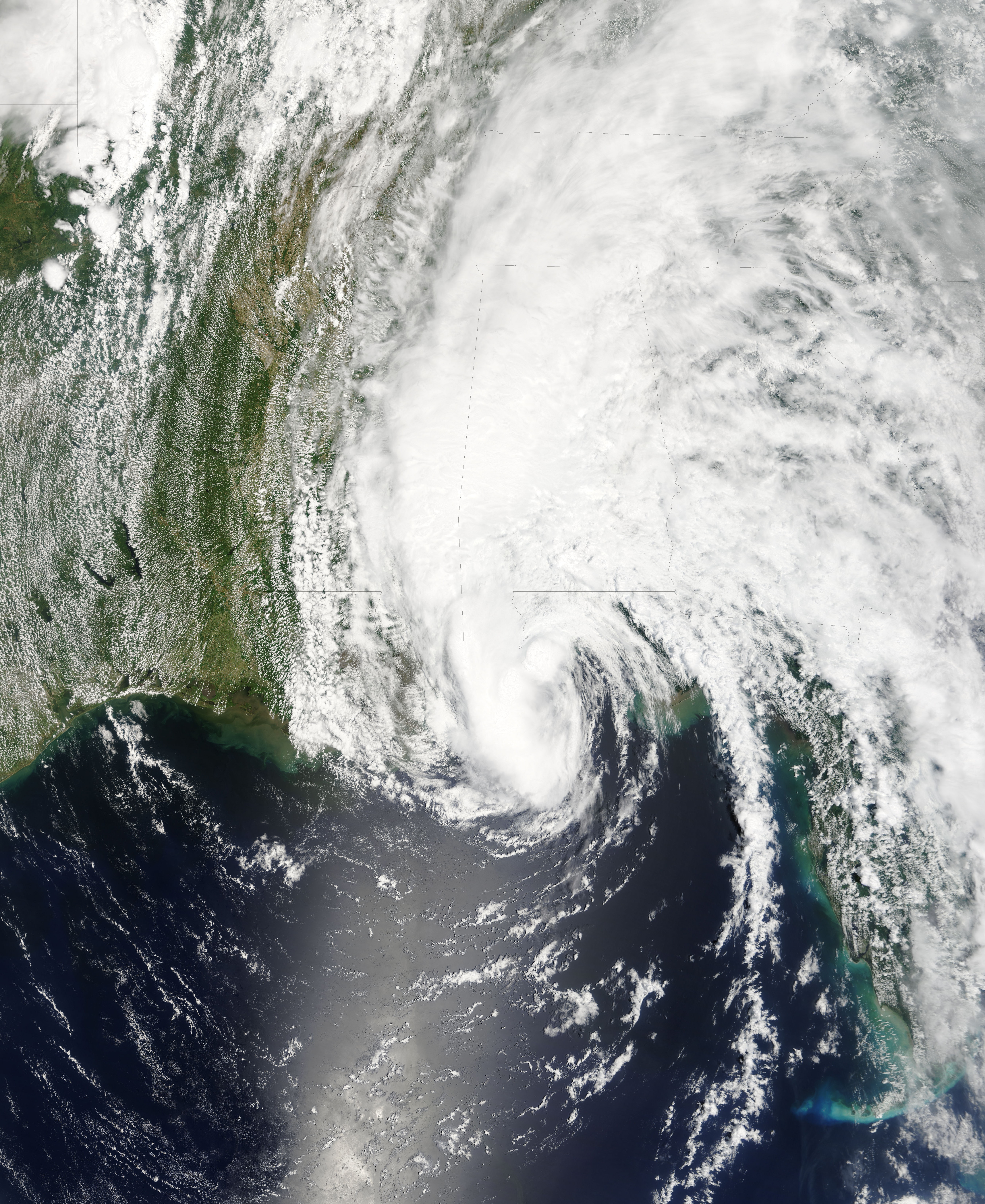
Track=Arlene 2005 track.png
Dissipated=June 13
1-min winds=60
Pressure=989Honduras . Despite moderate wind shear, the low managed to organize, and was designated Tropical Depression One on June 8. The storm strengthened further, and it was upgraded to Tropical Storm Arlene on the following day. From this point, Arlene headed north, intensifying steadily as it spread tropical storm-force winds and heavy rains to theCayman Islands andCuba . Arlene made landfall in Cuba nearCabo Corrientes with 50 mph (80 km/h) winds. Wind shear weakened as the storm entered theGulf of Mexico on the morning of June 10, and the storm intensified to just under hurricane strength with 70 mph (110 km/h) winds.cite web| author=National Hurricane Center| year=2005| title=Tropical Cyclone Report: Tropical Storm Arlene| publisher=NOAA| accessdate=2006-02-14| url=http://www.nhc.noaa.gov/pdf/TCR-AL012005_Arlene.pdf| format=PDF]Arlene made landfall just west of
Pensacola, Florida with 60 mph (95 km/h) winds on June 11. After moving inland, Arlene persisted as a dissipating tropical depression for two days, passing intoIndiana andMichigan before being absorbed by a frontal system over southeastern Canada on June 14.The only death attributed to Arlene was a female student caught in
rip current inMiami Beach, Florida , far from the center of circulation. [ [http://abcnews.go.com/US/wireStory?id=839989 Panhandle Braces for Tropical Storm Arlene] , Associated Press, June 11, 2005] Damage from Arlene totaled to $11.8 million.* The National Hurricane Center (NHC)'s [http://www.nhc.noaa.gov/archive/2005/refresh/ARLENE+shtml/ archive on Tropical Storm Arlene]
* The Hydrometeorological Prediction Center (HPC)'s [http://www.hpc.ncep.noaa.gov/tropical2005/ARLENE/ARLENE_archive.shtml archive on Tropical Storm Arlene]Tropical Storm Bret
Infobox Hurricane Small
Basin=Atl
Track=Bret 2005 track.png
Dissipated=June 30
1-min winds=35
Pressure=1002Bay of Campeche and quickly became better organized. It was designated Tropical Depression Two on the evening of June 28, and, two hours later, data from aHurricane Hunter aircraft indicated that it had strengthened into a tropical storm, at which point the system was named Bret. This was the first time that two tropical storms had formed in June since the 1986 season, and only the thirteenth time since 1851.cite web| author=National Hurricane Center| year=2006| title=Tropical Cyclone Report: Tropical Storm Bret| publisher=NOAA| accessdate=2006-02-14| url=http://www.nhc.noaa.gov/pdf/TCR-AL022005_Bret.pdf| format=PDF]As the storm developed very close to shore, it only briefly traveled west-northwest before making landfall near
Tuxpan ,Veracruz ,Mexico early on June 29 as a weak tropical storm. It continued inland, producing heavy rain over the state of Veracruz until dissipating over the mountains ofSan Luis Potosí late on June 29. Hundreds of homes were damaged, and several towns, including Naranjos and Chinampa, about 60 miles (95 km) south ofTampico , were severely flooded, but the only reported fatalities were the two occupants of a car that was swept away by floodwaters in Naranjos. [Palm Beach Post's [http://www.palmbeachpost.com/storm/content/storm/2005/atlantic/bret/news.html Bret Recap] ]
*The NHC's [http://www.nhc.noaa.gov/archive/2005/refresh/BRET+shtml/ archive on Tropical Storm Bret]Hurricane Cindy
Infobox Hurricane Small
Basin=Atl
Track=Cindy 2005 track.png
Dissipated=July 7
1-min winds=65
Pressure=991Yucatán Peninsula . The system emerged into theGulf of Mexico on July 4 at which point a new center of circulation developed at the northern edge of the system and the system strengthened to a tropical storm, becoming Tropical Storm Cindy early July 4. The storm moved rapidly across the Gulf and made landfall nearGrand Isle, Louisiana late July 5 as a minimal hurricane; though it was originally thought to have been only a tropical storm at landfall, it was upgraded to a hurricane in the post-storm analysis.cite web| author=National Hurricane Center| year=2006| title=Tropical Cyclone Report: Hurricane Cindy| publisher=NOAA| accessdate=2006-02-14| url=http://www.nhc.noaa.gov/pdf/TCR-AL032005_Cindy.pdf| format=PDF] As most storms do, it weakened while over land and became extratropical over theCarolinas on July 7.As a tropical depression well inland, Cindy spawned an F2
tornado which damaged landmarks inHampton, Georgia , including theAtlanta Motor Speedway , which suffered 40 million in damage alone. While tornadoes are often spawned by tropical systems, F2 tornadoes spawned this way are relatively rare. Large and sometimes record-breaking amounts of rain, more than 5 inches in places, fell over parts ofLouisiana ,Mississippi ,Alabama , andMaryland . Three deaths were attributed to Cindy—two in Georgia and another in Alabama.
*The NHC's [http://www.nhc.noaa.gov/archive/2005/refresh/CINDY+shtml/ archive on Hurricane Cindy]
*The HPC's [http://www.hpc.ncep.noaa.gov/tropical2005/CINDY/CINDY_archive.shtml archive on Hurricane Cindy]Hurricane Dennis
Infobox Hurricane Small
Basin=Atl
Track=Dennis 2005 track.png
Dissipated=July 13
1-min winds=130
Pressure=930Hispaniola . The next day it strengthened rapidly to become a Category 4 hurricane. Dennis moved betweenJamaica andHaiti on July 7. Dennis reached its peak as the strongest recorded Atlantic storm to form before August with a minimum central pressure of 930 mbar just south ofCuba - a record that would stand only for eight days until Emily broke it. On July 8, Dennis passed overCuba close to the capital,Havana . A second episode of rapid intensification occurred on July 9 as it moved north toward theGulf Coast of the United States . Dennis made landfall as a Category 3 storm just southeast ofPensacola, Florida .cite web| author=National Hurricane Center| year=2005| title=Tropical Cyclone Report: Hurricane Dennis| publisher=NOAA| accessdate=2006-02-14| url=http://www.nhc.noaa.gov/pdf/TCR-AL042005_Dennis.pdf| format=PDF]Dennis claimed at least 88 lives: 56 in
Haiti , 16 in Cuba, 15 in the U.S. and 1 in Jamaica. Total damages are estimated at $4-6 billionUSD , including $2.23 billion in the United States and the rest in the Caribbean. Dennis was most damaging toCuba , where the storm wiped out a significant portion of thecitrus crop. As the storm struck near the end of Cuba's dry season, farmers were not yet prepared for the heavy rainfall brought by the storm. In the United States, Dennis drew comparison withHurricane Ivan of the previous year, but it was both smaller and weaker than Ivan at landfall and caused significantly fewer damages, partly because the region had not yet fully rebuilt.
* The NHC's [http://www.nhc.noaa.gov/archive/2005/refresh/DENNIS+shtml/ archive on Hurricane Dennis]
* The HPC's [http://www.hpc.ncep.noaa.gov/tropical2005/DENNIS/DENNIS_archive.shtml archive on Hurricane Dennis]Hurricane Emily
Infobox Hurricane Small
Basin=Atl
Track=Emily 2005 track.png
Dissipated=July 21
1-min winds=140
Pressure=929Lesser Antilles on July 11. It moved westward and hitGrenada on July 14 as a Category 1 storm. It entered theCaribbean Sea and began intensifying rapidly. It reached Category 4 intensity on July 15. Emily brokeHurricane Dennis 's eight-day-old record for the most intense storm to form prior to August when it reached a minimum pressure of 929 mbar, along with 160 mph (260 km/h) winds on July 16. It was originally believed that Emily peaked at Category 4. However, some readings indicated that Emily briefly reached Category 5 strength around this time, [The July 17 5 a.m. EDT [http://www.nhc.noaa.gov/archive/2005/dis/al052005.discus.026.shtml? Discussion (#26) for Hurricane Emily] , National Hurricane Center] and Emily was upgraded to Category 5 status in the post-storm analysis.cite web| author=National Hurricane Center| year=2006| title=Tropical Cyclone Report: Hurricane Emily| publisher=NOAA| accessdate=2006-03-13| url=http://www.nhc.noaa.gov/pdf/TCR-AL052005_Emily.pdf| format=PDF] The storm weakened slightly, however, and after passing south ofJamaica and theCayman Islands , Emily made landfall on theYucatán Peninsula nearTulum on the morning of July 18 as a Category 4 hurricane. Emily emerged over theBay of Campeche and made its second landfall in rural northeastMexico nearBoca Madre ,Tamaulipas as a Category 3 storm.Emily is blamed for at least fourteen deaths; one in Grenada, four in Jamaica, seven in the Caribbean and two in Mexico. The storms also caused an estimated $550 million (2005
USD ) in damages, almost entirely inGrenada and theMexican state ofQuintana Roo . Some minor flooding occurred in northeastern Mexico and extreme southernTexas as a result of Emily's final landfall, but damages were light.
* The NHC's [http://www.nhc.noaa.gov/archive/2005/refresh/EMILY+shtml/ archive on Hurricane Emily]Tropical Storm Franklin
Infobox Hurricane Small
Basin=Atl
Track=Franklin 2005 track.png
Dissipated=July 29
1-min winds=60
Pressure=997Bahamas organized into Tropical Depression Six on the afternoon of July 21. The depression became the sixth named storm of the season only two hours later, the first time the sixth storm of the season had ever formed that early in the season. The storm headed northward from the Bahamas, then northeast over theAtlantic , becoming disorganized by July 24 under the effects of shear and drier air. It moved erratically, inching closer toBermuda while barely remaining a tropical storm. Bermuda received some strong wind gusts, but was otherwise unaffected. Tropical Storm Franklin then accelerated north and northeast, roughly paralleling theEast Coast of the United States , and intensified to near hurricane strength. Eventually, Franklin became extratropical along the coast ofNova Scotia and Newfoundland.cite web| author=National Hurricane Center| year=2006| title=Tropical Cyclone Report: Tropical Storm Franklin| publisher=NOAA| accessdate=2006-03-17| url=http://www.nhc.noaa.gov/pdf/TCR-AL062005_Franklin.pdf| format=PDF]
* The NHC's [http://www.nhc.noaa.gov/archive/2005/refresh/FRANKLIN+shtml/ archive on Tropical Storm Franklin]Tropical Storm Gert
Infobox Hurricane Small
Basin=Atl.png)
Track=Gert 2005 track.png
Dissipated=July 25
1-min winds=40
Pressure=1005Honduras and theYucatán peninsula, organized into Tropical Depression Seven on the afternoon of July 23 in theBay of Campeche . It was upgraded to Tropical Storm Gert early the next day, the earliest formation of a seventh named storm on record. It strengthened little before making landfall on the coast ofMexico south ofTampico late on July 24 with maximum sustained winds of 45 mph (70 km/h) and a minimum central pressure of 1005 mbar. It moved inland over centralMexico before dissipating on July 25.cite web| author=National Hurricane Center| year=2005| title=Tropical Cyclone Report: Tropical Storm Gert| publisher=NOAA| accessdate=2006-02-14| url=http://www.nhc.noaa.gov/pdf/TCR-AL072005_Gert.pdf| format=PDF]Gert struck in roughly the same area as Hurricane Emily just four days earlier, causing fear of flooding and landslides due to saturated lands. As a precaution some 1,000 people were evacuated from low-lying residences and businesses near the towns of Naranjos and Tamiahua.
* The NHC's [http://www.nhc.noaa.gov/archive/2005/refresh/GERT+shtml/ archive on Tropical Storm Gert]Tropical Storm Harvey
Infobox Hurricane Small
Basin=Atl
Track=Harvey 2005 track.png
Dissipated=August 8
1-min winds=55
Pressure=994Bermuda on August 2. It became a tropical storm the next day.cite web| author=National Hurricane Center| year=2006| title=Tropical Cyclone Report: Tropical Storm Harvey| publisher=NOAA| accessdate=2006-03-17| url=http://www.nhc.noaa.gov/pdf/TCR-AL082005_Harvey.pdf| format=PDF]Harvey was not initially a particularly well-organized storm, and had some subtropical characteristics, but it soon became more tropical in nature. It passed just south of Bermuda early on August 4 while at its peak intensity, with maximum sustained winds of 65 mph (105 km/h) and a minimum central pressure of 994 mbar. Though Bermuda was soaked by Harvey, the island sustained no damage.
Harvey then headed east and later northeast over the open Atlantic. The storm became extratropical on the afternoon of August 8.
* The NHC's [http://www.nhc.noaa.gov/archive/2005/HARVEY.shtml? archive on Tropical Storm Harvey]Hurricane Irene
Infobox Hurricane Small
Basin=Atl
Track=Irene 2005 track.png
Dissipated=August 18
1-min winds=90
Pressure=970Cape Verde on the afternoon of August 4, the second Cape Verde-type storm of the season. The system encountered dry air and wind shear as it turned to the northwest and it broke down. Despite poor organization and shearing winds, it became Tropical Storm Irene on August 7. Further shear and dry air disrupted the cyclone's structure, and Irene was downgraded to a tropical depression on August 8.cite web| author=National Hurricane Center| year=2006| title=Tropical Cyclone Report: Hurricane Irene| publisher=NOAA| accessdate=2006-02-14| url=http://www.nhc.noaa.gov/pdf/TCR-AL092005_Irene.pdf| format=PDF]Irene cycled between apparent reintensification and significant weakening, becoming so disorganized in the early morning of August 10 that forecasters were considering declaring the storm dissipated. [The August 10 5 a.m. [http://www.nhc.noaa.gov/archive/2005/dis/al092005.discus.023.shtml? Discussion (#23) for Tropical Depression Irene] ] However, the depression continued to move westward into more favorable conditions and again attained tropical storm status, rapidly strengthening to a Category 1 hurricane on August 14. Later, it strengthened even further in low shear conditions under an upper level
anticyclone . On August 16 it briefly strengthened to a Category 2 hurricane, but began to weaken in cooler waters shortly thereafter. It became extratropical southeast ofCape Race, Newfoundland on August 18, having never posed a threat to land.
*The NHC's [http://www.nhc.noaa.gov/archive/2005/IRENE.shtml? archive on Hurricane Irene]Tropical Depression Ten
Infobox Hurricane Small
Basin=Atl.png)
Track=10-L 2005 track.png
Dissipated=August 14
1-min winds=30
Pressure=1008Lesser Antilles on August 13. Conditions were not favorable for development, as strong vertical shear literally ripped the system apart, and advisories were discontinued the next day when it showed no organized deep convection. The remnants of Tropical Depression Ten continued drifting northwestward before degenerating into a tropical wave north of theLeeward Islands . The mid-level remnant circulation eventually merged with another system in the "complex genesis" of what would become Tropical Depression Twelve and, eventually,Hurricane Katrina .cite web| author=National Hurricane Center| year=2006| title=Tropical Cyclone Report: Tropical Depression Ten| publisher=NOAA| accessdate=2006-02-14| url=http://www.nhc.noaa.gov/pdf/TCR-AL102005_Ten.pdf| format=PDF]
* The NHC's [http://www.nhc.noaa.gov/archive/2005/TEN.shtml? archive on Tropical Depression Ten]Tropical Storm Jose
Infobox Hurricane Small
Basin=Atl
Track=Jose 2005 track.png
Dissipated=August 23
1-min winds=50
Pressure=998Bay of Campeche on August 22. Later in the day it strengthened into Tropical Storm Jose over the warm waters of the Gulf of Mexico and achieved a maximum strength of 60 mph (95 km/h) before it made landfall in the state ofVeracruz ,Mexico on August 23. It then rapidly weakened and soon dissipated as it moved inland over Mexico. While drenching Mexico's Gulf coast, Jose forced some 25,000 residents from their homes in Veracruz state. Eight deaths (six direct) were attributed to Jose's heavy rains in the Mexican state ofOaxaca . Two more were reported missing. [cite web | title=http://www.alertnet.org/thenews/newsdesk/N23540113.htm | url=http://www.alertnet.org/thenews/newsdesk/N23540113.htm | accessdate=December 3 | accessyear=2005 ] cite web| author=National Hurricane Center| year=2006| title=Tropical Cyclone Report: Tropical Storm Jose| publisher=NOAA| accessdate=2006-02-14| url=http://www.nhc.noaa.gov/pdf/TCR-AL112005_Jose.pdf| format=PDF] Damage in Mexico totaled to $45 million. [cite web | title= Estiman daños en Veracruz por 500 millones de pesos | year=2005 | publisher=Teorema Ambiental|accessdate=2006-04-22|url=http://www.teorema.com.mx/articulos.php?id_sec=44&id_art=184]Later analysis showed that Jose became more organized two hours before making landfall and was forming an eye, but its winds remained under hurricane strength. [The August 23 5 a.m. [http://www.nhc.noaa.gov/archive/2005/dis/al112005.discus.005.shtml? Discussion (#5) for Tropical Storm Jose] ] The final report suggested that the winds made it up to 60 mph (95 km/h) and made landfall as such, but was still rapidly intensifying before running out of water.
* The NHC's [http://www.nhc.noaa.gov/archive/2005/JOSE.shtml? archive on Tropical Storm Jose]
* The NHC's [http://www.nhc.noaa.gov/pdf/TCR-AL112005_Jose.pdf Tropical Cyclone Report for Jose]Hurricane Katrina
Infobox Hurricane Small
Basin=Atl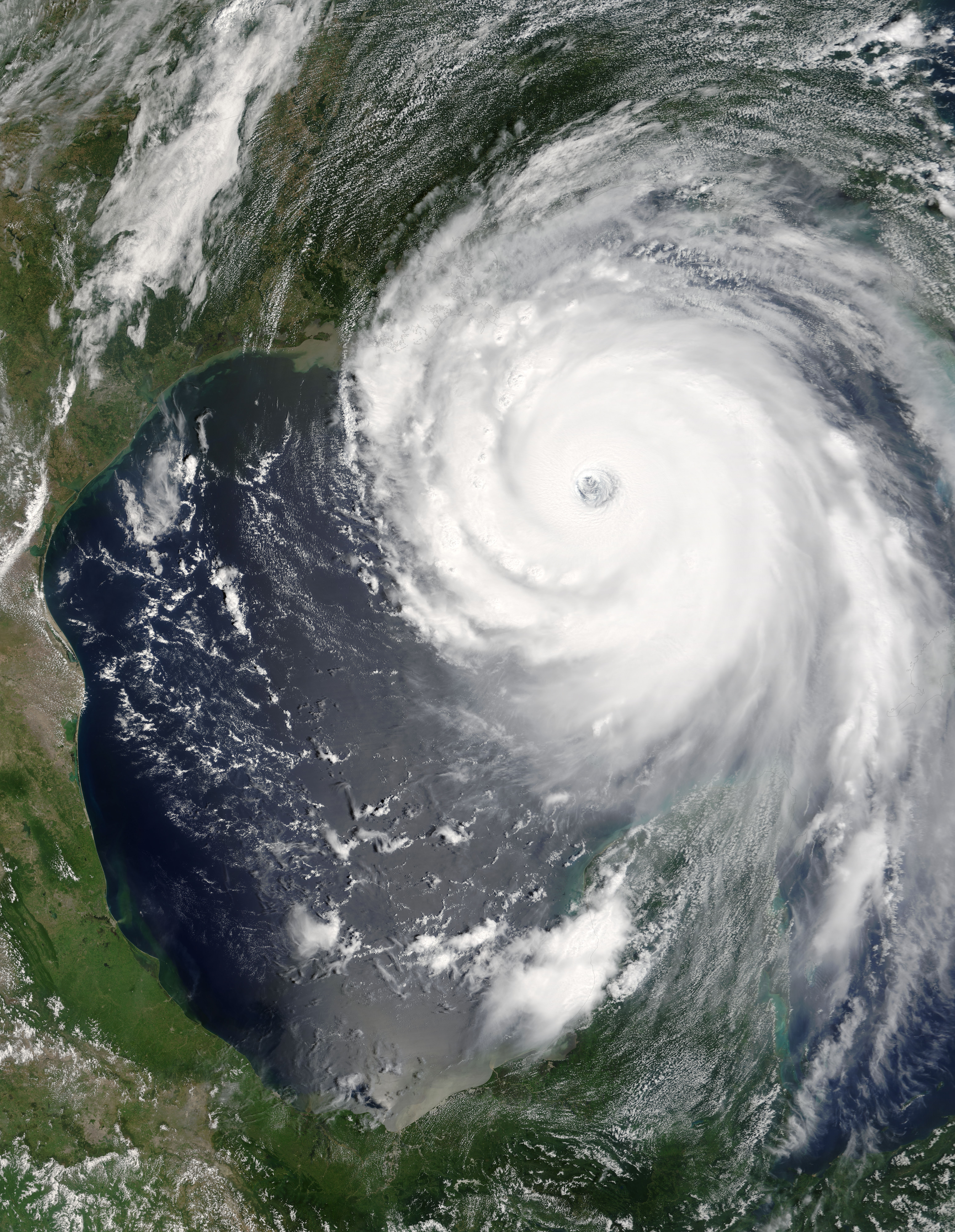
Track=Katrina 2005 track.png
Dissipated=August 30
1-min winds=150
Pressure=902Bahamas developed into a tropical depression on August 23, becoming a tropical storm on the 24th and a hurricane on the 25th. It made landfall on August 25 in southernFlorida , emerging a few hours later into theGulf of Mexico . Katrina rapidly intensified to Category 5 status on the morning of August 28, becoming the fourth most intense recorded hurricane in theAtlantic basin . The hurricane weakened to a Category 4 as it turned northward, and weakened to a Category 3 hurricane with 125 mph winds as it made landfall in southeasternLouisiana (as confirmed by the post-storm report; initially it was estimated as a Category 4 landfall). Hours later, it crossed theBreton Sound and held its strength, making its third and final landfall with 120 mph winds nearPearlington, Mississippi .cite web| author=National Hurricane Center| year=2005| title=Tropical Cyclone Report: Hurricane Katrina| publisher=NOAA| accessdate=2006-02-14| url=http://www.nhc.noaa.gov/pdf/TCR-AL122005_Katrina.pdf| format=PDF]The Mississippi and Alabama coastlines suffered catastrophic damage from the storm's 30-foot (9 m) storm surge. New Orleans escaped the worst damage from the storm, but
levee s along theGulf Intracoastal Waterway and 17th Street andLondon Avenue Canal s ultimately were breached bystorm surge , flooding about 80% of the city. 1,836 people have been confirmed dead across 7 US states. Katrina is the costliest and one of the deadliest natural disasters in U.S. history, with damage totals around $81.2 billion (USD ). The damage and fatality estimates remain incomplete.
* The NHC's [http://www.nhc.noaa.gov/archive/2005/KATRINA.shtml? archive on Hurricane Katrina]
* The HPC's [http://www.hpc.ncep.noaa.gov/tropical2005/KATRINA/KATRINA_archive.shtml archive on Hurricane Katrina]Tropical Storm Lee
Infobox Hurricane Small
Basin=Atl
Track=Lee 2005 track.png
Dissipated=September 2
1-min winds=35
Pressure=1006tropical wave about 960statute mile s (1,550 km) east of theLesser Antilles on August 28. It then degenerated into a broad area of low pressure on August 29, but later regenerated on August 31 and theNational Hurricane Center resumed advisories. Later that day, it strengthened into Tropical Storm Lee, the 12th named storm of the season. It was a tropical storm for twelve hours, before being downgraded to a tropical depression later that evening, having encountered an unfavorable upper level environment. The tropical depression dissipated on the morning of September 2.cite web| author=National Hurricane Center| year=2005| title=Tropical Cyclone Report: Tropical Storm Lee| publisher=NOAA| accessdate=2006-02-14| url=http://www.nhc.noaa.gov/pdf/TCR-AL132005_Lee.pdf| format=PDF]Lee never posed any threat to land as it remained in the middle of the
Atlantic .
* The NHC's [http://www.nhc.noaa.gov/archive/2005/refresh/LEE+shtml/ archive on Tropical Storm Lee]Hurricane Maria
Infobox Hurricane Small
Basin=Atl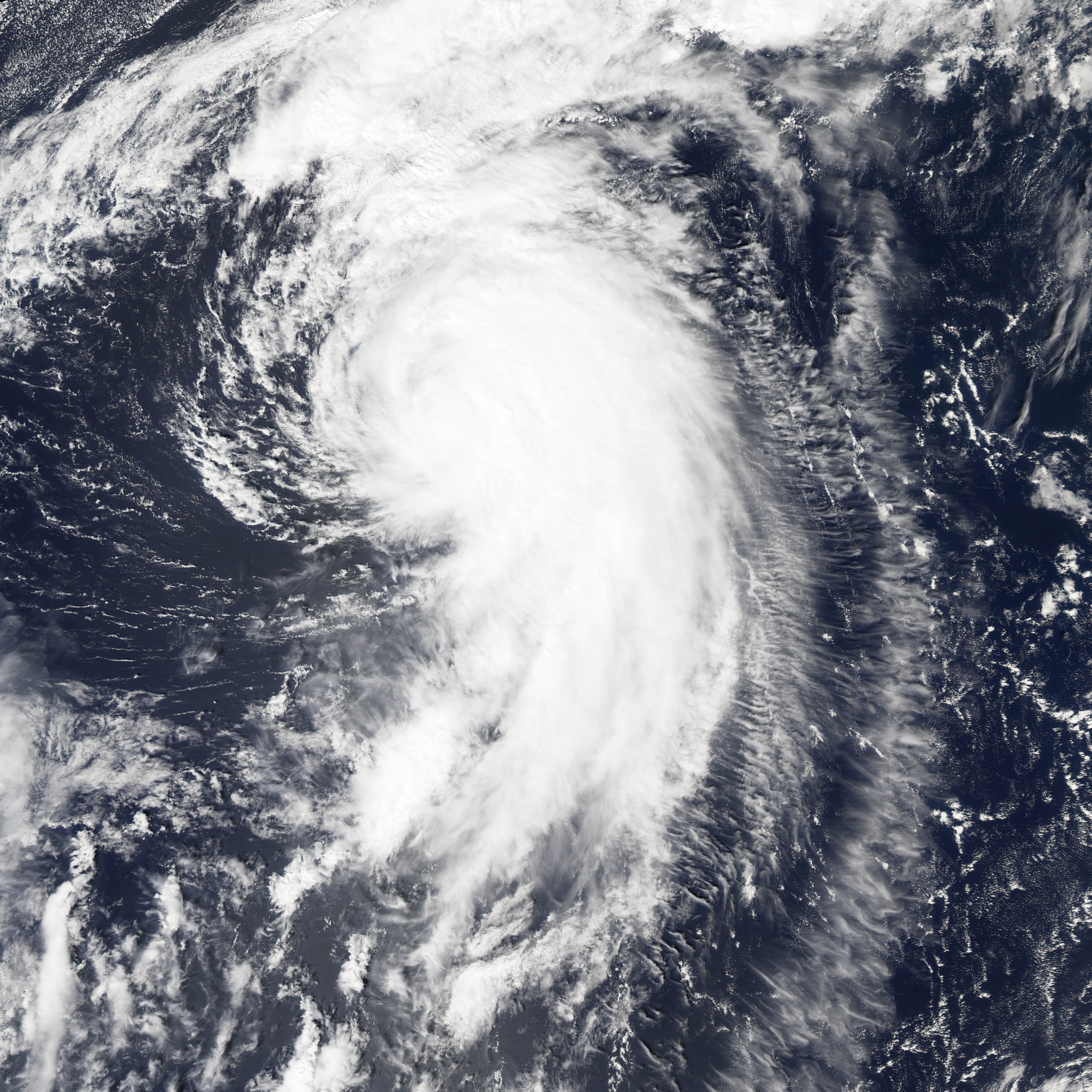
Track=Maria 2005 track.png
Dissipated=September 10
1-min winds=100
Pressure=962tropical wave 1100 statute miles (1,770 km) east of theLeeward Islands on September 1, and strengthened to Tropical Storm Maria the next day. Early on September 4, Maria became the fifth hurricane of the season. On September 5, it briefly strengthened to Category 3 intensity, making it the fourth major hurricane of the season. It gradually weakened and dropped to tropical storm strength on September 8.cite web| author=National Hurricane Center| year=2006| title=Tropical Cyclone Report: Hurricane Maria| publisher=NOAA| accessdate=2006-02-14| url=http://www.nhc.noaa.gov/pdf/TCR-AL142005_Maria.pdf| format=PDF]Maria became
extratropical mid-way betweenCape Race and theAzores on September 10. It never threatened land as a hurricane, but Maria became a strongextratropical storm, and actually strengthened to hurricane strength once again while moving towardsIceland . [cite web | title=Ramblings' Journal: Five-day track on Hurricane Maria puts it near ICELAND! | url=http://mhking.mu.nu/archives/117015.php | accessdate=December 3 | accessyear=2005 ]The remnants of Maria triggered a landslide in
Norway that killed three people.
* The NHC's [http://www.nhc.noaa.gov/archive/2005/refresh/MARIA+shtml/ archive on Hurricane Maria]Hurricane Nate
Infobox Hurricane Small
Basin=Atl
Track=Nate 2005 track.png
Dissipated=September 10
1-min winds=80
Pressure=979statute mile s (560 km) south-southwest ofBermuda organized into a tropical depression on September 5. It strengthened into Tropical Storm Nate that evening and continued to strengthen with little change in position, becoming the sixth hurricane of the season on September 7.cite web| author=National Hurricane Center| year=2005| title=Tropical Cyclone Report: Hurricane Nate| publisher=NOAA| accessdate=2006-02-14| url=http://www.nhc.noaa.gov/pdf/TCR-AL152005_Nate.pdf| format=PDF]Hurricane Nate passed 125 statute miles (200 km) south of
Bermuda on September 8 and reached peak intensity of 90 mph (145 km/h). Nate then began to weaken. After turning north, it becameextratropical over the centralAtlantic Ocean on September 10.Canadian Navy
ships headed to the U.S. Gulf Coast to help in the aftermath ofHurricane Katrina were slowed down trying to avoid Nate andHurricane Ophelia (see below). [cite web | title=The Sun News : 09/11/2005 : Storms delay Katrina-aid ships | url=http://www.myrtlebeachonline.com/mld/myrtlebeachonline/news/nation/12616069.htm | accessdate=December 3 | accessyear=2005 ]
* The NHC's [http://www.nhc.noaa.gov/archive/2005/refresh/NATE+shtml/ archive on Hurricane Nate]Hurricane Ophelia
Infobox Hurricane Small
Basin=Atl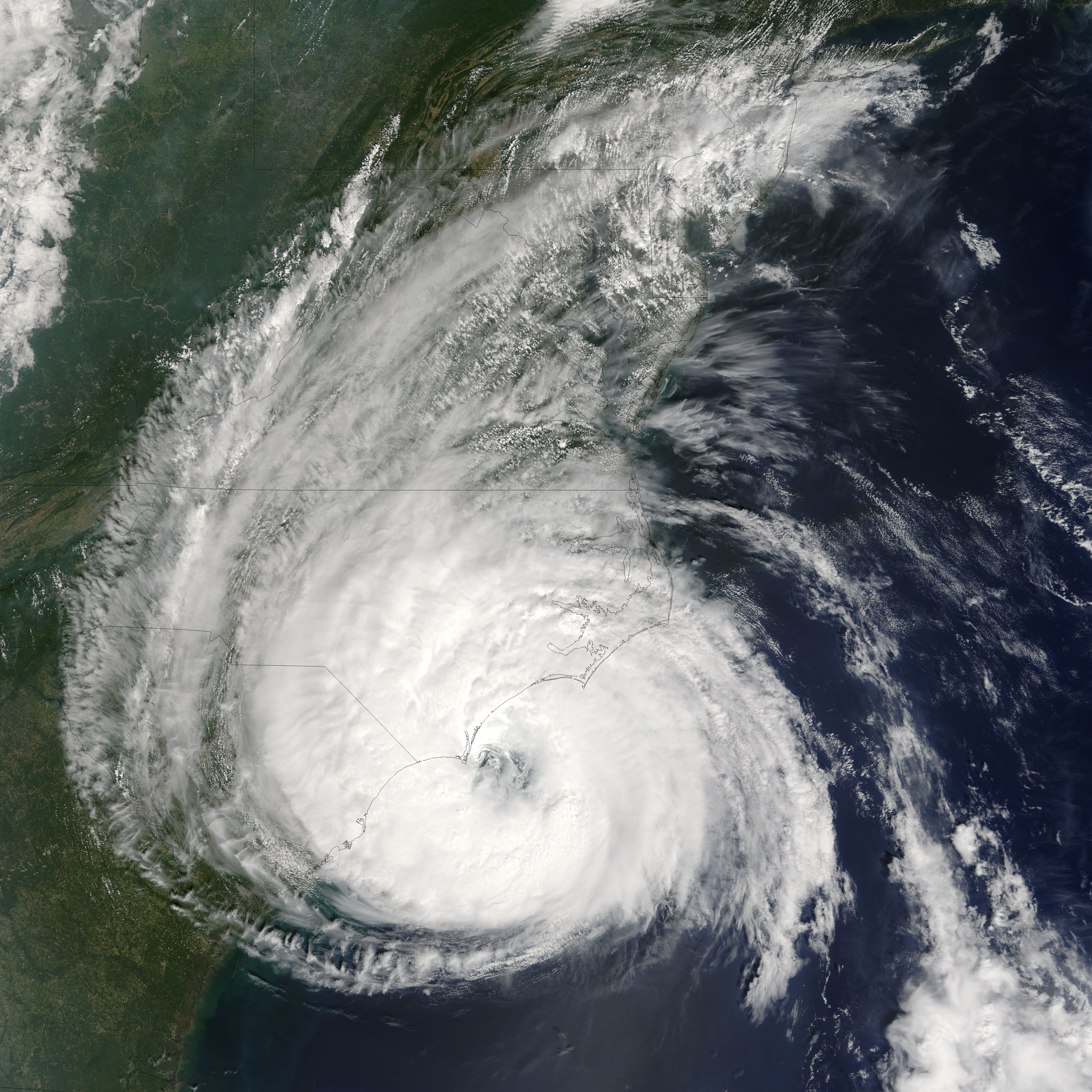
Track=Ophelia 2005 track.png
Dissipated=September 17
1-min winds=75
Pressure=976Bahamas on September 6. Early on September 7, it organized into Tropical Storm Ophelia, becoming a hurricane the next day. It churned nearly stationary for two days off the coast ofFlorida where significantcoastal erosion resulted from the churning waves. On September 12, the storm began moving slowly towardNorth Carolina , at times nearly stalling and alternating between tropical storm and hurricane intensity. The hurricane did not make landfall, although the westerneyewall reached the coastal areas ofNorth Carolina , causing extensive damage in theOuter Banks and aroundCape Fear . Ophelia moved north and became extratropical late on September 17 nearNova Scotia , but it continued northeastward, producing strong winds and heavy rain overAtlantic Canada .cite web| author=National Hurricane Center| year=2006| title=Tropical Cyclone Report: Hurricane Ophelia| publisher=NOAA| accessdate=2006-02-14| url=http://www.nhc.noaa.gov/pdf/TCR-AL162005_Ophelia.pdf| format=PDF]Only three fatalities were reported, one direct death in
Florida from high surf, one indirect death in atraffic accident inNorth Carolina and a second indirect death due to a fall inNova Scotia . Damage is estimated at around $70 million, mostly inNorth Carolina but also in theBahamas andNova Scotia and on theFlorida coast. While the storm was initially estimated to have caused as much as $1 billion in damages, that number was determined to be a significant overestimate.
* The NHC's [http://www.nhc.noaa.gov/archive/2005/refresh/OPHELIA+shtml/ archive on Hurricane Ophelia]Hurricane Philippe
Infobox Hurricane Small
Basin=Atl
Track=Philippe 2005 track.png
Dissipated=September 23
1-min winds=70
Pressure=985Leeward Islands . It was upgraded to a tropical storm late that evening. This marked only the third time that the 'P ' name had been used to name anAtlantic storm since alphabetical naming began in 1950. The other times were for Pablo in 1995 and Peter in 2003.cite web| author=National Hurricane Center| year=2006| title=Tropical Cyclone Report: Hurricane Philippe| publisher=NOAA| accessdate=2006-02-14| url=http://www.nhc.noaa.gov/pdf/TCR-AL172005_Philippe.pdf| format=PDF]On September 18, Philippe was upgraded to a hurricane, becoming the eighth Atlantic hurricane of the season. It was downgraded to a tropical storm on the afternoon of September 20 and dissipated 3 days later south of
Bermuda .
* The NHC's [http://www.nhc.noaa.gov/archive/2005/refresh/PHILIPPE+shtml/ archive on Hurricane Philippe]Hurricane Rita
Infobox Hurricane Small
Basin=Atl
Track=Rita 2005 track.png
Dissipated=September 26
1-min winds=155
Pressure=895Turks and Caicos Islands on September 18. Later that day, it became the seventeenth tropical storm of the season. Rita slowly intensified to become a hurricane on September 20. It was at Category 1 and later Category 2 intensity as it moved south of theFlorida Keys . Rapid intensification ensued as Rita moved into theGulf of Mexico on September 20, and Rita became a Category 5 hurricane on September 21, becoming at the time the third-most intense hurricane ever recorded in the Atlantic Basin with a minimum central pressure of 897 mbar, though it would later fall to fourth followingHurricane Wilma . However, as the storm moved slowly across theGulf of Mexico it gradually weakened until landfall. Rita made landfall as a weak Category 3 hurricane inCameron Parish ,Louisiana near theTexas /Louisiana border on September 24, 2005.cite web| author=National Hurricane Center| year=2006| title=Tropical Cyclone Report: Hurricane Rita| publisher=NOAA| accessdate=2006-03-17| url=http://www.nhc.noaa.gov/pdf/TCR-AL182005_Rita.pdf| format=PDF]Major flooding was reported in Port Arthur and Beaumont. Cameron and Calcasieu Parishes in
Louisiana were also devastated. Offshore oil platforms throughout Rita's path also suffered significant damage, though the refineries ofHouston, Texas , originally thought to be at risk, escaped the brunt of the storm. Seven people are confirmed dead from Rita's direct effects, and total damage from the storm is estimated at $10 billion, almost entirely inTexas andLouisiana . 55-112 indirect deaths have also been reported, most resulting from incidents during the evacuation ofHouston, Texas when the storm was predicted to strike the city. Many of the indirect deaths were caused by a single bus fire in the mass exodus.
* The NHC's [http://www.nhc.noaa.gov/archive/2005/refresh/RITA+shtml/ archive on Hurricane Rita]
* The HPC's [http://www.hpc.ncep.noaa.gov/tropical2005/RITA/RITA_archive.shtml archive on Hurricane Rita]Tropical Depression Nineteen
Infobox Hurricane Small
Basin=Atl
Track=19-L 2005 track.png
Dissipated=October 2
1-min winds=30
Pressure=1006Cape Verde Islands and developed into a tropical depression on September 30. It moved to the northwest and reached a peak strength of 35 mph and minimum central pressure of 1006 mbar. It experienced strong shear and dissipated on October 2 without strengthening to a tropical storm.cite web| author=National Hurricane Center| year=2006| title=Tropical Cyclone Report: Tropical Depression Nineteen| publisher=NOAA| accessdate=2006-02-14| url=http://www.nhc.noaa.gov/pdf/TCR-AL192005_Nineteen.pdf| format=PDF]
* The NHC's [http://www.nhc.noaa.gov/archive/2005/refresh/NINETEEN+shtml/ archive on Tropical Depression Nineteen]Hurricane Stan
Infobox Hurricane Small
Basin=Atl
Track=Stan 2005 track.png
Dissipated=October 5
1-min winds=70
Pressure=977Caribbean Sea organized into Tropical Depression Twenty on October 1. Off the coast of theYucatán Peninsula , it strengthened into Tropical Storm Stan on October 2. Stan made landfall on the Yucatán and weakened to a tropical depression, but upon reemerging into theBay of Campeche it quickly strengthened into a hurricane on October 4. Stan made landfall later that morning on the east-central coast ofMexico , south of Veracruz, as a Category 1 hurricane.cite web| author=National Hurricane Center| year=2006| title=Tropical Cyclone Report: Hurricane Stan| publisher=NOAA| accessdate=2006-02-14| url=http://www.nhc.noaa.gov/pdf/TCR-AL202005_Stan.pdf| format=PDF]Stan was associated with a large area of loosely-organized but very heavy shower activity existing over Mexico and Central America during this time. Torrential rainfall in this area caused catastrophic flooding and mudslides which were responsible for at least 1,662 deaths in six countries; 1,500 of these casualties occurred in
Guatemala alone. Initially, more than a thousand deaths were attributed toHurricane Stan , but theNational Hurricane Center postulates that all but less than 100 of the deaths were more related to the larger weather event. This was not definitively confirmed in the Tropical Cyclone Report for Hurricane Stan, though it is certain that only 80-100 deaths resulted from the "direct" effects of the hurricane.In addition to the large number of people killed during this time, over 100,000 people were forced to evacuate. The eruption of the
Santa Ana Volcano on October 1 contributed to the destruction in Central America as a result of the floods and mudslides caused.
*The NHC's [http://www.nhc.noaa.gov/archive/2005/refresh/STAN+shtml/ archive on Hurricane Stan]Unnamed Subtropical Storm
Infobox Hurricane Small
Basin=Atl
Type=subtropical.jpg)
Track=2005 Atlantic subtropical storm 19 track.png
Dissipated=October 5
1-min winds=45
Pressure=997National Hurricane Center identified an additional subtropical storm that had gone unnoticed during the course of the season. The storm formed on October 4 and was absorbed by a non-tropical low the next day after passing over theAzores , whereSanta Maria Island reported sustained winds up to 40 mph (60 km/h). The low that absorbed the storm would eventually become Hurricane Vince. At its peak, the storm had winds of 50 mph (80 km/h) and a minimum central pressure of 997mbar (hPa ). No damages or casualties were reported. [cite web| author=National Hurricane Center| year=2006| title=Tropical Cyclone Report: Unnamed Subtropical Storm| publisher=NOAA| accessdate=2006-04-11| url=http://www.nhc.noaa.gov/pdf/TCR-AL212005_Unnamed_Subtropical_Storm.pdf| format=PDF]Tropical Storm Tammy
Infobox Hurricane Small
Basin=Atl
Track=Tammy 2005 track.png
Dissipated=October 6
1-min winds=45
Pressure=1001Bahamas showed signs of having a well-defined surface circulation and sufficient wind velocity, and was upgraded toTropical Storm Tammy at 7:30 a.m. EDT (1130 UTC) October 5 east of Florida, skipping tropical depression status. This marked only the second time that the 'T' name has been used to name an Atlantic storm since alphabetical naming began in 1950; the other time was for Tanya in 1995.cite web| author=National Hurricane Center| year=2006| title=Tropical Cyclone Report: Tropical Storm Tammy| publisher=NOAA| accessdate=2006-02-14| url=http://www.nhc.noaa.gov/pdf/TCR-AL222005_Tammy.pdf| format=PDF]Tammy made landfall in the vicinity of
Naval Station Mayport nearJacksonville, Florida late that same evening. Tammy then moved rapidly inland across southern Georgia andAlabama before dissipating into a remnant low that drifted south into theGulf of Mexico . The rains associated with Tammy became disconnected from the cyclonic circulation after landfall, and affected much of Georgia,South Carolina and parts ofNorth Carolina . The frontal system it merged with was responsible for the flooding in the northeast. (See Northeast Flooding of October 2005.)
*The NHC's [http://www.nhc.noaa.gov/archive/2005/refresh/TAMMY+shtml/ archive on Tropical Storm Tammy]
*The HPC's [http://www.hpc.ncep.noaa.gov/tropical2005/TAMMY/TAMMY_archive.shtml archive on Tropical Storm Tammy]ubtropical Depression Twenty-two
Infobox Hurricane Small
Basin=Atl
Type=subtropical
Track=22-L 2005 track.png
Dissipated=October 10
1-min winds=30
Pressure=1008Bermuda on October 8. The system encountered unfavorable conditions, and advisories were discontinued later that night as the system dissipated at 11 p.m. EDT (0300UTC October 9). The NHC continued to monitor the remnant as it headed towards the east coast of the United States. The extratropical system continued to pull tropical moisture northward (and strengthened to tropical storm intensity) cite web| author=National Hurricane Center| year=2006| title=Tropical Cyclone Report: Subtropical Depression Twenty-Two| publisher=NOAA| accessdate=2006-02-14| url=http://www.nhc.noaa.gov/pdf/TCR-AL232005_Twenty-two.pdf| format=PDF] and was, along with Tropical Storm Tammy, a partial cause of severe flooding inNew York ,New Jersey andNew England during early to mid-October. The flooding killed 10 people and contributed to the wettest month on record in locales throughout the Northeastern United States. [cite web | title=1010 WINS: October Was Wettest Month On Record | url=http://1010wins.com/topstories/local_story_305070459.html | accessdate=December 3 | accessyear=2005 ]
*The NHC's [http://www.nhc.noaa.gov/archive/2005/refresh/TWENTY-TWO+shtml/ archive on Subtropical Depression Twenty-two]Hurricane Vince
Infobox Hurricane Small
Basin=Atl
Track=Vince 2005 track.png
Dissipated=October 11
1-min winds=65
Pressure=988Madeira (east-southeast of theAzores ) and was upgraded to a hurricane later that day though later analysis indicated that it had formed as a subtropical storm the previous day. Although Vince was a very small and short-lived storm that only briefly reached hurricane strength, it was notable for developing in the eastern Atlantic, well away from where hurricanes are usually found. This may be the farthest north and east a tropical cyclone has ever formed in the Atlantic Basin.cite web| author=National Hurricane Center| year=2006| title=Tropical Cyclone Report: Hurricane Vince| publisher=NOAA| accessdate=2006-02-22| url=http://www.nhc.noaa.gov/pdf/TCR-AL242005_Vince.pdf| format=PDF]Vince made landfall on the
Iberian Peninsula nearHuelva , Spain on October 11 just after weakening to a tropical depression. Vince was the first tropical cyclone on record to make landfall in Europe. No damages or injuries were reported.
*The NHC's [http://www.nhc.noaa.gov/archive/2005/refresh/VINCE+shtml/ archive on Hurricane Vince]Hurricane Wilma
Infobox Hurricane Small
Basin=Atl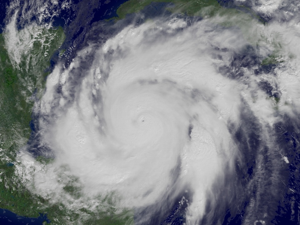
Track=Wilma 2005 track.png
Dissipated=October 25
1-min winds=160
Pressure=882Jamaica on October 15 and was upgraded to a tropical storm on October 17. On October 18, the storm developed a tiny, well-defined eye and began intensifying rapidly, reaching Category 5 strength with a record-setting pressure of 882 millibars by October 19. The rapid intensification from tropical storm to Category 5 hurricane in 24 hours was the fastest ever recorded in theAtlantic Ocean , and the second-fastest worldwide, after Super Typhoon Forrest.cite web| author=National Hurricane Center| year=2006| title=Tropical Cyclone Report: Hurricane Wilma| publisher=NOAA| accessdate=2006-02-14| url=http://www.nhc.noaa.gov/pdf/TCR-AL252005_Wilma.pdf| format=PDF] Wilma slowly drifted towards theYucatán Peninsula , weakening slowly to a Category 4 before landfall onCozumel and then theYucatán coast on October 22. It drifted equally slowly over the peninsula, bringing heavy rain and wind to an area hit hard by Hurricane Emily only 3 months before; Hurricane Emily had also passed directly overCozumel . After leaving the Yucatán as a Category 2 storm, the storm moved rapidly to the northeast and strengthened slightly, making landfall on southernFlorida on October 24 as a Category 3 storm. After crossing Florida, Wilma reintensified to a Category 3 storm over theGulf Stream but sped rapidly out into the Atlantic, and became extratropical shortly after absorbing the remnants of Tropical Storm Alpha (see below).62 people are confirmed dead as a result of Wilma, 28 from the direct effects of the storm and 34 from indirect effects, with majority of the deaths, 35, in the United States. Wilma caused $28.8 billion (2005
USD ) in damages across theCaribbean ,Mexico andFlorida , including $20.6 billion inFlorida , making Wilma the third-costliest hurricane to strike the United States. Well-executed evacuations throughout its path may have lessened the death toll.
*The NHC's [http://www.nhc.noaa.gov/archive/2005/refresh/WILMA+shtml/ archive on Hurricane Wilma]Tropical Storm Alpha
Infobox Hurricane Small
Basin=Atl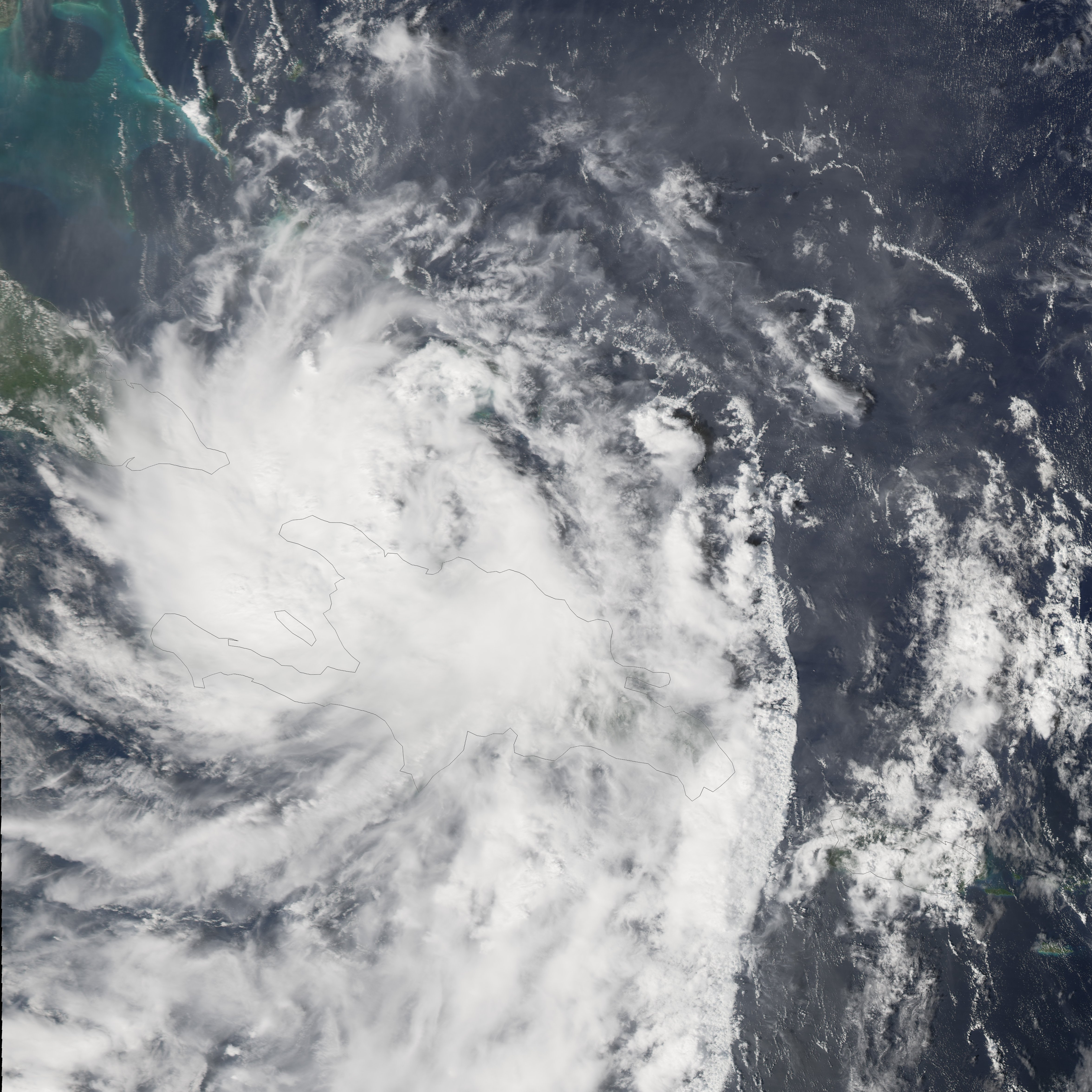
Track=Alpha 2005 track.png
Dissipated=October 24
1-min winds=45
Pressure=998Caribbean Sea on October 22. Later that day, it strengthened into a tropical storm as it moved west-northwestward.cite web| author=National Hurricane Center| year=2006| title=Tropical Cyclone Report: Tropical Storm Alpha| publisher=NOAA| accessdate=2006-02-14| url=http://www.nhc.noaa.gov/pdf/TCR-AL262005_Alpha.pdf| format=PDF] On the morning of October 23, it made landfall with 50 mph (85 km/h) winds near the city ofBarahona in theDominican Republic , then moved overHaiti . Alpha weakened to a tropical depression overHispaniola 's steep mountains. Alpha reentered the Atlantic Ocean where it was absorbed by Hurricane Wilma.Tropical Storm Alpha was the 22nd named system in the 2005 Atlantic hurricane season, breaking the 1933 season's record and becoming the first tropical storm to be named using the Greek Alphabet. A total of 43 people have been reported dead because of Tropical Storm Alpha, mostly in Haiti.
*The NHC's [http://www.nhc.noaa.gov/archive/2005/refresh/ALPHA+shtml/ archive on Tropical Storm Alpha]Hurricane Beta
Infobox Hurricane Small
Basin=Atl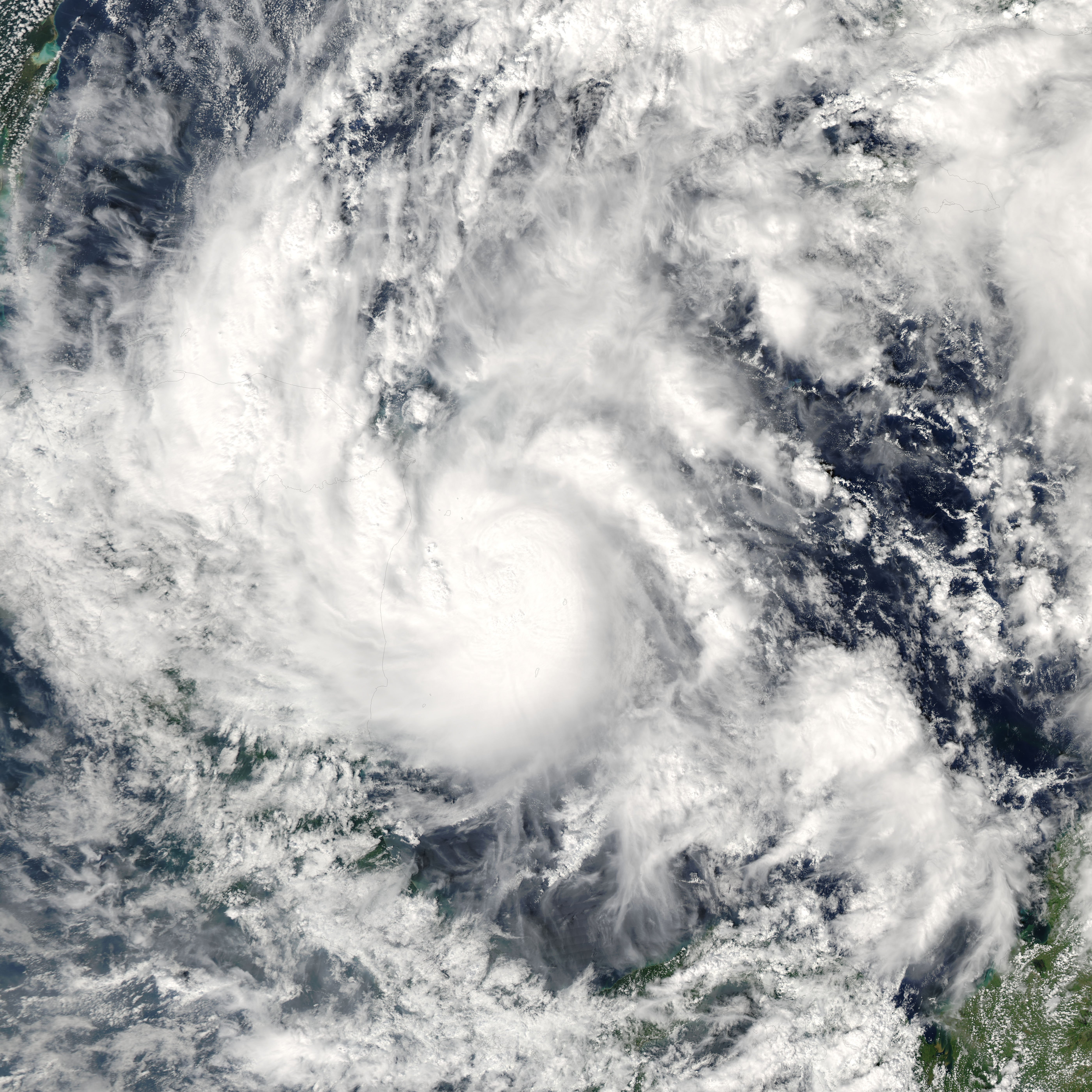
Track=Beta 2005 track.png
Dissipated=October 31
1-min winds=100
Pressure=962Caribbean Sea developed and became Tropical Depression Twenty-six. Six hours later, it was upgraded to Tropical Storm Beta. Beta strengthened into a hurricane on October 29. On October 30, Hurricane Beta became a major hurricane with sustained winds around 115 mph (185 km/h). That brought the total amount of major hurricanes in the 2005 season to 7, one short of the record 8 set in the 1950 season.cite web| author=National Hurricane Center| year=2006| title=Tropical Cyclone Report: Hurricane Beta| publisher=NOAA| accessdate=2006-04-03| url=http://www.nhc.noaa.gov/pdf/TCR-AL272005_Beta.pdf| format=PDF]Beta extended the record for most tropical storms in a season to 23 and was the first use of the name Beta for a tropical system. At the time it formed, Beta was considered the 13th hurricane of 2005, breaking the 1969 record of 12 hurricanes; later analysis showed Tropical Storm Cindy was a hurricane, which means the record-breaking 13th hurricane was actually Hurricane Wilma. Additionally, it was both the first hurricane (as opposed to a tropical storm), and the first major hurricane, named with a Greek letter.
The
Colombia n island of Providencia, about 140 miles off the coast ofNicaragua , was subjected to hurricane force winds for several hours as the center of the storm moved very slowly by the island. Reports indicate extensive damage to homes and a loss of communications with the islanders.
*The NHC's [http://www.nhc.noaa.gov/archive/2005/refresh/BETA+shtml/ archive on Hurricane Beta]Tropical Storm Gamma
Infobox Hurricane Small
Basin=Atl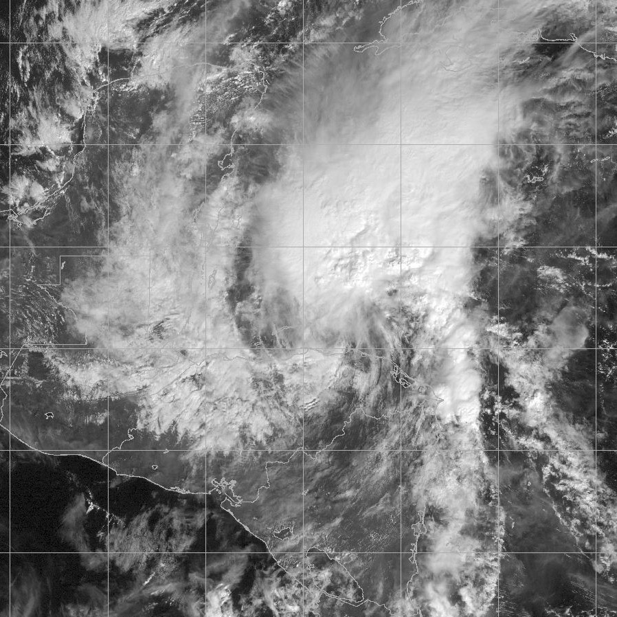
Track=Gamma 2005 track.png
Dissipated=November 21
1-min winds=45
Pressure=1002St. Lucia . While passing through the Lesser Antilles, the heavy rainfall caused mudslides, killing two people. On later reanalysis,cite web| author=National Hurricane Center| year=2005| title=Tropical Cyclone Report: Tropical Storm Gamma| publisher=NOAA| accessdate=2006-02-14| url=http://www.nhc.noaa.gov/pdf/TCR-AL282005_Gamma.pdf| format=PDF] it had briefly attained tropical storm status (without being named), butwind shear prevented further development of the system, and advisories were discontinued on November 16 as it lost its closed circulation about 305 miles southeast of Kingston,Jamaica .The remnants of the depression continued westward and moved along the northern shore of Honduras, merging with parts of a larger low pressure system. It is uncertain whether the remnants of Gamma absorbed the low pressure system or vice versa. The storm grew in strength, and a closed circulation formed on November 18, becoming a tropical storm for the second time (but named Gamma only starting here). After regeneration, floods from Gamma killed 34 people in Honduras. Gamma meandered in the Caribbean Sea for a short time, until slowly weakening. The storm eventually disintegrated into a remnant low late on November 20, after causing 37 direct and 4 indirect deaths in total.
*The NHC's [http://www.nhc.noaa.gov/archive/2005/refresh/GAMMA+shtml/ archive on Tropical Storm Gamma]Tropical Storm Delta
Infobox Hurricane Small
Basin=Atl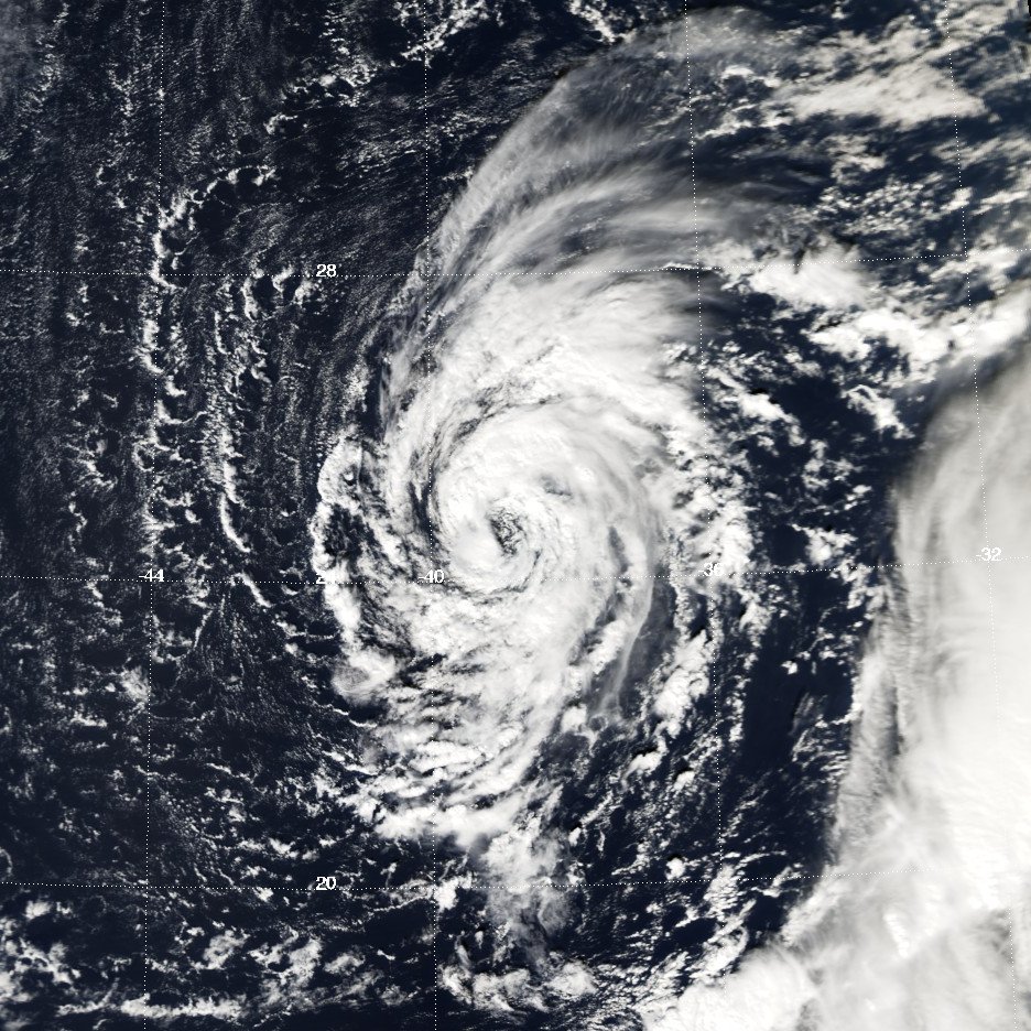
Track=Delta 2005 track.png
Dissipated=November 28
1-min winds=60
Pressure=980Delta drifted slowly and erratically southwards for several days before accelerating north-eastwards then eastwards towards the
Canary Islands and north Africa. During this period, it twice approached hurricane strength, although it never achieved hurricane intensity. On November 28 it merged with a frontal system northwest of the Canaries and became a vigorous extratropical storm. It caused severe damage in the Canary Islands and claimed at least seven lives, [cite web | title=Reuters AlertNet - Canary Islands storm hits power, communications | url=http://www.alertnet.org/thenews/newsdesk/L29780821.htm | accessdate=December 3 | accessyear=2005 ] including six who drowned while attempting to reach the Canary Islands by boat from Africa. [cite web | title=Reuters AlertNet - Six immigrants drown in Canary Island storm waves | url=http://www.alertnet.org/thenews/newsdesk/L28289044.htm | accessdate=December 3 | accessyear=2005 ]El Dedo de Dios , or God’s Finger, a geological feature which had been pointing towards the sky for over a millennium and an important landmark for the Canary Islands, was toppled during the storm. [ [http://www.gran-canaria-info.com/wiki/tiki-index.php?page=Dedo+de+Dios Pictures of Dedo de Dios, before and after.] ] [cite web | title=Tenerife News | url=http://www.tenerifenews.com/cms/front_content.php?client=1&lang=1&idcat=29&idart=2983 | accessdate=February 27 | accessyear=2006 ] Delta also caused power outages, leaving some 200,000 people without power and forcing airports to close down. [cite web | title=Planet Ark : Canary Islands Struggle to Restore Power After Storm | url=http://www.planetark.com/dailynewsstory.cfm/newsid/33737/story.htm | accessdate=December 3 | accessyear=2005 ]The remnants of Delta later moved into Morocco, bringing needed rain. It caused no damage and was described as a "normal atmospheric disturbance". [cite web | title=Cape Times - Canary Islands feel the full force of deadly Storm Delta | url=http://www.capetimes.co.za/index.php?fSectionId=272&fArticleId=3016238 | accessdate=December 3 | accessyear=2005 ]
*The NHC's [http://www.nhc.noaa.gov/archive/2005/refresh/DELTA+shtml/ archive on Tropical Storm Delta]Hurricane Epsilon
Infobox Hurricane Small
Basin=Atl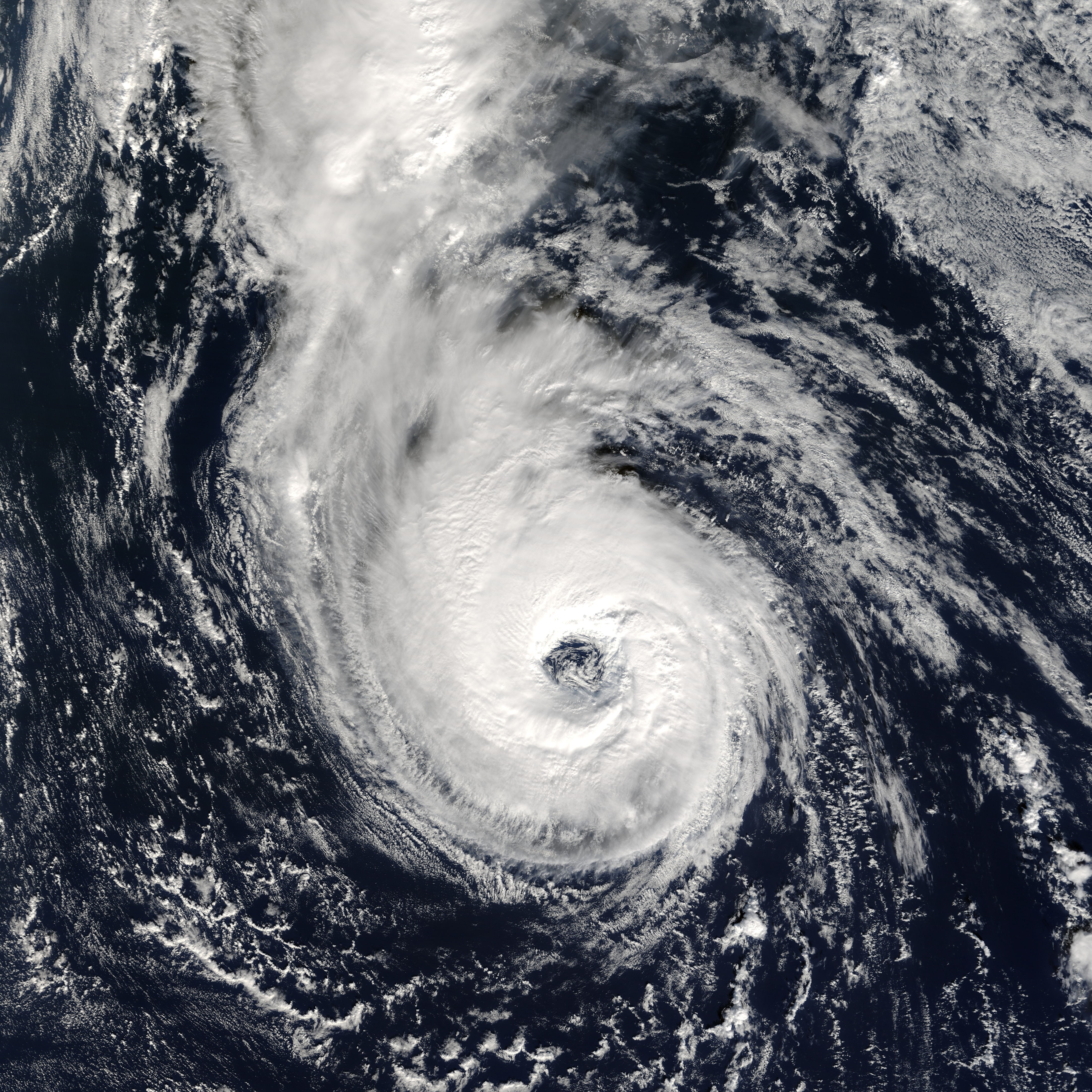
Track=Epsilon 2005 track.png
Dissipated=December 8
1-min winds=75
Pressure=981Hurricane Epsilon strengthened further to tie for the second-strongest December hurricane on record with 85 mph winds at its peak, and it lasted longer than any other hurricane ever to form in December. However, it was eventually torn apart by shear and absorbed into an approaching front. It never made landfall or threatened land. The development and persistence of Epsilon perplexed forecasters at the National Hurricane Center throughout the lifetime of the storm.
*The NHC's [http://www.nhc.noaa.gov/archive/2005/refresh/EPSILON+shtml/ archive on Hurricane Epsilon]Tropical Storm Zeta
Infobox Hurricane Small
Basin=Atl
Track=Zeta 2005 track.png
Dissipated=January 6
1-min winds=55
Pressure=994Zeta is one of the latest-forming tropical cyclones ever to develop in the recorded history of Atlantic hurricane seasons; the only later storm was
Hurricane Alice of 1954-55, which is estimated to have become tropical on December 30, 1954 at 1 a.m. EST (0600 UTC). It is also the second recorded North Atlantic storm (after Alice) to exist in two calendar years. In addition, Zeta surpassed Alice as the longest-lived tropical cyclone to form in December and cross over into the next year, and it was also the longest-lived January tropical cyclone. Zeta finally dissipated on January 6, 2006.
*The NHC's [http://www.nhc.noaa.gov/archive/2005/refresh/ZETA+shtml/ archive on Tropical Storm Zeta]ee also
*
2005 Atlantic hurricane season
*2005 Atlantic hurricane season statistics
*Lists of tropical cyclone names
*Timeline of the 2005 Atlantic hurricane season References
External links
* [http://www.nhc.noaa.gov/2005atlan.shtml NHC 2005 archives]
Wikimedia Foundation. 2010.
List of storms in the 2007 Atlantic hurricane season — The 2007 Atlantic hurricane season was an event in the annual cycle of tropical cyclone formation. It officially started June 1, 2007, and ended November 30, 2007, dates that conventionally delimit the period when most tropical cyclones form in… … Wikipedia
List of storms in the 2006 Atlantic hurricane season — The list of storms in the 2006 Atlantic hurricane season is a complete list of all tropical cyclones of the 2006 Atlantic hurricane season in the Atlantic Ocean basin. The season started on June 1, 2006, and officially ended on November 30, 2006 … Wikipedia
List of storms in the 2008 Atlantic hurricane season — The 2008 Atlantic hurricane season is an ongoing event in the annual cycle of tropical cyclone formation. The season officially started on June 1 and will run through November 30. These dates conventionally delimit the period of each year when… … Wikipedia
List of storms in the 2003 Atlantic hurricane season — The 2003 Atlantic hurricane season officially began June 1, 2003 and officially ended on November 30, 2003.cite web|author=Jack Beven|year=2003|title=June 1 Tropical Weather Outlook|publisher=National Hurricane Center|accessdate=2007 12… … Wikipedia
Timeline of the 2005 Atlantic hurricane season — The timeline of the 2005 Atlantic hurricane season documents the formations, strengthenings, weakenings, landfalls, extratropical transitions, and dissipations of the season s tropical and subtropical storms. The 2005 Atlantic hurricane season… … Wikipedia
2005 Atlantic hurricane season statistics — The 2005 Atlantic hurricane season broke numerous records for cyclonic formation and intensity. It saw a total of thirty one tropical and subtropical cyclones form, many of which broke records as individual storm as well as contributing to a… … Wikipedia
2005 Atlantic hurricane season — Infobox hurricane season Basin=Atl Year=2005 Track=2005 Atlantic hurricane season map.png First storm formed=June 8, 2005 Last storm dissipated=January 6, 2006 Strongest storm name=Wilma Strongest storm pressure=882 Strongest storm winds=160… … Wikipedia
Timeline of the 2005 Pacific hurricane season — ImageSize = width:800 height:200PlotArea = top:10 bottom:80 right:20 left:20 DateFormat = dd/mm/yyyyPeriod = from:01/05/2005 till:31/10/2005TimeAxis = orientation:horizontalScaleMinor = grid:black unit:month increment:1 start:01/05/2005Colors =… … Wikipedia
Timeline of the 2006 Atlantic hurricane season — The 2006 Atlantic hurricane season was the first since 2001 in which no hurricanes made landfall in the United States, and the first since 1994 that no tropical cyclones formed during October.cite web|author=Mainelli; Bevan|date=2006 11… … Wikipedia
2005 Pacific hurricane season — Infobox hurricane season Basin=EPac Year=2005 Track=2005 Pacific hurricane season map.png First storm formed=May 17, 2005 Last storm dissipated=October 20, 2005 Strongest storm name=Kenneth Strongest storm pressure=947 Strongest storm winds=115… … Wikipedia
List of storms in the 2005 Atlantic hurricane season
- List of storms in the 2005 Atlantic hurricane season
The 2005 Atlantic hurricane season officially began June 1, 2005 and officially ended on November 30, 2005. These dates conventionally delimit the period of each year when mosttropical cyclone s form in theAtlantic basin , although effectively the season persisted into January 2006 due to continued storm activity.List of storms in the 2007 Atlantic hurricane season — The 2007 Atlantic hurricane season was an event in the annual cycle of tropical cyclone formation. It officially started June 1, 2007, and ended November 30, 2007, dates that conventionally delimit the period when most tropical cyclones form in… … Wikipedia
List of storms in the 2006 Atlantic hurricane season — The list of storms in the 2006 Atlantic hurricane season is a complete list of all tropical cyclones of the 2006 Atlantic hurricane season in the Atlantic Ocean basin. The season started on June 1, 2006, and officially ended on November 30, 2006 … Wikipedia
List of storms in the 2008 Atlantic hurricane season — The 2008 Atlantic hurricane season is an ongoing event in the annual cycle of tropical cyclone formation. The season officially started on June 1 and will run through November 30. These dates conventionally delimit the period of each year when… … Wikipedia
List of storms in the 2003 Atlantic hurricane season — The 2003 Atlantic hurricane season officially began June 1, 2003 and officially ended on November 30, 2003.cite web|author=Jack Beven|year=2003|title=June 1 Tropical Weather Outlook|publisher=National Hurricane Center|accessdate=2007 12… … Wikipedia
Timeline of the 2005 Atlantic hurricane season — The timeline of the 2005 Atlantic hurricane season documents the formations, strengthenings, weakenings, landfalls, extratropical transitions, and dissipations of the season s tropical and subtropical storms. The 2005 Atlantic hurricane season… … Wikipedia
2005 Atlantic hurricane season statistics — The 2005 Atlantic hurricane season broke numerous records for cyclonic formation and intensity. It saw a total of thirty one tropical and subtropical cyclones form, many of which broke records as individual storm as well as contributing to a… … Wikipedia
2005 Atlantic hurricane season — Infobox hurricane season Basin=Atl Year=2005 Track=2005 Atlantic hurricane season map.png First storm formed=June 8, 2005 Last storm dissipated=January 6, 2006 Strongest storm name=Wilma Strongest storm pressure=882 Strongest storm winds=160… … Wikipedia
Timeline of the 2005 Pacific hurricane season — ImageSize = width:800 height:200PlotArea = top:10 bottom:80 right:20 left:20 DateFormat = dd/mm/yyyyPeriod = from:01/05/2005 till:31/10/2005TimeAxis = orientation:horizontalScaleMinor = grid:black unit:month increment:1 start:01/05/2005Colors =… … Wikipedia
Timeline of the 2006 Atlantic hurricane season — The 2006 Atlantic hurricane season was the first since 2001 in which no hurricanes made landfall in the United States, and the first since 1994 that no tropical cyclones formed during October.cite web|author=Mainelli; Bevan|date=2006 11… … Wikipedia
2005 Pacific hurricane season — Infobox hurricane season Basin=EPac Year=2005 Track=2005 Pacific hurricane season map.png First storm formed=May 17, 2005 Last storm dissipated=October 20, 2005 Strongest storm name=Kenneth Strongest storm pressure=947 Strongest storm winds=115… … Wikipedia
Look at other dictionaries:
- Contact us: Technical Support, Advertising