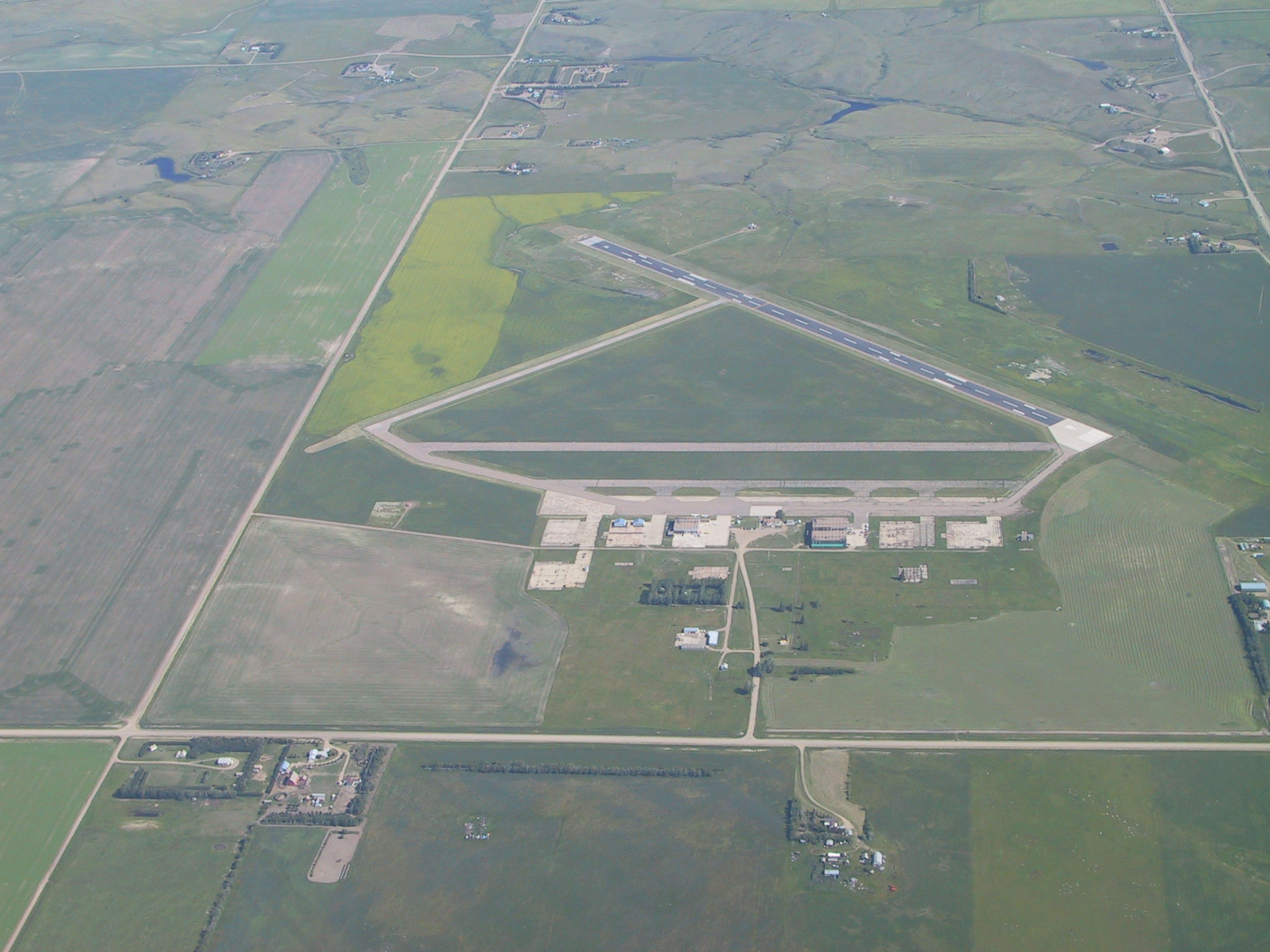
- Swift Current Airport
Infobox Airport
name = Swift Current Airport

IATA = YYN
ICAO = CYYN
type = Public
owner =
operator = Swift Current Airport Ltd.
city-served =
location =Swift Current, Saskatchewan
elevation-f = 2,680
elevation-m = 817
coordinates = coord|50|17|31|N|107|41|26|W|type:airport|display=inline
website = [http://www.swiftcurrentairport.com www.swiftcurrentairport.com]
r1-number = 04/22
r1-length-f = 2,500
r1-length-m = 762
r1-surface =Asphalt
r2-number = 12/30
r2-length-f = 4,250
r2-length-m = 1,295
r2-surface = Asphalt
footnotes = Source:Canada Flight Supplement [CFS]Swift Current Airport Airport codes|YNN|CYYN is located convert|4|NM|abbr=on|lk=in east of Swift Current,
Saskatchewan ,Canada . This airport had scheduled service throughout the 1950s and '60s. At the moment (2006), it has no scheduled service, but plans for expansion have recently been accepted. In its current state, the largest aircraft it could accommodate would be aBoeing 737 , but it would not be a comfortable fit. It would be possible in an emergency, but not the most common plan.From
1940 to1944 , the airport served as a training base for pilots who served with theRoyal Air Force . [ [http://www.tourismswiftcurrent.ca/history/index.php Tourism Swift Current - History] ] In March 1996, the City of Swift Current took over operations fromTransport Canada , and contracted out airport services. [ [http://www.city.swift-current.sk.ca/city_hall.php?name=Sections&op=viewarticle&artid=270 City of Swift Current - Airport Services] ]References
External links
* [http://www.swiftcurrentairport.com Swift Current Airport]
* [http://www.copanational.org/PlacesToFly/airport_view.php?pr_id=11&ap_id=208 Page about this airport] on COPA's "Places to Fly" airport directory
* [http://www.copa107.ca South West Flying Club - COPA Flight 107]
* [http://www.actionsouthwest.com/economicdevelopment/airport.html Grasslands Regional Airport Project]
* [http://maps.google.com/maps?t=h&hl=en&ie=UTF8&ll=50.289339,-107.691851&spn=0.025993,0.058365&z=14 Google Satellite Photo]
Wikimedia Foundation. 2010.
