- Mansfield Airport
-
This article is about the airport in Ontario. For the airport in Massachusetts, US, see Mansfield Municipal Airport. For the airport in Ohio, US, see Mansfield Lahm Regional Airport.
Mansfield Airport IATA: none – ICAO: none – TC LID: CPV4 Summary Airport type Private Operator Carl Lovett Location Mansfield, Ontario Elevation AMSL 995 ft / 303 m Coordinates 44°09′00″N 080°01′11″W / 44.15°N 80.01972°WCoordinates: 44°09′00″N 080°01′11″W / 44.15°N 80.01972°W Map Location in Ontario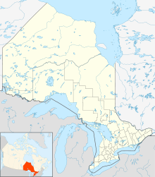
 CPV4
CPV4Runways Direction Length Surface ft m 08/26 1,900 579 Turf 15/33 1,400 430 Turf Source: Canada Flight Supplement[1] Mansfield Airport, (TC LID: CPV4), is located 1.5 NM (2.8 km; 1.7 mi) south southeast of Mansfield, Ontario, Canada.
References
- ^ Canada Flight Supplement. Effective 0901Z 20 October 2011 to 0901Z 15 December 2011
Airports in Canada By name A–B · C–D · E–G · H–K · L–M · N–Q · R–S · T–ZBy location indicator CA · CB · CC · CD · CE · CF · CG · CH · CI · CJ · CK · CL · CM · CN · CO · CP · CR · CS · CT · CV · CW · CY · CZBy province/territory National Airports System Calgary · Charlottetown · Edmonton · Fredericton · Gander · Halifax · Iqaluit · Kelowna · London · Moncton · Montréal-Mirabel · Montréal-Trudeau · Ottawa · Prince George · Québec · Regina · Saint John · St. John's · Saskatoon · Thunder Bay · Toronto · Vancouver · Victoria · Whitehorse · Winnipeg · YellowknifeRelated List of airports by ICAO code: C · List of defunct airports in Canada · List of heliports in Canada · List of international airports in Canada · National Airports System · Operation Yellow RibbonCategories:- Airports in Ontario
- Ontario airport stubs

Wikimedia Foundation. 2010.