- Meole Brace
-
Meole Brace is a suburb of Shrewsbury, Shropshire, England.
The Rea Brook flows through the area, a tributary of the River Severn. The brook was in the past known as the "Meole Brook". The name Meole Brace comes from the old Saxon manor house, which no longer stands, owned by the Brace family (perhaps originally 'de Bracey': Norman barons). It has been known as Meole, or Mole, or Mill for almost 1000 years; it may come from Mill, as in flour mill, as there was certainly a mill on the brook, or possibly from the Welsh 'Moel' meaning "bare", or, by extension "bare hill"- or from Old English mele, "meal" as in "oatmeal", referring to the sediment in the brook giving a "mealy" appearance. This latter etymology is supported by most of the earlier (Middle English) spellings which have "Mele" without an "o"; 'Malvern', derived from the Welsh 'Moel' appears as mal- or mael- while Old English myll "mill" only appears with an e in southeastern (mostly Kentish) texts.
Amenities
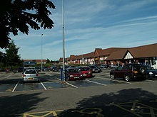
A5112 (Hereford Road), formerly the A49 is the main road running north-south. There is a large retail park in Meole Brace, with several leading retailers[1]. The Welsh Marches Line and Cambrian Line run through the area, but there is no longer a railway station here.
There is also a local comprehensive secondary school - Meole Brace School Science College [1] and in heart of the village there is a Church of England infant and primary school.
The village also boasts a church, Meole Brace Holy Trinity. Built at a cost of £7500 on the site of the old vicarage, it was consecrated by the Bishop of Hereford in 1869[2]
Meole Brace is home to Meole Brace Bowling Club, built in 1934, and to the council-run 12-hole Meole Brace Municipal Golf Course which links the village to the nearby conurbations of Reabrook and Sutton Park as well as Reabrook Nature Reserve. The New Meadow football ground, home of Shrewsbury Town F.C. is situated nearby, with the local pub 'The Brooklands Hotel' enjoying a brisk trade with home and away football supporters (official matchday parking is available on site).
Meole Village is the name used locally for the older part of Meole Brace, which was originally a village outside Shrewsbury. It still retains a village feel, though it is surrounded by newer urban development. This older settlement lies on the route of a Roman road and could be older than the town of Shrewsbury.
Nearby are the small villages of Nobold and Pulley.
References
- ^ http://www.completelyretail.co.uk/scheme/3267 Meole Brace Retail Park on CompletelyRetail
- ^ "Trinity Churches". http://www.trinitychurches.org/about-us/history-of-our-churches.php.
External links
Categories:- Suburbs of Shrewsbury
- Shropshire geography stubs

Wikimedia Foundation. 2010.