- Sha Tin District
Infobox HK District
official_name = Sha Tin District
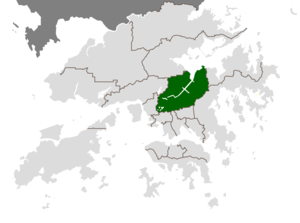
map_caption = Location inHong Kong
google = http://maps.google.com/maps?ll=22.392806,114.218551&spn=0.058545,0.078359&t=k&hl=en
leader_title =District Council Chairman
leader_name =Wai Kwok Hung , JP
constituencies = 36
area_note =
area_magnitude = 1 E9
area_total = 69.46
area_land =
area_water =
population_as_of = 2006
population_note =
population_total = 607,544
population_density = 8,842
latitude = 22°39' N
longitude = 114°21' E
website = [http://www.districtcouncils.gov.hk/st/english/welcome.htm Sha Tin District Council]
footnotes =
Sha Tin District is one of the 18 districts of the Hong Kong Special Administrative Region of thePeople's Republic of China . One of the 9 districts located in theNew Territories , it covers the areas ofSha Tin ,Tai Wai ,Ma On Shan ,Fo Tan ,Siu Lek Yuen andMa Liu Shui (Ma Liu Shui is where The Chinese University of Hong Kong is located). The district has the highest population. According to the 2001 census, it had a population of 628,634 in 2001, including about 27,000 people living in 48 indigenous villages.Overview
The Sha Tin District covers approximately 70 km² (27 sq. mi), including the Sha Tin New Town and several country parks. Built mostly on reclaimed land in
Sha Tin Hoi , the well-developed Sha Tin New Town comprises mainly residential areas along the banks of the Shing Mun River Channel. In the early 1970s it was a rural township of about 30,000 people. After Sha Tin's first public housing estate,Lek Yuen Estate , was completed in 1976, the settlement began to expand. Today, about 65% of the district's population live in public rental housing, housing under Hong Kong'sTenants Purchase Scheme , orHome Ownership Scheme (HOS). Sha Tin has now become a major new community, including an extension at Ma On Shan, of about 640,000 people today. The total development area of the new town in Sha Tin and Ma On Shan is about 20 km² (8 sq. mi).The
Hong Kong Government used to showcase Sha Tin as an achievement in building a modern new town. Visiting foreign dignitaries were often invited to tour Sha Tin and its housing estates.History
Tai Wai Village , the oldest and largest walled village in the town, was built in 1574. Sha Tin was a former market town at the present location ofSha Tin Centre Street andNew Town Plaza shopping centre.Sha Tin was the second batch of satellite towns, or
new town , to be built in the New Territories, on land reclaimed from the sea.Sha Tin was formerly named
Lek Yuen (literally "Source of Trickling" or "Source of Clear Water").Land use
In addition to the residential areas, there are four industrial areas for light industries:
Tai Wai ,Fo Tan ,Siu Lek Yuen andShek Mun .The
Chinese University of Hong Kong is also located in Sha Tin. People typically travel there via theMTR East Rail Line and get off at the University station. A minibus service operates on campus.Sha Tin is the location for
Hong Kong 's second equestrian racecourse (the first and most famous being inHong Kong Island 's Happy Valley - seeHong Kong Jockey Club ), which has a capacity of up to 85,000. This course is to host the equestrian events during the2008 Summer Olympics . The Olympics are to be hosted byBeijing ; there is concern over proper quarantine and disease monitoring in the Chinese capital.Penfold Park is located inside the racecourse and closed on race days. It is best accessed via theFo Tan Station .Sha Tin Park is another major park located in Sha Tin.hing Mun River
The Shing Mun River is a 7 km long, 200m wide channel originating at the Shing Mun Reservoir (
Tai Mo Shan catchment) that runs as a river from the Tai Wai area, through the Sha Tin town centre to theTolo Harbour . It has three main tributaries, namelyTai Wai Nullah ,Fo Tan Nullah andSiu Lek Yuen Nullah . Along the Shing Mun River are high-rise residential, commercial and industrial buildings with numerous village type developments scattered around.Transportation
Sha Tin District has the largest number of
East Rail Line stations of any district in Hong Kong. It has five stations, namely Tai Wai, Sha Tin, Fo Tan, Racecourse and University. TheMa On Shan Line runs between Tai Wai, Che Kung Temple, Sha Tin Wai, City One, Shek Mun, Tai Shui Hang, Heng On, Ma On Shan, and Wu Kai Sha stations.A network of cycle tracks throughout Sha Tin measures about 50 km long and is the longest cycle track network in Hong Kong.
Increasing population in the town has exerted pressure on the transportation. Several construction plans have been launched to cope with the demand. The construction of Route T7 linking Ma On Shan Road to Sai Sha Road has been started on January 2001 and completed in 2005. The Route 8 connecting
Cheung Sha Wan ,Kowloon and Sha Tin is scheduled for construction at the end of 2003 and will complete at the end of 2007. The construction of theMa On Shan Line (11.4 km long) began in December 2000 and was completed at the end of 2004.Tai Po Road ,Sha Lek Highway ,Sha Tin Road ,Lion Rock Tunnel ,Sai Sha Road ,Tate's Cairn Tunnel ,Tolo Highway andShing Mun Tunnels already serve the Sha Tin District.chools
*
S.K.H. Tsang Shiu Tim Secondary School
*Baptist Lui Ming Choi Secondary School
*Hang Seng School of Commerce
*Sha Tin Government Secondary School
*Sha Tin Methodist Collage
*POH Chan Kai Memorial College
*Kwok Tak Seng Catholic Secondary School
*Shatin Tsung Tsin Secondary school
*Shatin Pui Ying College
*Sha Tin College - The onlyEnglish Schools Foundation high school in Sha Tin.
*Buddhist Wong Wan Tin College
*International Christian School of Hong Kong Hospitals
There are four hospitals in Sha Tin.
* ThePrince of Wales Hospital , one of the centers of the 2003SARS outbreak among health care workers; (Ward 8A)
* TheSha Tin Hospital ;
* TheCheshire Home ; and
* The Union Hospital, a private hospital, where James Wong died.Tourist attractions
Local and tourist attractions in Sha Tin include, most famously, the
Hong Kong Heritage Museum , which is Hong Kong's newest and arguably best museum. The Museum was opened on16 December 2000 and includes 12 galleries, a cafe and museum shop. Other attractions include:*
Sha Tin Racecourse
* Che Kung Miu. This expansion of the temple was built in Japanese style and has its own Wheel of Fortune.
*Tao Fung Shan
*Amah Rock
*Tsang Tai Uk (曾大屋). An 1848 dwelling of granite, timber and green brick, with defence towers and a still-used ancestral hall.
*Lion Pavilion (獅子亭)
*New Town Plaza - a large shopping mall in Shatin
*Ten Thousand Buddhas Monastery (萬佛寺)
*Shing Mun River
*Lion Rock
*Sha Tin Park (沙田公園). This popular park runs alongside the Shing Mun river channel (open daily 0700 - 2245).
*Penfold Park
*Sha Tin Town Hall . The number one cultural venue in the eastern New Territories, hosting cultural events and exhibitions.
*Snoopy's World . Six zones of amusements on the third floor of the New Town Plaza, including Snoopy's House, a canoe ride and a museum of Peanuts characters (open daily, 1000-2200).ee also
*
List of buildings, sites and areas in Hong Kong External links
* [http://www.districtcouncils.gov.hk/st/english/welcome.htm Sha Tin District Council]
* [http://www.eac.gov.hk/pdf/distco/2007dc/dc2007r.pdf List and map of electoral constituencies (large PDF file)]
* [http://www.cedd.gov.hk/eng/about/achievements/regional/regi_shatin.htm Sha Tin New Town]
* [http://www3.ha.org.hk/pwh/Index_c.html Prince of Wales Hospital]
* [http://www.cuhk.edu.hk/ Chinese University of Hong Kong]
* [http://www.heritagemuseum.gov.hk/ Hong Kong Heritage Museum]
* [http://webserv1.discoverhongkong.com/eng/touring/hkiidistricts/ta_dist_shat1.jhtml/ Hong Kong Tourist Board's Sha Tin website]
* [http://maps.google.com/maps?ll=22.397690,114.203911&spn=0.067291,0.111065&t=k&hl=en Satellite image of Sha Tin New Town by Google Maps]

Wikimedia Foundation. 2010.