- Ismoil Somoni Peak
-
Ismoil Somoni Peak 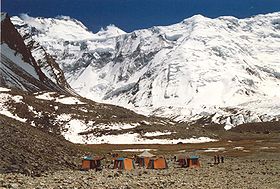
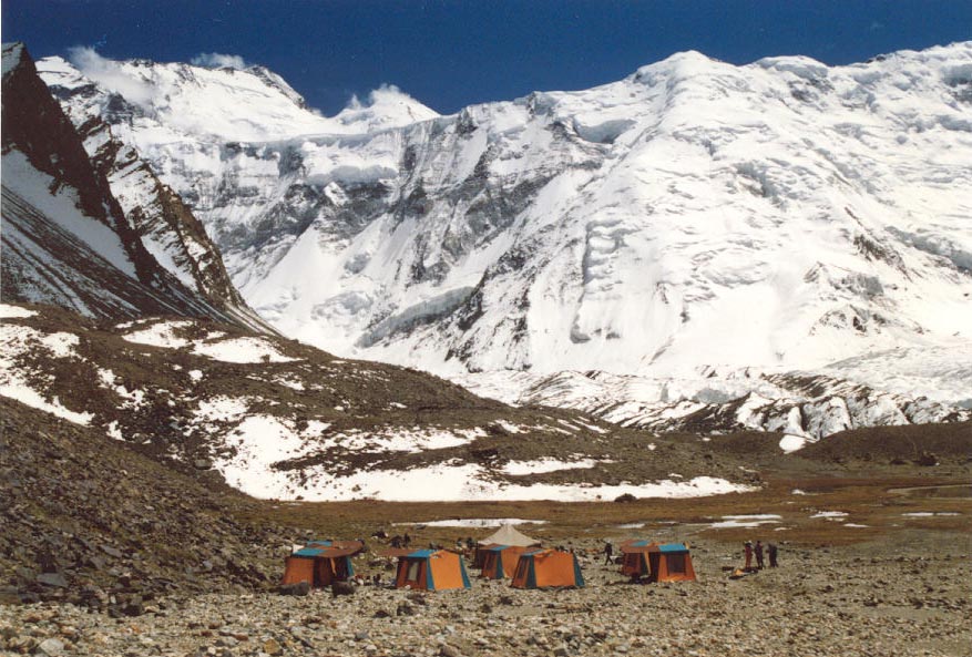
Ismoil Somoni Peak (then known as Communism Peak) taken in 1989.Elevation 7,495 m (24,590 ft)
Ranked 50thProminence 3,402 m (11,161 ft) Listing Country high point
UltraLocation 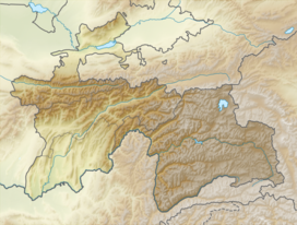
 Ismoil Somoni Peak
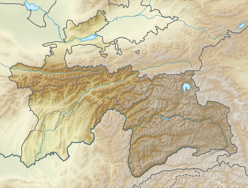
 Tajikistan, northwestern Gorno-Badakhshan
Range Pamirs Coordinates 38°55′00″N 72°01′00″E / 38.9166667°N 72.0166667°ECoordinates: 38°55′00″N 72°01′00″E / 38.9166667°N 72.0166667°E Climbing First ascent 9 September 1933
 Yevgeniy Abalakov
Easiest route rock/snow/ice climb Ismoil Somoni Peak (Tajik: Қуллаи Исмоили Сомонӣ, Qullai Ismoili Somonī, Russian: пик Исмаила Самани pik Ismaila Samani) is the highest mountain in Tajikistan and in the former Soviet Union, named after Ismoil Somoni, the ancestor of the Samanid dynasty.
When the existence of a peak in the Soviet Pamir Mountains higher than Lenin Peak was first established in 1928, the mountain was tentatively identified with Garmo Peak; but as the result of the work of further Soviet expeditions, it became clear by 1932 that they were not the same, and in 1933 the new peak, in the Akademiya Nauk Range, was named Stalin Peak (Pik Stalina, пик Сталина), after Joseph Stalin. In 1962, the name was changed to Communism Peak (Tajik: Пики Коммунизм, Russian: Pik Kommunizma, пик Коммуни́зма), and in 1998 to its current name.
The first ascent was made 9 September 1933 by the Soviet mountaineer Yevgeniy Abalakov.[citation needed]
There are glaciers on Ismoil Somoni Peak.[citation needed]
See also
References
- The Free Dictionary: Imeni Ismail Samani Peak
External links
- "Pik Kommunizma". SummitPost.org. http://www.summitpost.org/page/150290.
Categories:- Mountains of Tajikistan
- Tajikistan geography stubs
Wikimedia Foundation. 2010.