- Fort Ann (village), New York
Infobox Settlement
official_name = Village of Fort Ann
other_name =
native_name =
nickname =
settlement_type = Village
motto =
imagesize =
image_caption =
flag_size =
image_
seal_size =
image_shield =
shield_size =
image_blank_emblem =
blank_emblem_size =
imagesize =
image_caption =
flag_size =
image_
seal_size =
image_shield =
shield_size =
image_blank_emblem =
blank_emblem_size =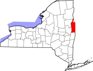
mapsize = 250px
map_caption = Map of Washington County, New York
mapsize1 =
map_caption1 =
pushpin_
pushpin_label_position =
subdivision_type = Country
subdivision_name =United States
subdivision_type1 = State
subdivision_name1 =New York
subdivision_type2 = County
subdivision_name2 = Washington
subdivision_type3 = Metro Area
subdivision_name3 =Glens Falls, New York
subdivision_type4 = Town
subdivision_name4 = Town of Fort Ann
government_type =
leader_title =
leader_name =
leader_title1 =
leader_name1 =
leader_title2 =
leader_name2 =
leader_title3 =
leader_name3 =
leader_title4 =
leader_name4 =
established_title = Fort Built
established_date = 1757
established_title2 = Incorporated
established_date2 = 1820
established_title3 =
established_date3 =
area_magnitude =
unit_pref = Imperial
area_footnotes =
area_total_km2 = 0.8
area_land_km2 = 0.8
area_water_km2 = 0.0
area_total_sq_mi = 0.3
area_land_sq_mi = 0.3
area_water_sq_mi = 0.0
area_water_percent =
area_urban_km2 =
area_urban_sq_mi =
area_metro_km2 =
area_metro_sq_mi =
population_as_of = 2000
population_footnotes =
population_note =
population_total = 471
population_density_km2 = 606.5
population_density_sq_mi = 1570.8
population_metro =
population_density_metro_km2 =
population_density_metro_sq_mi =
population_urban =
population_density_urban_km2 =
population_density_urban_sq_mi =
timezone = Eastern (EST)
utc_offset = -5
timezone_DST = EDT
utc_offset_DST = -4
latd = 43 |latm = 24 |lats = 54 |latNS = N
longd = 79 |longm = 29 |longs = 24 |longEW = W
elevation_footnotes =
elevation_m = 48
elevation_ft = 157
postal_code_type =ZIP code
postal_code = 12827
area_code = 518
website = [http://www.fortannpost.com Fort Ann Information]
blank_name = FIPS code
blank_info = 36-26704
blank1_name = GNIS feature ID
blank1_info = 0950461
footnotes = Fort Ann is avillage in Washington County,New York ,United States . It is part of theGlens Falls, New York Metropolitan Statistical Area. The population was 471 at the 2000 census. The name is derived indirectly from Queen Anne.The Village of Fort Ann is inside the Town of Fort Ann at the junction of US Route 4 and
New York State Route 149 .History
The village was incorporated in
1820 . The area was the location of a militaryfort , built in 1757. Also the site of the1777 Battle of Fort Ann e during theSaratoga Campaign .Geography
Fort Ann is located at coor dms|43|24|54|N|73|29|24|W|city (43.415021, -73.490175)GR|1.
According to the
United States Census Bureau , the village has a total area of 0.3square mile s (0.8km² ).None of the area is covered with water.Demographics
As of the
census GR|2 of 2000, there were 471 people, 187 households, and 127 families residing in the village. Thepopulation density was 1,570.8 people per square mile (606.2/km²). There were 212 housing units at an average density of 707.0/sq mi (272.8/km²). The racial makeup of the village was 99.36% White, 0.21% Black or African American, 0.21% Native American, and 0.21% from two or more races. Hispanic or Latino of any race were 0.64% of the population.There were 187 households out of which 30.5% had children under the age of 18 living with them, 48.7% were married couples living together, 16.0% had a female householder with no husband present, and 31.6% were non-families. 23.5% of all households were made up of individuals and 11.2% had someone living alone who was 65 years of age or older. The average household size was 2.52 and the average family size was 3.01.
In the village the population was spread out with 22.9% under the age of 18, 11.5% from 18 to 24, 26.5% from 25 to 44, 23.8% from 45 to 64, and 15.3% who were 65 years of age or older. The median age was 37 years. For every 100 females there were 97.9 males. For every 100 females age 18 and over, there were 86.2 males.
The median income for a household in the village was $44,318, and the median income for a family was $48,750. Males had a median income of $31,875 versus $24,375 for females. The
per capita income for the village was $22,201. About 8.4% of families and 9.1% of the population were below thepoverty line , including 14.8% of those under age 18 and 2.4% of those age 65 or over.References
External links
* [http://www.fortannpost.com Fort Ann Information]
Wikimedia Foundation. 2010.