- Connecticut Route 17
-
For the Route 17 that existed in the 1920s, see Route 17 (New England).
Route 17

Route information Maintained by ConnDOT Length: 36.33 mi (58.47 km) Existed: 1948 – present Major junctions South end: Middletown Avenue (near  I-91) in New Haven
North end:  Route 2 in Glastonbury
Highway system Routes in Connecticut
Special Service Roads • State Roads←  Route 16
Route 19  →
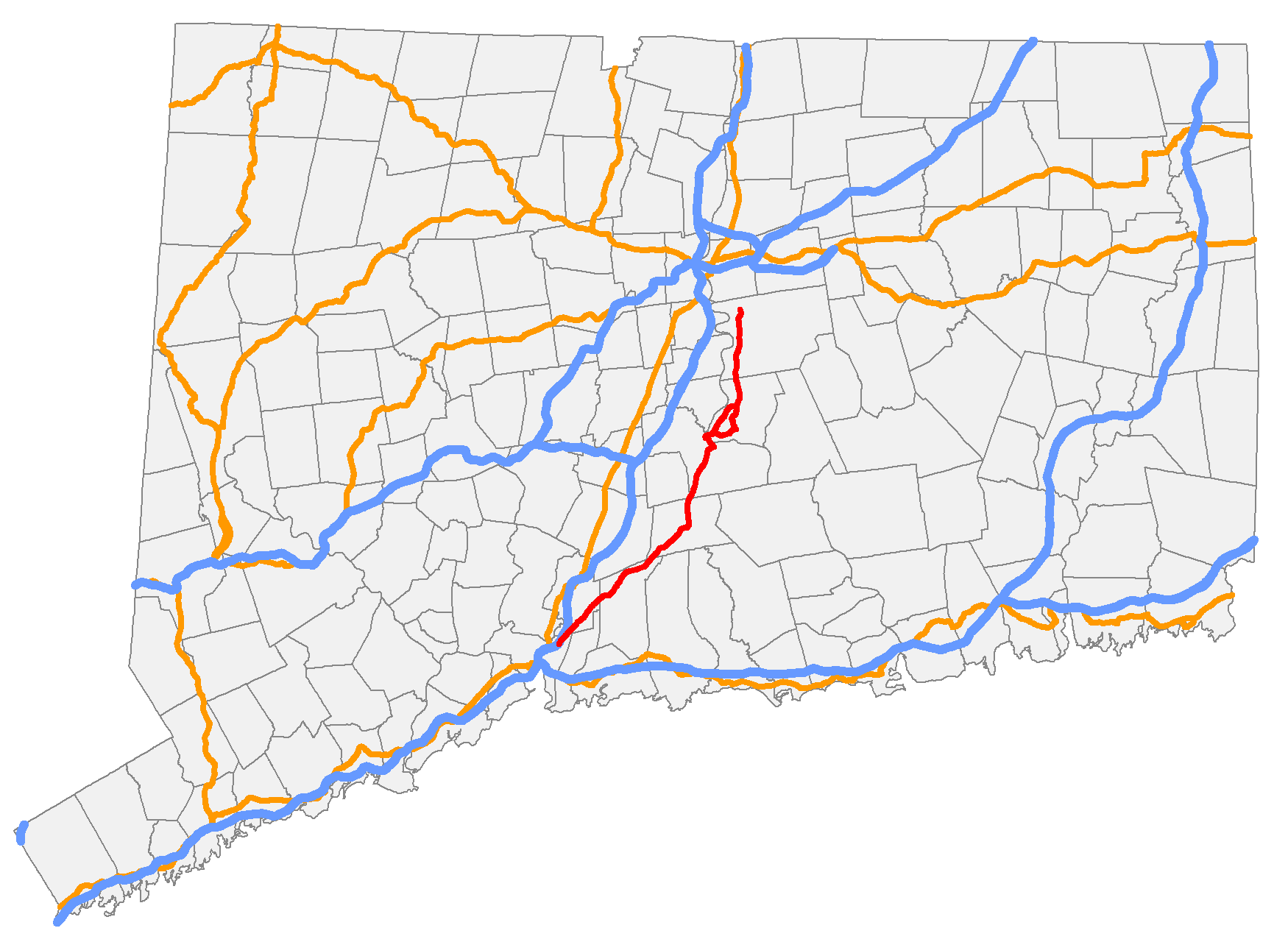
→Route 17 is a primary north–south state route beginning in New Haven, through Middletown, and ending in Glastonbury, with a length of 36.33 miles (58.47 km).
Contents
Route description
Route 17 officially begins about 0.1 miles (0.16 km) west of its interchange with Interstate 91 (at Exit 8). Route 80 begins at the interchange and continues eastward while Route 17 turns northward. Route 17 is a 4-lane principal arterial road in New Haven, becoming 2 lanes as it passes through North Haven, Northford, Durham, and Middletown. In Middletown it becomes a 4-lane freeway for 0.6 miles (0.97 km) leading to an interchange with the Route 9 freeway. Route 17 then runs on Route 9 for about 0.8 miles (1.3 km). Route 9 then briefly becomes a surface road at which point Route 17 then splits off and overlaps with Route 66 for about 3.0 miles (4.8 km) including a Connecticut River crossing into Portland town on the Arrigoni Bridge. From Portland to Glastonbury, Route 17 is a secondary 2-lane arterial road, bypassing the downtown Portland area. A 3.02-mile (4.86 km) long alternate route, Route 17A, serves the town center. The last 1.4 miles (2.3 km) in Glastonbury is freeway, ultimately ending at an interchange with Route 2.[1]
Special designations
The southern surface road section from New Haven to Middletown is also known as George Washington Memorial Highway. The 0.6-mile (0.97 km) freeway section from South Main Street to Route 9 in Middletown is known as the Catholic War Veterans Memorial Highway. A 1.4-mile (2.3 km) section in Durham, from the junction with Route 77 to just north of the junction with Route 68, is a designated state scenic road.[1]
History
The road between New Haven and Middletown via Durham was one of the routes used by the Boston Post Road in colonial times. In 1813, the road became a private turnpike known as the Middletown, Durham and New Haven Turnpike. The turnpike corporation was dissolved in the late 19th century. By 1922, Connecticut had numbered roads that were maintained by the state, which included all of modern Route 17. The roads were designated as Highway 114 from New Haven to Durham; part of Highway 112 from Durham to Middletown; and Highway 104 from Middletown to Glastonbury.[2][3]
In the 1932 state highway renumbering, the road from New Haven to Glastonbury became part of the newly-established Route 15. At that time, Route 15 used all of modern Route 17, then continued north along Main Street in East Hartford, then northeast via modern Route 30, Route 190, and Route 171 to the Massachusetts state line. In 1948, the Route 15 designation was reassigned to the Merritt Parkway, Wilbur Cross Parkway, Berlin Turnpike, and Wilbur Cross Highway. The old Route 15 south of Glastonbury was renumbered to Route 17.[3]
Junction list
Location Mile Exit Destinations Notes New Haven 0.14 I-910.21  Route 80
North Haven 1.70  Route 103
Northford 7.04  Route 22
Durham 14.98  Route 77
15.15  Route 79
16.00  Route 68
16.58  Route 147
Middletown 19.95  Route 155
21.97 13  Route 9 south – Old Saybrook
Route 17 joins Route 9 northbound and leaves Route 9 southbound; no access from northbound Route 9 to southbound Route 17 14 deKoven Drive – Harbor Area Southbound exit to deKoven Drive and northbound entrance from Harbor Drive 15  Route 66 west – Middletown
At-grade intersection; unsigned SR 545 22.97 16 Route 9 north – New BritainRoute 17 joins Route 9 southbound and leaves northbound
At-grade intersection23.14 Route 66Begin overlap Portland 24.17  Route 17A (Main Street)
26.12 Route 66End overlap 28.15 Route 17A (Main Street)Glastonbury 32.63  Route 160
36.12  Route 94
34.05 Main Street At-grade intersection 35.19 — Glastonbury Center Southbound exit to Hubbard Street and northbound entrance from Williams Street east 35.65 — New London Turnpike Separate directional exits southbound 36.33 — Route 2 west – HartfordNorthbound junction only; milepost at merge 1.000 mi = 1.609 km; 1.000 km = 0.621 mi Route 17A
Route 17A
Location: Portland Length: 3.02 mi (4.86 km) Route 17A is an alternate route running for 3.02 miles (4.86 km) from Route 17 and 66, through Portland center, and back to Route 17. It serves as the Main Street of the town. The original Route 17 (then Route 15) used the 17A alignment. The main route bypassed the town center by 1940 and Main Street became Route 15A. When Route 15 was relocated and the route through Portland became Route 17, Route 15A was also renumbered to 17A.[1]
References
- ^ a b c Connecticut State Highway Log (2006)
- ^ F.J. Wood, The Turnpikes of New England, (Marshall Jones, 1919)
- ^ a b kurumi.com - CT Route 17
Coordinates: 41°25′49″N 72°43′51″W / 41.430372°N 72.730865°W
External Links
Categories:- State highways in Connecticut
- Transportation in New Haven County, Connecticut
- Transportation in Middlesex County, Connecticut
- Transportation in Hartford County, Connecticut

Wikimedia Foundation. 2010.