- Mount Garnet, Queensland
-
Mount Garnet
Queensland
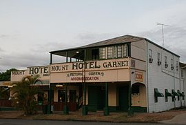
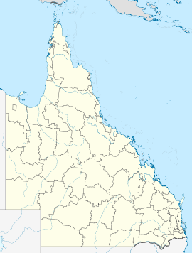
Mount Garnet pubPopulation: 458 (2006 Census)[1] Postcode: 4872 Elevation: 660 m (2,165 ft) Mount Garnet is a small town located in north-eastern Queensland, Australia. It is located at the south-western edge of the Atherton Tableland and is on the Kennedy Highway. Mount Garnet is about a three hour drive from Cairns. At the 2006 census, Mount Garnet had a population of 458.[1]
Contents
Overview
Mount Garnet's current population is around 400 people with 35% being Aboriginal. Various small communities populate the area around Mount Garnet. These include Tableland Tin, Innot Hot Springs, Silver Valley and Battle Creek.
Mount Garnet is situated on the traditional lands of the Mbarbaram peoples. Mount Garnet was built as a mining community in the 19th century and several minerals can be found in the area, including tin, copper, zinc and garnet. The Mountain itself, situated a few hundred metres from the state school, was a main vein of tin and garnet in the late 19th century. Open mine shafts still litter the mountain only covered with sheets of tin. A beautiful landscape neglected by proper care, a definite tourist attraction for the common hiker.
Transport
A railway was authorised to be built from Lappa, on the then Chillagoe Railway and Mines Company's line, to Mount Garnet by the Mount Garnet Freehold Mining Company in 1897. It suffered a rather shakey construction period and it was not until 11 January 1904 that the line was ready as far as a flood-damaged Return Creek bridge, across that creek from the town. It took another 11 years before trains could officially negotiate the bridge to the Mount Garnet station. The line was taken over by the Government from 23 December 1914. It closed on 1 July 1961.[2]
In the 1930s several cattle stations were established within the community as well as farms that grew many crops, including tobacco, potatoes, corn, peanuts and maize. Various mining operations, as well as lime production, are in operation today just outside the town.
References
- ^ a b Australian Bureau of Statistics (25 October 2007). "Mount Garnet (L) (Urban Centre/Locality)". 2006 Census QuickStats. http://www.censusdata.abs.gov.au/ABSNavigation/prenav/LocationSearch?collection=Census&period=2006&areacode=UCL341200&producttype=QuickStats&breadcrumb=PL&action=401. Retrieved 13 June 2011.
- ^ The Mount Garnet Railway Kerr, John Australian Railway Historical Society Bulletin, August, 1997 pp259-274
External links
Coordinates: 17°41′S 145°07′E / 17.683°S 145.117°E
Categories:- Towns in Queensland
- Far North Queensland
- Far North Queensland geography stubs
Wikimedia Foundation. 2010.

