- Blakelaw and North Fenham
-
Coordinates: 54°59′31″N 1°39′47″W / 54.992°N 1.663°W
Blakelaw and North Fenham 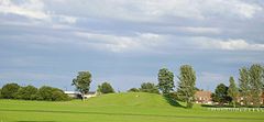
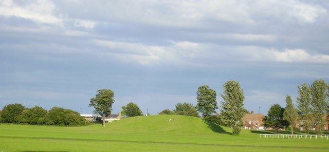
Blakelaw Sports Field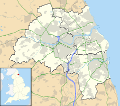
 Blakelaw and North Fenham
Blakelaw and North Fenham shown within Tyne and WearPopulation 6,468 (2001) OS grid reference NZ2166 Parish Blakelaw and North Fenham Metropolitan borough Newcastle upon Tyne Metropolitan county Tyne and Wear Region North East Country England Sovereign state United Kingdom Post town NEWCASTLE UPON TYNE Postcode district NE5 Dialling code 0191 Police Northumbria Fire Tyne and Wear Ambulance North East EU Parliament North East England UK Parliament Newcastle upon Tyne Central List of places: UK • England • Tyne and Wear Blakelaw and North Fenham is a suburb and civil parish in the City of Newcastle upon Tyne in Tyne and Wear, England. It is north west of the city centre, and is entirely surrounded by the unparished area of Newcastle upon Tyne. It covers the areas of Blakelaw, Cowgate and North Fenham, and has a population of 6,468.[1]
References
- ^ "Census 2001: Parish Headcounts: Newcastle upon Tyne". Neighbourhood Statistics. Office for National Statistics. http://www.neighbourhood.statistics.gov.uk/dissemination/viewFullDataset.do?instanceSelection=03070&productId=779&$ph=60_61&datasetInstanceId=3070&startColumn=1&numberOfColumns=8&containerAreaId=790258. Retrieved 18 November 2011.
External links
 Media related to Blakelaw and North Fenham at Wikimedia Commons
- and North Fenham Parish Council
Categories:- Tyne and Wear geography stubs
- Civil parishes in Tyne and Wear

Wikimedia Foundation. 2010.