- Mascot railway station, Sydney
Cityrail Station alt|station_name=Mascot|
servicearea=Airport & East Hills Line|servicearea_color=#East Hills line colour|servicearea_textcolor=white
code=MCO|suburb=Mascot|street=Bourke Rd
Church Rd|distance=5.19|altitude=?|traintype=Suburban all stops
Suburban limited stops|platforms=2|tracks=2|platform_arr=2 Side|stationtype=Underground|gates=Yes|connect=Bus|disabled=Yes
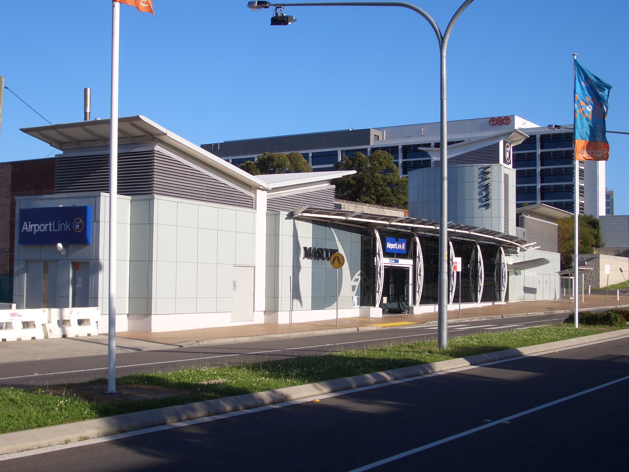
facilities= [http://www.cityrail.info/facilities/facilities.jsp?n=173&giveOutput=true&facility= Link]Mascot (also known as Mascot Suburban to avoid confusion with the neighbouring airport stations) is the second station from the city on the Airport branch of the
CityRail Airport and East Hills line inSydney . It is located in the business area of the suburb of Mascot and was opened with the rest of the Airport branch in May 2000. The station was built and is operated by a private company, rather than by CityRail, and as a result use of the station requires payment of a Station Access Fee on top of the usual CityRail fares. [Rail Corporation New South Wales , " [http://www.cityrail.info/fares/Passenger_Fares_Handbook.pdf "Passenger Fares & Coaching Rates Handbook"] ",2 July ,2006 . Accessed2 October ,2007 .] At Mascot and the preceding station, Green Square, the two Airport line stations which are not actually at the airport, the fee is significantly less than it is at the two Airport stations.Platforms/Service
Mascot station serves trains on the Airport & East Hills Line. Services run approximately every 10-15 minutes in each direction, with more services during peak hours.
Platform 1:
*East Hills line colour>Airport & East Hills Line - all stations services around theCity Circle (anticlockwise: first stop Museum).Platform 2:
*East Hills line colour>Airport & East Hills Line - all stations and limited stops services to Kingsgrove, East Hills, Glenfield, Campbelltown and Macarthur via the Airport.Transport Links
Sydney Buses runs two routes via Mascot station:
*Route 400 - Limited Stops Services - West to Westfield Burwood, East to Bondi Junction Interchange.*Route 410 - Weekdays(Monday to Friday)Peak Hour Limited Stops Services - West to Rockdale station, East to Bondi Junction Interchange.
ee also
*
Airport Link Company *
References
Wikimedia Foundation. 2010.