- Redfern railway station, Sydney
Cityrail Station alt|code=RDF|
station_name=Redfern
servicearea=South Coast Line|servicearea_color=#South Coast line colour|servicearea_textcolor=white
servicearea2=Blue Mountains Line|servicearea_color2=#Blue Mountains line colour|servicearea_textcolor2=black
servicearea3=Newcastle and Central Coast Line|servicearea_color3=#Newcastle and Central Coast line colour|servicearea_textcolor3=white
servicearea4=Eastern Suburbs & Illawarra Line|servicearea_color4=#Illawarra line colour|servicearea_textcolor4=white
servicearea5=Bankstown Line|servicearea_color5=#Bankstown line colour|servicearea_textcolor5=white
servicearea6=Inner West Line|servicearea_color6=#Inner West line colour|servicearea_textcolor6=white
servicearea7=Airport & East Hills Line|servicearea_color7=#East Hills line colour|servicearea_textcolor7=white
servicearea8=South Line|servicearea_color8=#South line colour|servicearea_textcolor8=black
servicearea9=Western Line|servicearea_color9=#Western line colour|servicearea_textcolor9=black
servicearea10=Olympic Park Line|servicearea_color10=#Olympic Park line colour|servicearea_textcolor10=white
servicearea11=Northern Line|servicearea_color11=#Northern line colour|servicearea_textcolor11=white
suburb=Redfern|street=Lawson St
Gibbons St|distance=1.30|altitude=?|traintype=Suburban all stations
Suburban limited stops
Intercity|platforms=12|tracks=12|platform_arr=2 side
5 island|stationtype=Ground/Underground|gates=Yes|connect=Train
Bus|disabled=No
facilities= [http://www.cityrail.info/facilities/facilities.jsp?n=230&giveOutput=true&facility= Link]Redfern railway station is a major railway station in Redfern which is to the south of the
Sydney city centre. It is a major connecting station for the CityRail network, as well as being the closest railway station to theUniversity of Sydney .History
In the early history of the
New South Wales Railways , "Redfern" was the name of the principal Sydney terminus. It was located to the south of Devonshire St and opened on26 September 1855 in an area known as "Cleveland Fields." This original "Redfern" station comprised one wooden platform in a corrugated iron shed. As traffic increased the original station was replaced in 1874 by a brick building containing two platforms. This second station, which grew to 14 platforms, was designed for through traffic if the lines were extended in the city direction. This second station was found to be too far from the city centre, so a new station (the present Sydney Central Station) was built to the north of Devonshire Street and opened on4 August 1906 . The 1874 station was soon demolished.A station was opened in 1876 1.3 km on the Parramatta side of the "original Redfern" and called 'Eveleigh'. In 1885 Eveleigh's platforms were reconstructed at the present Redfern site, and on
21 October 1906 this station was renamed Redfern.Platforms 11 and 12, as well as the area containing the unfinished platforms (see below), were constructed in the late 1970s as part of the Eastern Suburbs Railway construction, which opened in 1979.
Until the early 1990s Redfern had an overhead footbridge at the Eveleigh end of the platforms, connecting all platforms 1-10 by stairs. This was demolished because the funds for its maintenance were not available.A single track underground tunnel for trains going to Eveleigh Maintenance Centre, known as the "Engine Dive", runs under the above ground platforms. Various chimneys on the platforms (especially on platform 1) are evidence of this. The tunnel surfaces near the Eveleigh end of platform 10 and on the non-station side of the Lawson St bridge.The station is walking distance to the suburb of Waterloo known by its Govt Housing high rise buildings.
The present Redfern station was damaged by fire in the
2004 Redfern riots . The ticketing area and station master's office were significantly damaged - and the windows in the front of the station were bricked up for almost a year afterwards to prevent further attacks. They have since been replaced with glass windows.tation Configuration
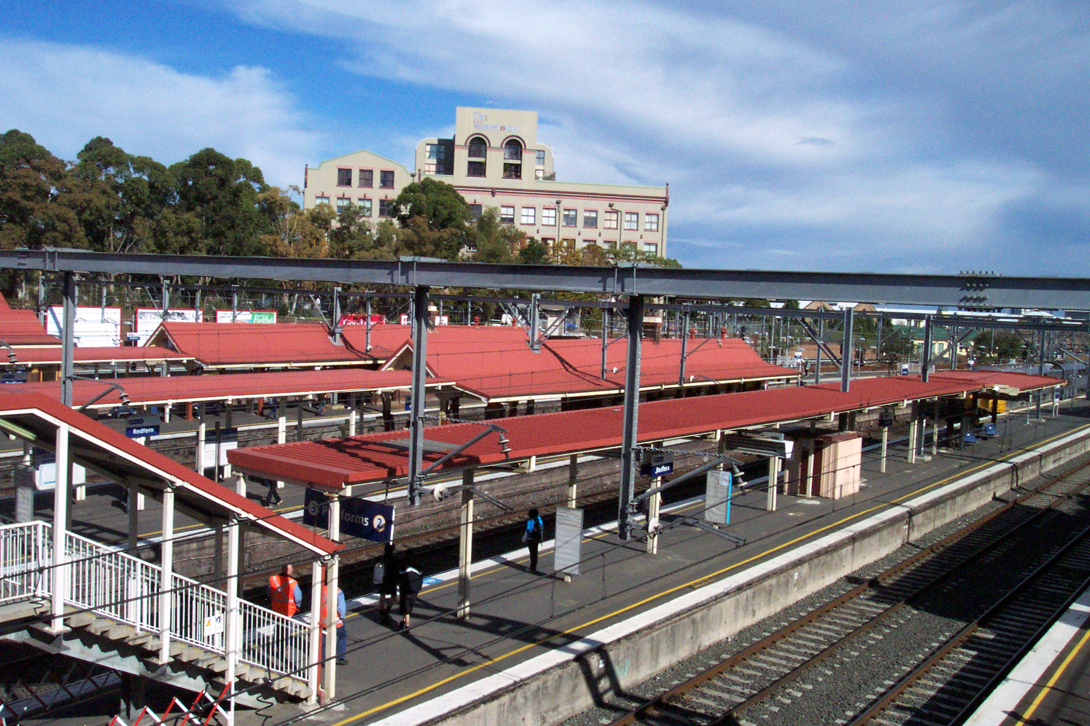
Redfern has 12 platforms - 10 above ground (linked by stairs to the concourse at Lawson St), and 2 underground (linked by stairs and escalators to the concourse at Gibbons St). The two concourses are linked. Station offices and facilities such as toilets and the main indicator boards are located next to the Lawson St entry.
As part of the construction of the Eastern Suburbs Railway (now platforms 11 and 12), it was proposed to build up to four platforms for the underground route (similar to Central.) Two of these platforms were built and now are Platforms 11 and 12, however, the two platforms above were half constructed above Platforms 11 and 12. These are visible through a small gap in the wall opposite Platform 11, as well as by a boarded up entry portal under the Lawson St Bridge (which was to be the down track), and a now filled-in dive tunnel under the Wells St Sectioning Hut on the Central side of Lawson St (which was to be the up track). The area in which the platforms were to be situated is visible from the station concourse at the entrance to Platform 10.
Platforms/Service
The station serves all Cityrail suburban lines except the airport branch of the Airport & East Hills Line, the Carlingford line, and the Cumberland Line. In peak hours, to serve connecting passengers and students at the University of Sydney, intercity services to the Blue Mountains, Newcastle & the Central Coast, and the South Coast also stop at the station to pick up or set down.
Despite an extension of the platform in the late 1990s, Platform 1 is considered a short platform, and passengers are asked to travel in the front six carriages of Intercity trains using the platform.
Platform 1
*South Coast line colour>South Coast Line - setting down peak hour intercity services to Central.
*Blue Mountains line colour>Blue Mountains Line - setting down peak hour intercity services to Central.
*Newcastle and Central Coast line colour>Newcastle & Central Coast Line - setting down peak hour intercity services to Central.
*Olympic Park line colour>Olympic Park Line - setting down services to Central (during special events and weekday off peak only).Platform 2
*South Coast line colour>South Coast Line - picking up peak hour intercity services to Thirroul, Wollongong, Port Kembla, Dapto and Kiama.
*Blue Mountains line colour>Blue Mountains Line - picking up peak hour intercity services to Springwood, Katoomba, Mt Victoria and Lithgow.
*Newcastle and Central Coast line colour>Newcastle & Central Coast Line - picking up peak hour intercity services to Gosford, Wyong and Newcastle via Strathfield.
*Olympic Park line colour>Olympic Park Line - services to Olympic Park (during special events and weekday off peak only).Platform 3:
*Western line colour>Western Line - all stations services to Central; then all stations and limited stops services to North Sydney, Lindfield, Gordon, Hornsby and Berowra, and peak hour intercity services to Gosford and Wyong via the North Shore Line.
*Northern line colour>Northern Line - all stations services to North Sydney; then services to Lindfield, Gordon and Hornsby via the North Shore Line.Platform 4:
*Blue Mountains line colour>Blue Mountains Line - peak hour intercity services to Springwood.
*Western line colour>Western Line - all stations and limited stops services to Blacktown, Riverstone, Richmond, Penrith and Emu Plains.
*Northern line colour>Northern Line - all stations and limited stops services to Eastwood and Hornsby via Strathfield.Platform 5:
*Inner West line colour>Inner West Line - all stations services around theCity Circle (clockwise).
*South line colour>South Line - all stations services around theCity Circle (clockwise).Platform 6:
*Inner West line colour>Inner West Line - all stations and limited stops services to Ashfield, Cabramatta and Liverpool via Regent's Park.
*South line colour>South Line - all stations and limited stops services to Glenfield and Campbelltown via Granville.
*This platform is used by trains from the Bankstown Line and Airport & East Hills line returning to the Macdonaldtown turnback from the City Circle.Platform 7:
*Bankstown line colour>Bankstown Line - all stations services around theCity Circle (anticlockwise).
*East Hills line colour>Airport & East Hills Line - peak hour all stations services around theCity Circle (anticlockwise).Platform 8:
*Bankstown line colour>Bankstown Line - all stations services to Bankstown, Lidcombe and Liverpool via Sydenham.
*East Hills line colour>Airport & East Hills Line - peak hour express services to Campbelltown and Macarthur via Sydenham & East Hills.Platform 9:
*Eastern Suburbs & Illawarra Line - very rare trains from the Ilawarra line that travel via the City circle. These moves are being phased out under the Clearways project. The platform was used for Illawarra line trains before the Eastern Suburbs railway was built in 1979.
*The platform is mostly used for stabling trains, for trains coming from the Eveleigh Maintenance Centre, or for trains coming from the Macdonaldtown Turnback returning to the Inner West Line or Southern Line via the City Circle (anticlockwise).Platform 10:
*Illawarra line colour>Eastern Suburbs & Illawarra Line - very rare trains from the Ilawarra line that travel via the City circle. These moves are being phased out under the Clearways project. The platform was used for Illawarra line trains before the Eastern Suburbs railway was built in 1979.
*The platform is mostly used for stabling trains, for trains returning to the Eveleigh Maintenance Centre, or for trains going to the Macdonaldtown Turnback from the Inner West Line or Southern Line.Platform 11 (underground)
*Illawarra line colour>Eastern Suburbs & Illawarra Line - all stations services to Bondi Junction.Platform 12 (underground)
*Illawarra line colour>Eastern Suburbs & Illawarra Line - all stations and limited stops services to Hurstville, Mortdale, Sutherland, Cronulla, and Waterfall.
*South Coast line colour>South Coast Line - peak hour intercity services to Thirroul, Wollongong and Port Kembla."Platforms 13-14 (unfinished)"
*These were not fully constructed; are situated above Platforms 11 & 12 and next to Platform 10.Accessibility/Exits
The station has three main exits - the main entrance and exit on Lawson St next to the ticketing area (Exit A on the diagram below), a second entrance on Gibbons St (especially for passengers using platforms 11 and 12) (Exit B on the diagram below), and a third exit to the
Australian Technology Park , which is accessed by walking along platform 10 (Exit C on the diagram). During peak hours, the entrance to platform 10 is blocked by fare gates to prevent fare evasion by those travelling to the Technology Park area; these are opened during off-peak times or on the rare occasion when a train needs to stop at the platform. The other two entrances have their fare gates operating at all times.At present, Redfern does not have Easy Access for wheelchairs. All above-ground platforms are accessible by stairs, so this would hinder most wheelchair access to the station. Platforms 11 and 12 are accessible by either stairs or escalators from a separate concourse near the Gibbons St exit.
In April 2006, Transport Minister John Watkins announced plans for a $2 million inquiry into concept designs for upgrading the station, including Easy Access facilities. The station requires upgrading due to an influx of new residents and workers set to result from the Redfern-Waterloo urban renewal project. ["$2 million concept: New designs on stations", Matt Sun, MX,
April 6 ,2006 , p. 4]tation Map
{| width="15%"
- bgcolor="orange"
style="color:black;"|Stairs/EscalatorsBus Services
Redfern does not have a connecting bus interchange; however, a stop close to the Gibbons Street entrance (near platforms 11 & 12) serves the following routes:
*305 - Railway Square (inbound); Qantas Centre, Mascot via Alexandria (outbound).
*308 - Millers Point (Argyle St) (inbound) via City; Marrickville Metro (Smidmore St) (outbound) via Alexandria.
*309/310 - Circular Quay via City (inbound) (outbound does not pass by Redfern Station). There are also peak hour express service equivalents X09 & X10.
*L09 - Peak hour limited stops service to Port Botany Bus Depot (Bumborah Pt Rd).This bus stop also services
NightRide buses and replacement buses during trackwork.There are stops further afield in Lawson Square, Botany Rd and Redfern St servicing bus routes to the City, Railway Square, Matraville, Pagewood and Marrickville.
Neighbouring stations
Notes
References/External Links
* [http://www.trainman.id.au/photos/tunnels Trainman's Train Page] - Pictures of the unfinished platforms 13 & 14.
* [http://www.railpage.org.au/neety/trains/ Neety's Train Page] - pictures and information on the station; facts and figures.
* [http://www.nswrail.net NSW Railways] - historical information on the station; facts and figures.
* [http://groups.google.com.au/group/aus.rail?hl=en aus.rail newsgroup] - various information.
* [http://www.cityrail.info CityRail website] - travel and station accessibility information.
* [http://www.sydneybuses.info Sydney Buses website] - bus stop information.
*Mapit-AUS-suburbscale old|long=151.19873|lat=-33.89202------------------------------------
----
Wikimedia Foundation. 2010.