- Nechako River
-
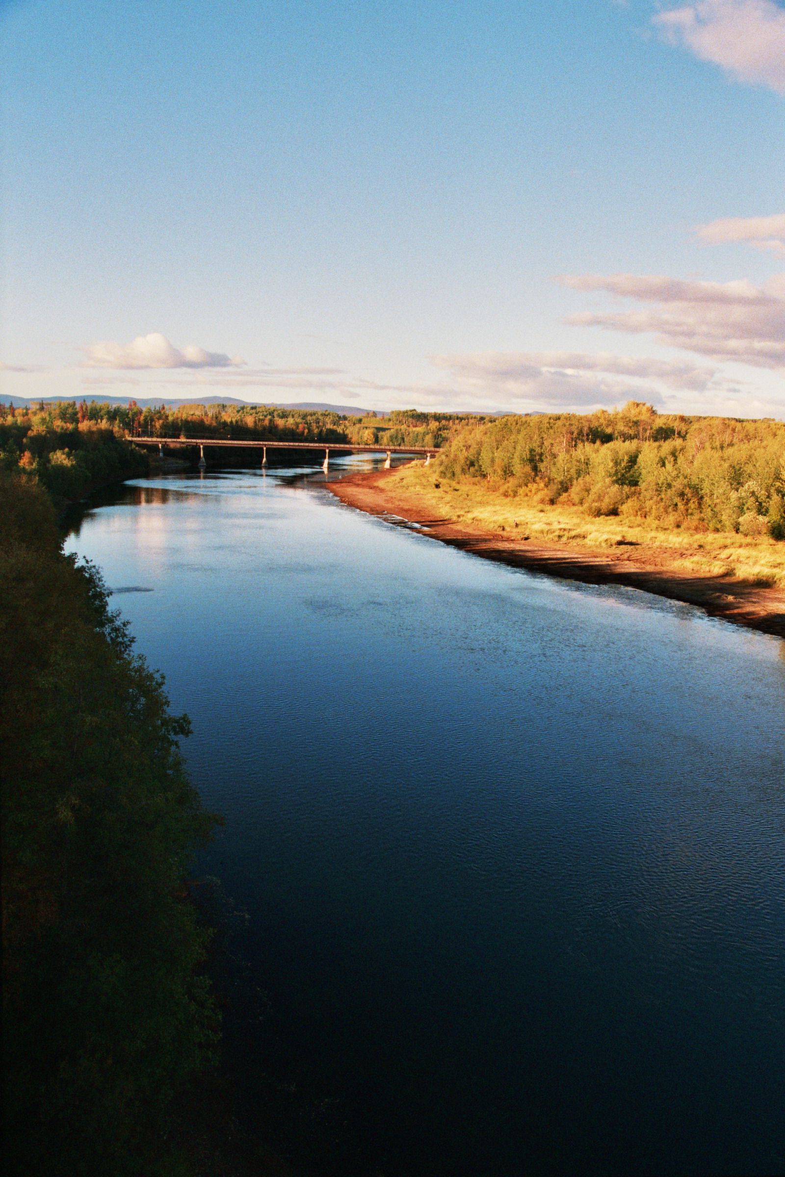
 The Nechako River and Highway 16 bridge, near Fort Fraser
The Nechako River (pronounced /nəˈtʃækoʊ/) arises on the Nechako Plateau east of the Kitimat Ranges of the Coast Mountains of British Columbia and flows north toward Fort Fraser, then east to Prince George where it enters the Fraser River. "Nechako" is an anglicization of [netʃa koh], its name in the indigenous Carrier language which means "big river".
Its main tributaries are the Stuart River, which enters about 45 km (28 mi) east of Vanderhoof; the Endako; the Chilako, which enters about 15 km (9 mi) west of Prince George; and the Nautley River, a short stream from Fraser Lake. Among the other tributaries is the Cheslatta River, which drains Cheslatta Lake and enters the Nechako at the foot of the Nechako Canyon via Cheslatta Falls and begins at the Kenny Dam and forms the Nechako Reservoir.
Contents
History
The expedition of Alexander MacKenzie went past the mouth of the Nechako in 1793, curiously, without observing it. The first European to ascend the Nechako was James McDougall, a member of Simon Fraser's expedition, in 1806.
Nechako Reservoir
The Nechako is one of the main tributaries of the Fraser River, although most of its flow has been diverted through the Coast Mountains to the Kemano generating station at sea level on the Gardner Canal, 858 m (2,815 ft) below the reservoir's intakes, which supplies power to the aluminum smelter at nearby Kitimat. The main reservoir of the Nechako power diversion is named the Nechako Reservoir or Ootsa Lake Reservoir, but there are many subnames for different parts of the lake as its conversion into a reservoir involved the amalgamation of chains of lakes, the largest of which were Eutsuk Lake and Natalkuz Lake, which form the south arm of the reservoir. The reservoir's alternate name comes from Ootsa Lake, now merged into the north arm of the reservoir but which was not on the course of the Nechako River. Other lakes also merged into the north arm are Whitesail Lake and Tahtsa Lake, with the correspondingly-named rivers connecting them re-dubbed Whitesail Reach and Tahtsa Reach. In between the two arms of the reservoir is the Quanchus Range.
The damming of the Nechako in 1952 and the consequent massive reduction in flow has been the source of considerable political controversy. The Cheslatta people (a subgroup of the Dakelh or Carrier) were flooded out by the creation of the reservoir and forced to abandon their homes with only two weeks' warning. The increase in water temperature caused by the reduction in flow has been an ongoing problem for the salmon run on the Fraser and Stuart Rivers as well as the Nechako.
Bibliography
- Christensen, Bev (1995) Too Good to be True. Vancouver: Talonbooks. (A history of the Kemano project, which dammed the Nechako.)
- Giesbrecht, Jean Clark (1994) Heritage Lost: A People's History of the Ootsa Lake Region 1905-1955. Likely, BC: Quesnel Lake Publishing. (Contains an account of the flooding caused by the construction of the Kemano Project.)
External links
- Fraser Watershed entry
- BC Lakes and Rivers
- "Engineers Invade Another Wilderness - Huge Canadian Power Project Marks 20th Century Frontier Boom" , by Richard Neuberger detailed 1951 Popular Science article on the Kemano Hydro Project
Hydrography of British Columbia Rivers Lakes Coastal features Categories:- Rivers of British Columbia
- Nechako Country
- Greater Prince George
- Regional District of Bulkley-Nechako
- Tributaries of the Fraser River
Wikimedia Foundation. 2010.