- Matane Airport
-
Matane Airport IATA: YME – ICAO: CYME Summary Airport type Public Operator Town of Matane Location Matane, Quebec Elevation AMSL 103 ft / 31 m Coordinates 48°51′23″N 067°27′08″W / 48.85639°N 67.45222°WCoordinates: 48°51′23″N 067°27′08″W / 48.85639°N 67.45222°W Map Location in Quebec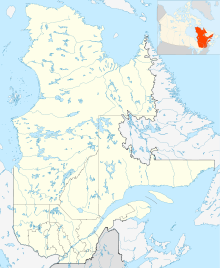
 CYME
CYMERunways Direction Length Surface ft m 09/27 5,500 1,676 Asphalt Source: Canada Flight Supplement[1] Matane Airport, (IATA: YME, ICAO: CYME), is located 2.5 NM (4.6 km; 2.9 mi) east of Matane, Quebec, Canada.
References
- ^ Canada Flight Supplement. Effective 0901Z 20 October 2011 to 0901Z 15 December 2011
Airports in Canada By name A–B · C–D · E–G · H–K · L–M · N–Q · R–S · T–ZBy location indicator CA · CB · CC · CD · CE · CF · CG · CH · CI · CJ · CK · CL · CM · CN · CO · CP · CR · CS · CT · CV · CW · CY · CZBy province/territory National Airports System Calgary · Charlottetown · Edmonton · Fredericton · Gander · Halifax · Iqaluit · Kelowna · London · Moncton · Montréal-Mirabel · Montréal-Trudeau · Ottawa · Prince George · Québec · Regina · Saint John · St. John's · Saskatoon · Thunder Bay · Toronto · Vancouver · Victoria · Whitehorse · Winnipeg · YellowknifeRelated List of airports by ICAO code: C · List of defunct airports in Canada · List of heliports in Canada · List of international airports in Canada · National Airports System · Operation Yellow RibbonCategories:- Airports in Quebec
- Matane
- Transportation in Bas-Saint-Laurent
- Quebec airport stubs

Wikimedia Foundation. 2010.