- Kuujjuaq Airport
-
Kuujjuaq Airport IATA: YVP – ICAO: CYVP
– WMO: 71906Summary Airport type Public Operator Kativik Regional Government
Administration régionale KativikLocation Kuujjuaq, Quebec Elevation AMSL 129 ft / 39 m Coordinates 58°05′46″N 068°25′37″W / 58.09611°N 68.42694°WCoordinates: 58°05′46″N 068°25′37″W / 58.09611°N 68.42694°W Map Location in Quebec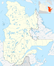
 CYVP
CYVPRunways Direction Length Surface ft m 07/25 6,000 1,829 Asphalt 13/31 5,000 1,524 Gravel Statistics (2010) Aircraft movements 12,485 Sources: Canada Flight Supplement[1]
Environment Canada[2]
Movements from Statistics Canada[3]Kuujjuaq Airport, (IATA: YVP, ICAO: CYVP), is located 1.5 NM (2.8 km; 1.7 mi) southwest of Kuujjuaq, Quebec, Canada.
Contents
Airlines and destinations
Airlines Destinations Air Inuit Aupaluk, Inukjuak, Kangiqsualujjuaq, Kangirsuk, Puvirnituq, Tasiujaq, Wabush, Sept-Iles connect to Montreal, Quebec City First Air Iqaluit, Montreal-Trudeau,[4] Ottawa [cargo] History
During World War II, the United States established a weather/radio station at this site, code-named "Crystal I". It was one of three "Crystal" weather sites in the Canadian Arctic Region, Frobisher Bay Air Base (now Iqaluit Airport), Northwest Territories being "Crystal II", and a station on Padloping Island being "Crystal III". A detachment of the 8th Weather Squadron, Air Transport Command (ATC) took up residence at the station on 1 October 1942.[5] The initial mission of the Crystal sites was to provide long-range weather information to the combat forces then building up in the United Kingdom.
Beginning in 1943, the North Atlantic Division, ATC, constructed an airstrip at Crystal I as part of the proposed Crimson Route for ferrying aircraft between the United States and Great Britain. Crystal I was planned to be a transport hub between the Eastern Route, which originated at Presque Isle Army Airfield, Maine and the Central Route, which originated at Romulus Army Airfield (Detroit Airport), Michigan. From Crytstal I, the aircraft would be ferried across over Baffin Island; Greenland; Iceland and delivered to Scotland. The development of the Mid-Atlantic Transport through the Azores led to the cancellation of the Crystal Route project in 1943. The United States presence at Crystal I was reduced to a skeleton weather squadron; which ended in 1945, and the facilities were turned over to the Canadian government.[6]
Nav Canada opened a $7-million air traffic control facility near the airport. The radar station allows controllers in Montreal to monitor the steady stream of transatlantic air traffic over northern Quebec[7]
A large-scale terminal expansion project was carried out at the airport between 2006 to 2008. The $14.9 million project included the expansion of the airport apron and the construction of a brand new 1,225m² terminal to replace the cramped building built in 1972. The building, designed by architect Alain Fournier, received a silver certification under the Canadian Leadership in Energy and Environmental Design (LEED) program.[7]
References
- ^ Canada Flight Supplement. Effective 0901Z 20 October 2011 to 0901Z 15 December 2011
- ^ Synoptic/Metstat Station Information
- ^ Total aircraft movements by class of operation — NAV CANADA flight service stations
- ^ First Air interactive weather/route map
- ^ USAFHRA Document 00076387
- ^ AFHRA Document 00076350
- ^ a b "Kuujjuaq Airport Terminal Expansion, Quebec, Canada". AirportTechnology.com. http://www.airport-technology.com/projects/kuujjuaq/. Retrieved May 8, 2011.
External links
- Past three hours METARs, SPECI and current TAFs for Kuujjuaq Airport from NAV CANADA as available.
Airports in Canada By name A–B · C–D · E–G · H–K · L–M · N–Q · R–S · T–ZBy location indicator CA · CB · CC · CD · CE · CF · CG · CH · CI · CJ · CK · CL · CM · CN · CO · CP · CR · CS · CT · CV · CW · CY · CZBy province/territory National Airports System Calgary · Charlottetown · Edmonton · Fredericton · Gander · Halifax · Iqaluit · Kelowna · London · Moncton · Montréal-Mirabel · Montréal-Trudeau · Ottawa · Prince George · Québec · Regina · Saint John · St. John's · Saskatoon · Thunder Bay · Toronto · Vancouver · Victoria · Whitehorse · Winnipeg · YellowknifeRelated List of airports by ICAO code: C · List of defunct airports in Canada · List of heliports in Canada · List of international airports in Canada · National Airports System · Operation Yellow RibbonCategories:- Airports in Quebec
- Transportation in Nord-du-Québec

Wikimedia Foundation. 2010.