- Drummondville Airport
-
Drummondville Airport IATA: none – ICAO: none – TC LID: CSC3 Summary Airport type Public Operator SDED - Aéroport de Drummondville Location Drummondville, Quebec Elevation AMSL 365 ft / 111 m Coordinates 45°50′43″N 072°23′41″W / 45.84528°N 72.39472°WCoordinates: 45°50′43″N 072°23′41″W / 45.84528°N 72.39472°W Website Map Location in Quebec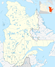
 CSC3
CSC3Runways Direction Length Surface ft m 06/24 4,000 1,219 Asphalt Statistics (2010) Aircraft movements 9,576 Source: Canada Flight Supplement[1]
Movements from Statistics Canada.[2]Drummondville Airport, (TC LID: CSC3), is located 4 NM (7.4 km; 4.6 mi) east southeast of Drummondville, Quebec, Canada.
The airport is classified as an airport of entry by NAV CANADA and is staffed by the Canada Border Services Agency. CBSA officers at this airport currently can handle general aviation aircraft only, with no more than 15 passengers.[1]
See also
References
- ^ a b Canada Flight Supplement. Effective 0901Z 20 October 2011 to 0901Z 15 December 2011
- ^ Total aircraft movements by class of operation
External links
- Page about this airport on COPA's Places to Fly airport directory
Airports in Canada By name A–B · C–D · E–G · H–K · L–M · N–Q · R–S · T–ZBy location indicator CA · CB · CC · CD · CE · CF · CG · CH · CI · CJ · CK · CL · CM · CN · CO · CP · CR · CS · CT · CV · CW · CY · CZBy province/territory National Airports System Calgary · Charlottetown · Edmonton · Fredericton · Gander · Halifax · Iqaluit · Kelowna · London · Moncton · Montréal-Mirabel · Montréal-Trudeau · Ottawa · Prince George · Québec · Regina · Saint John · St. John's · Saskatoon · Thunder Bay · Toronto · Vancouver · Victoria · Whitehorse · Winnipeg · YellowknifeRelated List of airports by ICAO code: C · List of defunct airports in Canada · List of heliports in Canada · List of international airports in Canada · National Airports System · Operation Yellow RibbonCategories:- Airports in Quebec
- Transportation in Drummondville
- Quebec airport stubs

Wikimedia Foundation. 2010.