- Navestock
-
Coordinates: 51°39′06″N 0°15′32″E / 51.6518°N 0.2588°E
Navestock 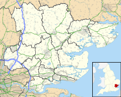
 Navestock
Navestock shown within EssexPopulation 510 OS grid reference TQ562972 District Brentwood Shire county Essex Region East Country England Sovereign state United Kingdom Post town ROMFORD Postcode district RM4 Dialling code 01277 Police Essex Fire Essex Ambulance East of England EU Parliament East of England UK Parliament Brentwood and Ongar List of places: UK • England • Essex Navestock is a civil parish in the Borough of Brentwood in south Essex, in the East of England region of the United Kingdom. It is located approximately 5 km (3.1 mi) North West of the town of Brentwood and the M25 motorway cuts through the western edge of the parish. It covers an area of in excess of 1800 hectares (4500 acres) and had a population of 510 in 2001. The name means ‘the stump on the headland’, which reflects its topography and landscape.[1]
Contents
Geography
Navestock remains a rural and agricultural parish despite being less than 30 km from central London. It is not served well by main roads and so despite being well within the London commuter belt has undergone little recent housing development, and retains a feeling of remoteness. There is no traditional nucleated village in Navestock, but there is a concentration of houses at Navestock Side in the east of the parish and a rather more dispersed one at Navestock Heath in the centre. The medieval church and hall are in an isolated position about a mile further north from Navestock Heath.
The greater part of the parish sits on top of two spurs divided by a stream flowing north into the River Roding, which forms the northern boundary of the parish. The highest point is 103m near Navestock Side in the eastern edge of the parish, while much of the centre and south of the parish forms a plateau generally above 70 metres. The land falls away steeply to the north to the Roding valley, the lowest point being below 30m where the Roding leaves the parish in the far north-west corner.
History
The western edge of the parish was within the ancient forest of Essex, and two boundary stones still mark its limits. Enclosure of common land took place in 1770. Navestock was an early centre for cricket, which has been played on the green at Navestock Side since the 18th century.[2]
According to the census of 1801 the population of Navestock was 623, and reached a peak of 982 in 1851. There was then a gradual decline in population during the period of agricultural depression in the late 19th century and the 1901 census recorded only 692 inhabitants After fluctuating at around that level in the first half of the 20th century the population has declined further and was only 510 in 2001.[2] This makes Navestock unusual in that despite its proximity to London its population is below its level of two hundred years ago.
Historically Navestock was included in the hundred of Ongar. It formed part of the Ongar Rural District Council from 1894 until that authority was absorbed into Epping and Ongar Rural District Council in 1955. Following local government reorganisation in 1974 it has been part of the Borough of Brentwood. The present civil parish retains largely the same boundaries as the ancient parish as it existed prior to the mid-19th century, and forms part of the 'Brizes and Doddinghurst' district council ward.
Places of interest
The country house Abbotswick Hall, now a Catholic retreat centre.
External links
- http://www.british-history.ac.uk/report.aspx?compid=15611
- http://www.essexinfo.net/navestock/
- http://www.freewebs.com/navestockcc/
- http://essex1841.com/Navestock-1841.php
References
- ^ Brentwood Borough Council, Navestock parish page. Date accessed: Tuesday, November 13, 2007.
- ^ a b A History of the County of Essex: Volume 4 (1956), pp. 139-143, Navestock: Introduction . Date accessed: Thursday, November 15, 2007.
Categories:- Civil parishes in Essex
- Brentwood

Wikimedia Foundation. 2010.