- Navestock Side
-
Coordinates: 51°39′04″N 0°15′25″E / 51.651°N 0.257°E
Navestock Side 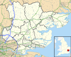
 Navestock Side
Navestock Side shown within EssexDistrict Brentwood Shire county Essex Region East Country England Sovereign state United Kingdom EU Parliament East of England List of places: UK • England • Essex Navestock Side is a hamlet near the A128 road, in the Brentwood District, in the county of Essex, England. It is located about three miles away from the town of Brentwood. It has a small country house called Abbotswick.
See also
References
- Essex A-Z (page 95)[Full citation needed]
Categories:- Brentwood
- Hamlets in Essex
- Essex geography stubs

Wikimedia Foundation. 2010.