- Coongulla, Victoria
-
Coongulla
Victoria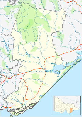
 Coongulla
Population: 165[1] Postcode: 3860 Location: LGA: Shire of Wellington State District: Gippsland East Federal Division: Gippsland Coongulla is a town in Victoria, Australia, located on Ryans Road, on the shores of Lake Glenmaggie in the Shire of Wellington. The postcode for Coongulla and the surrounding towns is 3860. At the 2006 census, Coongulla and the surrounding area had a population of 165.[1] Coongulla is 160 km from Melbourne.
Description
There are approx 256 separate houses in Coongulla. Of these, 57% are fully owned, 29% are purchasing and 8% are rented.
There are 165 people living in Coongulla. Of the residents of coongulla 53.3% were males and 46.7% were females
The top 5 religious affiliations for residents of Coongulla are:
- Anglican (26.1%)
- Catholic (18.8%)
- no religion (27.9%)
- Uniting Church (8.5%)
- Presbyterian and Reformed (6.7%)
Of the people in Coongulla, 83.6% are Australian-born. Of the immigrants, most are from the United Kingdom (5.5%), then Hungary 3.6% and the Netherlands 3.0%
Population age groups: 0-4 years 0 0.0%, 5-14 years 11 6.7%, 15-24 years 13 7.9%, 25-54 years 53 32.1%, 55-64 years 46 27.9%, 65 years and over 41 24.8%,
Median age of persons 56
The top five modes of transport to work are:
- car (driver) (55%)
- work at home (22%)
- car (passenger) (8%)
- walk (8.5%)
- bicycle (6%).
The education status of people living in Coongulla is Not Attending (Working) (73%), Infants/Primary (11%), Secondary Education (11%), Technical or Further Education (2%) and Pre-School (2%).
The Lake Glenmaggie Weir supplies irrigation water for all the farms in the area and also supplies drinking water to Maffra, Coongulla, Glenmaggie and Newry.
Some of the most common activities for locals and holidayers are: night walks, swimming, bike riding, canoeing or kayaking, yachting, grass boarding, water sports, and motorbike riding.
Local Climate
- Average January Max temperature: 26°C.
- Average July Max temperature: 14°C.
- Average January Min temperature: 13°C.
- Average July Min temperature: 4°C.
- Average Annual Rainfall: 594 mm.
- Average No. Rain Days: 115.
Footnotes
- ^ a b Australian Bureau of Statistics (25 October 2007). "Coongulla (State Suburb)". 2006 Census QuickStats. http://www.censusdata.abs.gov.au/ABSNavigation/prenav/LocationSearch?collection=Census&period=2006&areacode=SSC25391&producttype=QuickStats&breadcrumb=PL&action=401. Retrieved 2007-07-26.
Towns in the Shire of Wellington Alberton • Alberton West • Boisdale • Briagolong • Bushy Park • Carrajung • Coongulla • Cowwarr • Dargo • Glenmaggie • Heyfield • Kilmany • Licola • Loch Sport • Longford • Maffra • Newry • Port Albert • Rosedale • Sale • Seaton • Stratford • Tinamba • Upper Maffra West • Valencia Creek • Woodside · Woodside Beach • Yarram
Categories:- Towns in Victoria (Australia)
- Gippsland
- Australian Aboriginal placenames

Wikimedia Foundation. 2010.