- Republic of Maryland
-
Republic of Maryland 1854–1857  →
→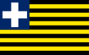
Flag (1854-57)
Capital Harper 1854 Language(s) English (de facto) Religion Christian Government Republic Governor - 1854 Samuel Ford McGill - 1854-1856 William A. Prout - 1856-1857 Boston Jenkins Drayton Historical era Victorian - Republic of Maryland Declaration of Independence 1854 - Annexed by Liberia. 1857 Currency United States Dollar ($) The Republic of Maryland (also known as the Independent State of Maryland) was a small African American nation which existed from 1854 to 1857, when it was united into what is now Liberia.
The area was first settled in 1834[1] by freed African-American slaves and freeborn African-Americans primarily from the U.S. state of Maryland, under the auspices of the Maryland State Colonization Society.[2] In 1838, other African-American settlements were united into the Commonwealth of Liberia, which declared its independence in 1847. The Maryland in Liberia colony remained apart, as the state colonization society wished to maintain its trade monopoly in the area. On 2 February 1841, Maryland-in-Africa became the State of Maryland. The state declared its independence on 29 May 1854 as Maryland in Liberia[3] with its capital at Harper.
Contents
History
In December 1831, the Maryland state legislature appropriated US$10,000 for 26 years to transport free blacks and ex-slaves from the United States to Africa, and the Maryland State Colonization Society was established for this purpose.[4]
Settlement of Cape Palmas
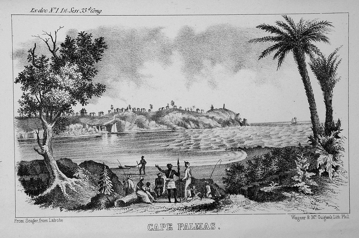
 Etching of Cape Palmas, c1853.
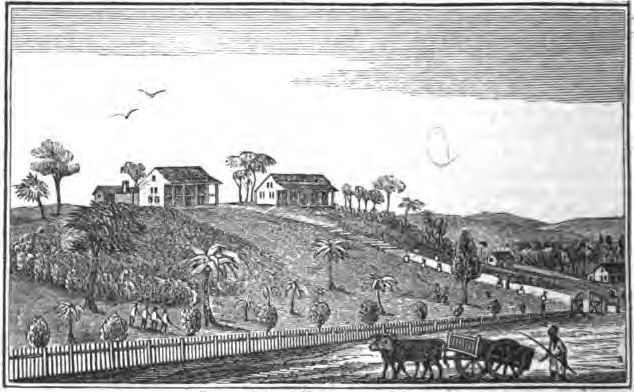
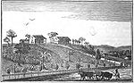 Cape Palmas mission, c1840.
Originally a branch of the American Colonization Society that had founded Liberia in 1822, the Maryland State Colonization Society decided to establish a new settlement of its own that could accommodate its emigrants. The first area to be settled was Cape Palmas, in 1834, somewhat south of the rest of Liberia.[1] The Cape is a small, rocky peninsula connected to the mainland by a sandy isthmus. Immediately to the west of the peninsula is the estuary of the Hoffman River. Approximately 21 km (15 mi) further along the coast to the east, the Cavalla River empties into the sea, marking the border between Liberia and the Ivory Coast. It marks the western limit of the Gulf of Guinea, according to the International Hydrographic Organisation (IHO).
Most of the settlers were freed African-American slaves and freeborn African-Americans primarily from the state of Maryland.[5] The colony was named Maryland In Africa (also known as Maryland in Liberia) on February 12, 1834.
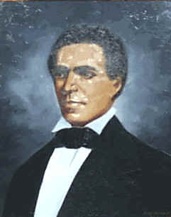
John Brown Russwurm
 John Brown Russwurm, first black governor of Maryland in Africa from 1836-1851.
In 1836 the colony appointed its first black governor John Brown Russwurm (1799–1851), who remained governor until his death. Russwurm encouraged the immigration of African-Americans to Maryland and supported agriculture and trade.[6] He had begun his career as the colonial secretary for the American Colonization Society between 1830 and 1834. He also worked as the editor of the Liberia Herald, though he resigned his post in 1835 to protest America's colonization policies.
In 1838, a number of other African-American settlements on the west coast of Africa united to form the Commonwealth of Liberia, which then declared its independence in 1847. However, the colony of Maryland in Liberia colony remained independent, as the Maryland State Colonization Society wished to maintain its trade monopoly in the area. On 2 February 1841, Maryland-in-Africa was granted[by whom?] statehood, and became the State of Maryland. In 1847 the Maryland State Colonization Society published the Constitution and Laws of Maryland in Liberia, based on the United States Constitution.
Declaration of Independence, and annexation by Liberia
On 29 May 1854, the State of Maryland declared its independence, naming itself Maryland in Liberia,[3] with its capital at Harper. It was also known as the Republic of Maryland. It held the land along the coast between the Grand Cess and San Pedro Rivers. However, it would survive just three years as an independent state.
Soon afterwards, local tribes including the Grebo and the Kru attacked the State of Maryland in retaliation for its disruption of the slave trade.[citation needed] Unable to maintain its own defence, Maryland appealed to Liberia, its more powerful neighbor, for help. President Roberts sent military assistance, and an alliance of Marylanders and Liberian militia troops successfully repelled the local tribesmen. However, it was now clear that the Republic of Maryland could not survive as an independent state, and Maryland was annexed by Liberia on 18 March 1857, becoming known henceforth as Maryland County.
Legacy
There is a statue of John Brown Russwurm at his burial site at Harper, Cape Palmas, Liberia.[7]
Governors of Maryland-in-Africa
(Dates in italics indicate de facto continuation of office)
Term Incumbent Notes 12 February 1834 Maryland State Colonization Society founds Maryland-in-Africa colony 12 February 1834 to February 1836 James Hall, Governor February 1836 to 1 July 1836 Oliver Holmes, Jr., Governor 1 July 1836 to 28 September 1836 Three-Man Committee 28 September 1836 to 2 February 1841 John Brown Russwurm, Governor State of Maryland in Liberia 2 February 1841 to 9 June 1851 John Brown Russwurm, Governor 9 June 1851 to 1852 Samuel Ford McGill, acting Governor 1852 to 29 May 1854 Samuel Ford McGill, Governor The Independent State of Maryland in Liberia 29 May 1854 to 8 June 1854 Samuel Ford McGill, Governor 8 June 1854 to April 1856 William A. Prout, Governor April 1856 to 18 March 1857 Boston Jenkins Drayton, Governor 18 March 1857 Incorporated into The Republic of Liberia See also
- History of Liberia
- History of slavery in Maryland
References
- Freehling, William H., The Road to Disunion: Volume I: Secessionists at Bay, 1776-1854 Retrieved March 12, 2010
- Hall, Richard, On Afric's Shore: A History of Maryland in Liberia, 1834-1857
- Latrobe, John H. B., p.125, Maryland in Liberia: a History of the Colony Planted By the Maryland State Colonization Society Under the Auspices of the State of Maryland, U. S. At Cape Palmas on the South - West Coast of Africa, 1833-1853 (1885). Retrieved Feb 16 2010
Notes
- ^ a b The African Repository, Volume 14, p.42. Retrieved March 13, 2010
- ^ Hall, Richard, On Afric's Shore: A History of Maryland in Liberia, 1834-1857
- ^ a b Constitution and Laws of Maryland in Liberia, p.1 Retrieved March 13, 2010
- ^ Latrobe, John H. B., p.125, Maryland in Liberia: a History of the Colony Planted By the Maryland State Colonization Society Under the Auspices of the State of Maryland, U. S. At Cape Palmas on the South - West Coast of Africa, 1833-1853, published in 1885. Retrieved Feb 16 2010
- ^ Richard Hall, On Afric's Shore: A History of Maryland in Liberia, 1834-1857
- ^ Lear, Alex (2006-12-07). "Crossing the color line". The Community Leader. http://communityleader.mainetoday.com/story.html?ID=978. Retrieved 2008-01-31.
- ^ The World Book encyclopedia. Chicago: World Book. 1996. ISBN 0-7166-0096-X. http://www.aaregistry.com/african_american_history/1176/John_Russwurm_an_early_PanAfricanist__. Retrieved March 13, 2010
Categories:- Former countries in Africa
- States and territories established in 1854
- States and territories disestablished in 1857
- History of Liberia
- Former republics
- 1857 disestablishments
- Colonialism
- 19th century in Africa
- History of Maryland
- African American establishments
- Maryland County

Wikimedia Foundation. 2010.