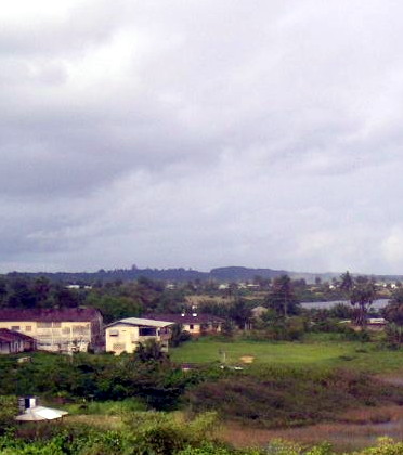
- Harper, Liberia
Infobox Settlement
official_name = Harper
other_name =
native_name =
nickname =
settlement_type =
motto =
imagesize = 300px
image_caption =
flag_size =
image_
seal_size =
image_shield =
shield_size =
image_blank_emblem =
blank_emblem_type =
blank_emblem_size =
mapsize =
map_caption =
mapsize1 =
map_caption1 =
image_dot_
dot_mapsize =
dot_map_caption =
dot_x = |dot_y =
pushpin_
pushpin_label_position =bottom
pushpin_mapsize =300
pushpin_map_caption =Location in Liberia
subdivision_type = Country
subdivision_name =
subdivision_type1 = County
subdivision_name1 =Maryland County
subdivision_type2 = District
subdivision_name2 =
subdivision_type3 =
subdivision_name3 =
subdivision_type4 =
subdivision_name4 =
government_footnotes =
government_type =
leader_title =
leader_name =
leader_title1 =
leader_name1 =
leader_title2 =
leader_name2 =
leader_title3 =
leader_name3 =
leader_title4 =
leader_name4 =
established_title =
established_date =
established_title2 =
established_date2 =
established_title3 =
established_date3 =
area_magnitude =
unit_pref =Imperial
area_footnotes =
area_total_km2 =
area_land_km2 =
area_water_km2 =
area_total_sq_mi =
area_land_sq_mi =
area_water_sq_mi =
area_water_percent =
area_urban_km2 =
area_urban_sq_mi =
area_metro_km2 =
area_metro_sq_mi =
area_blank1_title =
area_blank1_km2 =
area_blank1_sq_mi =
population_as_of =
population_footnotes =
population_note =
population_total =
population_density_km2 =
population_density_sq_mi =
population_metro =
population_density_metro_km2 =
population_density_metro_sq_mi =
population_urban =
population_density_urban_km2 =
population_density_urban_sq_mi =
population_blank1_title =Ethnicities
population_blank1 =
population_blank2_title =Religions
population_blank2 =
population_density_blank1_km2 =
population_density_blank1_sq_mi =
timezone =
utc_offset =
timezone_DST =
utc_offset_DST =
latd=4 |latm=22|lats=|latNS=N
longd=7|longm=43|longs= |longEW=W
elevation_footnotes =
elevation_m =
elevation_ft =
postal_code_type =
postal_code =
area_code =
blank_name =
blank_info =
blank1_name =
blank1_info =
website =
footnotes =Harper, situated on Cape Palmas, is the capital of
Maryland County inLiberia . Before theLiberian Civil War , Harper was an importantadministrative centre . Harper is slowly being rebuilt but without central electricity or water. No hotels and few low standard guesthouses andrestaurant s are functional.Magnificent unexploited
beaches stretch for miles on both sides of Harper and warm ocean temperature year round.Fish are found in abundance, as well aswhales ,dolphins and largeoysters . Fanti Canoes sail from Harper toMonrovia via Greenville. This trip can take from 3 to 6 days depending on the wind and weather. A UN ship sails fortnightly between Harper and Monrovia. From Ivory Coast Harper is easily accessible fromTabou .One of the city's most infamous sons is former interim minister of interior Marias, former warlord to
Charles Taylor , and responsible for the River-Gee massacre in April 2003. Harper is the place of birth ofWilliam Tubman , president of Liberia between 1944 and 1971, and Anthony Sio Riggio, the currentmayor of Laytonsville,Maryland ,United States .Cape Palmas is considered to be the traditional hometown of the "Americo-Liberians ", descendants of freed slaves from theUnited States who settled in Liberia and declared it an independent country in1847 .John Brown Russwurm , an African Americanabolitionist and governor of Monrovia, was buried in Harper after his death. There is a statue to commemorate his grave site.
Wikimedia Foundation. 2010.

