- Clarke Island (Tasmania)
-
Clarke Island 
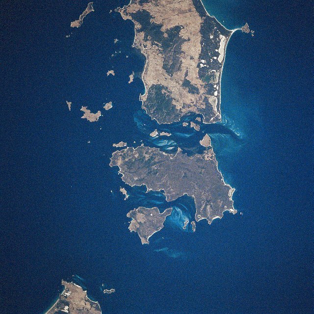
Lying below Flinders Island (the large land mass at the top of the image) and Cape Barren Island (the centre large island) is Clarke Island, roughly a quarter of the size of Cape Barren Island. The large land mass at the bottom left corner, separated by Banks Strait southwest of Clarke Island is Tasmania. Image taken from space, January 1997.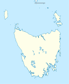
 Clarke Island (Tasmania)
Geography Coordinates 40°32′06″S 148°10′12″E / 40.535°S 148.170°E[1]Coordinates: 40°32′06″S 148°10′12″E / 40.535°S 148.170°E[1] Area 82 km2 (31.7 sq mi) Country AustraliaState Tasmania Demographics Population 1 Part of the Furneaux Group, Clarke Island (Lungtalanana Island)[2] has an area of 82 km2 (32 sq mi) and is located 15 miles (24 km)[3] off the northeast coast of Tasmania, south of Cape Barren Island. Off its west coast lies the shipwreck of the Litherland, which sank 1853 and was discovered in 1983.[4] Clarke Island is the eighth largest island of Tasmania.[5]
Contents
History
During 1794, European settlement in New South Wales was yet to develop agricultural self sufficiency, and merchant ships from India at the time supplied the colony. One such ship, the Sydney Cove, travelling from a southerly direction to New South Wales, sailed into Banks Strait due to strong winds and ran aground between two islands, now known as Preservation Island and Rum Island.[6] The supercargo of the ship, William Clark, for whom Clarke Island is named,[6][7] took a long boat with seventeen others and rowed to nearby Cape Everard before running aground. He recorded details of the trek in his diary.[8] Only three people Clark and two seamen were found by fishermen at Wattamolla Beach, south of Port Hacking.[9] Arriving at Port Jackson, they informed Governor Hunter of the situation pertaining to Sydney Cove and its remaining crew.[10] Once hearing all of this, Governor Hunter despatched the Francis and the Eliza to salvage and take the remaining crew and cargo to Port Jackson.[6] It was on the first salvage trip[10] of the Francis that the crew on board discovered when venturing on to Clarke Island, wombats.[11] One wombat was taken on board to its return trip to Port Jackson.[11] Matthew Flinders on board the Francis on its third and final salvage trip, decided to take a "specimen" from Clarke Island also to Port Jackson, to which Governor Hunter subsequently sent a corpse to the Literary and Philosophical Society courtesy to Joseph Banks[12] to verify it as a new species.
Recent developments
In 1912, Clarke Island was used by pastoralists.[3] The root fungus pathogen, Phytophthora cinnamomi, known to be able to kill Australian native plants was found in the island in an isolated case, in 2002.[13] Introduced animals still inhabiting the island in 2003 include rabbits, cats and rats.[14] The Aboriginal Lands Amendment Act 2004, allowed crown holding of Clarke Island to be returned to the Tasmanian Aboriginal community, where the island is currently managed by the Aboriginal Land Council Tasmania.[15] Only a single resident, resides permanently on the island in 2009, where current infrastructure is limited and ageing.[16]
Topography
A prominent feature of Clarke Island is a central plateau that rises 350 feet (110 m). This inland highland provides a limited water catchment from which water flows directly to the sea.[17] The highest elevation point is 676 feet (206 m), located on a northwestern point of the island.[18]
References
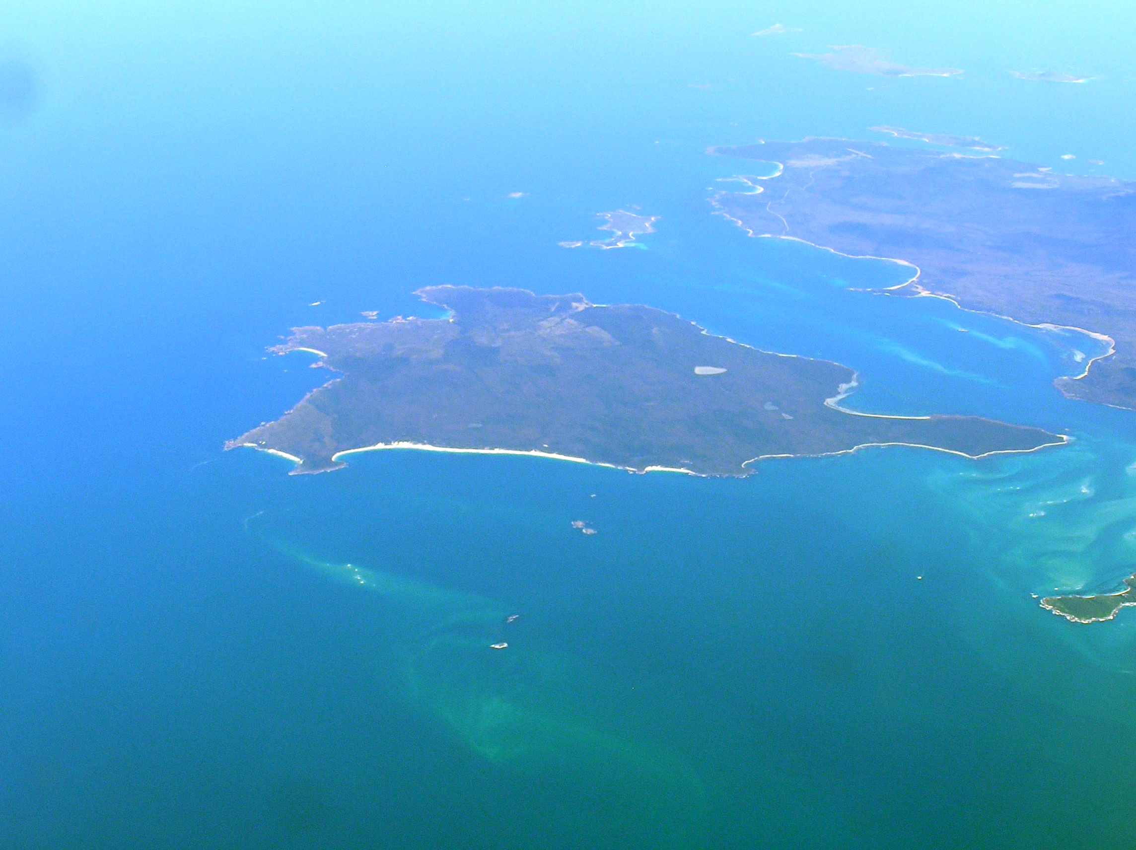
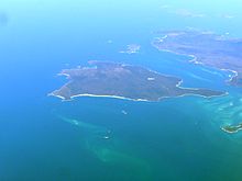 Aerial view of Clarke Is from south east
- ^ "Clarke Island, Tasmania (Islands & Reefs)". Gazetteer of Australia online. Geoscience Australia, Australian Government. http://www.ga.gov.au/bin/gazd01?rec=211717. Retrieved 29 December 2009.
- ^ "Awards and Competitions". Australian Government Department of the Environment, Water, Heritage and the Arts. 25 July 2006. http://www.cultureandrecreation.gov.au/news/archive/20060725/awardsandcompetitions20060725.htm. Retrieved 30 December 2009.
- ^ a b Official Year Book of the Commonwealth of Australia, No. 5 - 1912, Issue 6. Australian Commonwealth - Bureau of Census and Statistics. 1912. p. 78. http://books.google.com.au/books?id=kjVOUs7wG1EC&pg=PA78&dq=clarke+Island+tasmania&cd=8#v=onepage&q=clarke%20Island%20tasmania&f=false. Retrieved 30 December 2009.
- ^ Parks & Wildlife Service (25 July 2008). "Litherland". Shipwrecks. Tasmanian Department of Primary Industries, Parks, Water and Environment. http://www.parks.tas.gov.au/index.aspx?base=1772. Retrieved 26 December 2009.
- ^ "1384.6 - Statistics - Tasmania, 2008". Australian Bureau of Statistics. 3 January 2008. http://www.abs.gov.au/ausstats/abs@.nsf/0/D1C2967E40D51C1DCA2573C5000D9EC3?opendocument. Retrieved 30 December 2009.
- ^ a b c Nash, M. "Maritime Archaeology Monograph and Reports Series No.2 - Investigation of a Survivors Camp from the Sydney Cove Shipwreck." Master of Maritime Archaeology Thesis. Department of Archaeology, Flinders University, South Australia. 2004. Accessed 30 December 2009.
- ^ Moore-Robinson, J. (1911). A Record of Tasmanian nomenclature, with dates and origins. The Mercury Printing Office - Hobart, Tasmania. p. 28. http://ia351419.us.archive.org/attachpdf.php?file=%2F1%2Fitems%2Frecordoftasmania00mooriala%2Frecordoftasmania00mooriala.pdf. Retrieved 30 December 2009.
- ^ Furneaux Historical Research Association Inc. "The Sydney Cove (vessel): Diaries and Reports". http://eheritage.statelibrary.tas.gov.au/resources/detail.aspx?f=letter%3DS%26page%3D18&TITLE=The+Sydney+Cove+(vessel)%3A+Diaries+and+Reports&ID=FHR_00625. Retrieved 30 December 2009.
- ^ "First Europeon Steps - Ship Wrecked Sailors". A bit of history. Bega Valley Shire Council. http://www.begavalley.nsw.gov.au/About/History%20of%20the%20Shire/the_district.htm. Retrieved 30 December 2009.
- ^ a b Parks & Wildlife Service, (21 July 2008). "Voyage, Shipwreck and Salvage". The Sydney Cove. Tasmanian Department of Primary Industries, Parks, Water and Environment. http://www.parks.tas.gov.au/index.aspx?base=1739. Retrieved 30 December 2009.
- ^ a b Wells, R.T. (1989). "Volume 1B Mammalia". In Walton, D.W.. Vombatidae. Richardson, B.J.. AGPS Canberra/Department of the Environment, Water, Heritage and the Arts - Commonwealth of Australia. p. 4. ISBN 0-644-06056-5. http://www.environment.gov.au/biodiversity/abrs/publications/fauna-of-australia/pubs/volume1b/32-ind.pdf. Retrieved 30 December 2009.
- ^ Simpson, J. (16 January 2009). "The 'wombat' trail - David Nash". Transient Languages & Cultures. The University of Sydney. http://blogs.usyd.edu.au/elac/2009/01/the_wombat_trail_1.html. Retrieved 30 December 2009.
- ^ Schahinger, R., Rudman, T. and Wardlaw, T. "Conservation of Tasmanian Plant Species & Communities Threatened by Phytophthora cinnamomi - Strategic Regional Plan for Tasmania - Nature Conservation Branch Technical Report 03/03." Department of Primary Industries, Water and Environment and Resources. March 2003. Accessed 30 December 2009.
- ^ "State of the Environment Report 2009". Tasmanian Planning Commission. 18 December 2009. http://soer.justice.tas.gov.au/2009/indicator/112/index.php. Retrieved 30 December 2009.
- ^ "Aboriginal Heritage - Issue Report". State of the environment - People and places. Tasmanian Planning Commission. 18 Dec 2009. http://soer.justice.tas.gov.au/2009/ppl/5/issue/39/index.php. Retrieved 30 December 2009.
- ^ Wells, R. and Porter, D. (2009). "Session Five: Clarke Island Case Study – Hybrid SPS Installation". Regional Electrical Engineering Forum 2009 – IDC Technologies. http://idc-online.com. http://idc-online.com/pdf/Papers/WELLS.pdf. Retrieved 30 December 2009.>
- ^ Blake, F. "Preliminary Report on the Furneaux Group of Islands." Mineral Resources Tasmania, Department of Infrastructure, Energy and Resources, State Government of Tasmania. 17th October 1935. Accessed 30 December 2009.
- ^ Blake, F. "The Furneaux Group of islands." Mineral Resources Tasmania, Department of Infrastructure, Energy and Resources, State Government of Tasmania. 22 August 1947. Accessed 30 December 2009.
Categories:- Islands of Tasmania
- Bass Strait
- North East Tasmania

Wikimedia Foundation. 2010.