- Alvand
-
For the city in Iran, see Alvand, Iran. For the Iranian frigate Alvand, see Iranian frigate Alvand. For the village in Azerbaijan, see Əlvənd.
Alvand 
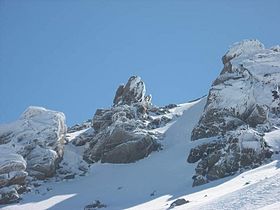
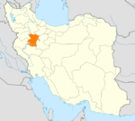
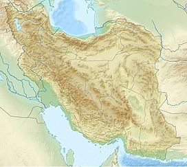
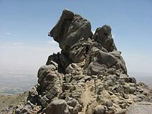
Elevation 3,570 m (11,713 ft) Prominence 1,654 m (5,427 ft) Listing Ultra Location Hamedan, Iran Range Zagros Mountains Coordinates 34°12′N 47°14′E / 34.2°N 47.233°ECoordinates: 34°12′N 47°14′E / 34.2°N 47.233°E Alvand or Alvand Kuh (Persian: الوند) is a subrange of Zagros in western Iran. This mountain chain is located near Hamedan, with a summit of 3570 m, and consists mainly of intrusive rocks (granite, granitoid and diorite).
It belong to pro-Zagros range mountains. Alvand and Damavand are holy mountains in Iran. Kalagh-Laneh, Daem-Barf (English pronunciation: Dyem-Barf) and Ghezel-Arsalan mountains are situated at the west side of Alvand.
Alvand is newer form of *Arvant,(from Indo-European > Indo-Iranian root of *ar), means "pointed". The word is familiar with "Alborz" and "Elbrus" < *arburz.[citation needed]
Located in the range is the Ganj Nameh, a trilingual ancient inscription by kings Darius the Great and Xerxes I in the ancient languages Neo-Elamite, Neo-Babylonian, and Old Persian. It is 10 km south of Hamadan.
External links
 Hamadan Province
Capital Hamadan
Counties and Cities Famenin CountyFameninKabudarahang CountyKabudarahang · Gol Tappeh · Shirin SuSights Ganjnameh • Shrine of Habakkuk,Toyserkan • Hamedan Stone Lion • Ali Sadr Cave • Hamedan Museum of Natural History • Noshijan fire temple,Malayer • Shrine of Esther and Mordechai,Hamedan • Baba Taher Mausleum,Hamedan • Avicenna mausoleum,Hamedan • Emamzadeh Yahya,Hamedan • Alvand ski resort • Pirsolayman lagoon • Median capital of Hegmataneh,Hamedan • Ecbatan dam • Geyan lagoon • Baba-pireh shrine • Ecbatana •Categories:- Mountains of Iran
- Hamadan Province
- Iran geography stubs
Wikimedia Foundation. 2010.


