- Munster, Western Australia
-
Munster
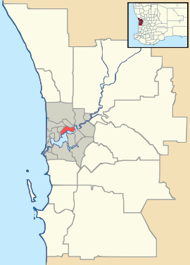
Perth, Western AustraliaPopulation: 2860 (2006 census)[1] Postcode: 6166 Location: 28 km (17 mi) SW of Perth LGA: City of Cockburn State District: Cockburn Federal Division: Fremantle Suburbs around Munster: Coogee
SpearwoodBibra Lake Munster Beeliar Henderson Henderson Wattleup Coordinates: 32°08′31″S 115°47′53″E / 32.142°S 115.798°E
Munster is a suburb of Perth, Western Australia, located within the City of Cockburn.
Contents
History
The suburb was named in 1954 from the original name of Lake Coogee being Lake Munster, which was named after Prince William, Earl of Munster, and later King William IV. The District had been known as South Coogee since the 1870s and this earlier name remains in use by older settlers of the area. The District contains the site of Thomas Peel's original settlement, the Clarence townsite, the first recorded land grants in the Cockburn area, and around Lake Coogee the remains of the cottages built by the Pensioner Guards in the 1880s. The Munster District is unique in the continuous occupation of the Anderson, Newman,and Sawle properties by those families since the last century.
In 1895 a postal directory mentioned that the suburb of Lake Munster was 'also known as Coogee'. In later years this name was applied more to the area north-west of the lake, while the rest of the area became known for postal purposes as Woodman Point and South Coogee in the 1950s. Munster was officially adopted as a suburb name in 1954[2].
Geography
The suburb is bounded by Troode and Barrington Streets to the north, Stock Road and Lorimer Roads to the east, Russell Road to the south and Cockburn Sound to the west[3]. The suburb includes Woodman Point, a 54 hectare national park with recreational facilities including parklands, playgrounds, jetties, and a caravan park. Lake Coogee which the suburb is centered around also forms part of the Beeliar Regional Park.
The suburb contains two major land use activities being the Woodman Point wastewater treatment plant[4] and the Cockburn Cement works[5], both of which have a significant impact on the surrounding land use (restricting the residential growth of the area). The Australian Marine Complex[6] is also partially located within the southern portion of the suburb, primarily the Technology Precinct (which includes Raytheon Australia, and a new TAFE facility - Australian Centre for Energy and Process Training (ACEPT) - Challenger Institute of Technology).
Facilities
There is one school in the area, Saint Jeromes School, a Catholic primary school.
The main recreational area in the suburb is Santich Park, which was named after Arthur Santich for his volunteer work within the Council (whose descendants still live in the area), is the home of the Yangebup Little Athletics Club and the South Coogee Junior Football Club.[7]
References
- ^ Australian Bureau of Statistics (25 October 2007). "Munster (State Suburb)". 2006 Census QuickStats. http://www.censusdata.abs.gov.au/ABSNavigation/prenav/LocationSearch?collection=Census&period=2006&areacode=SSC52011&producttype=QuickStats&breadcrumb=PL&action=401. Retrieved 2008-10-05.
- ^ Western Australian Land Information Authority. "History of metropolitan suburb names". http://www.landgate.wa.gov.au/corporate.nsf/web/History+of+metropolitan+suburb+names. Retrieved 2007-11-28.
- ^ Department of Land Information. StreetSmart® Perth Street Directory (50 (2009) ed.). West Australian Newspapers Ltd. pp. Maps 460-461, 490-491. ISBN 978-1-921048-28-9.
- ^ Woodman Point Waterwater Treatment Plant overview
- ^ Cockburn cement webpage
- ^ AMC website
- ^ City of Cockburn Club Sports Register
Suburbs of the City of Cockburn | Perth | Western Australia Atwell · Aubin Grove · Banjup · Beeliar · Bibra Lake · Cockburn Central · Coogee · Coolbellup · Hamilton Hill · Hammond Park · Henderson · Jandakot · Leeming · Munster · North Coogee · North Lake · South Lake · Spearwood · Success · Wattleup · Yangebup
Categories:- Suburbs of Perth, Western Australia
Wikimedia Foundation. 2010.

