- Cirque de Navacelles
-
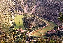
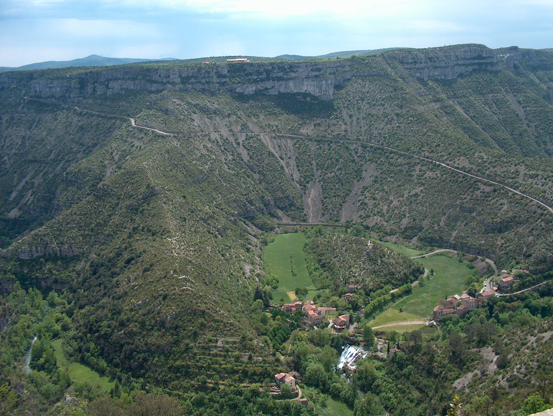
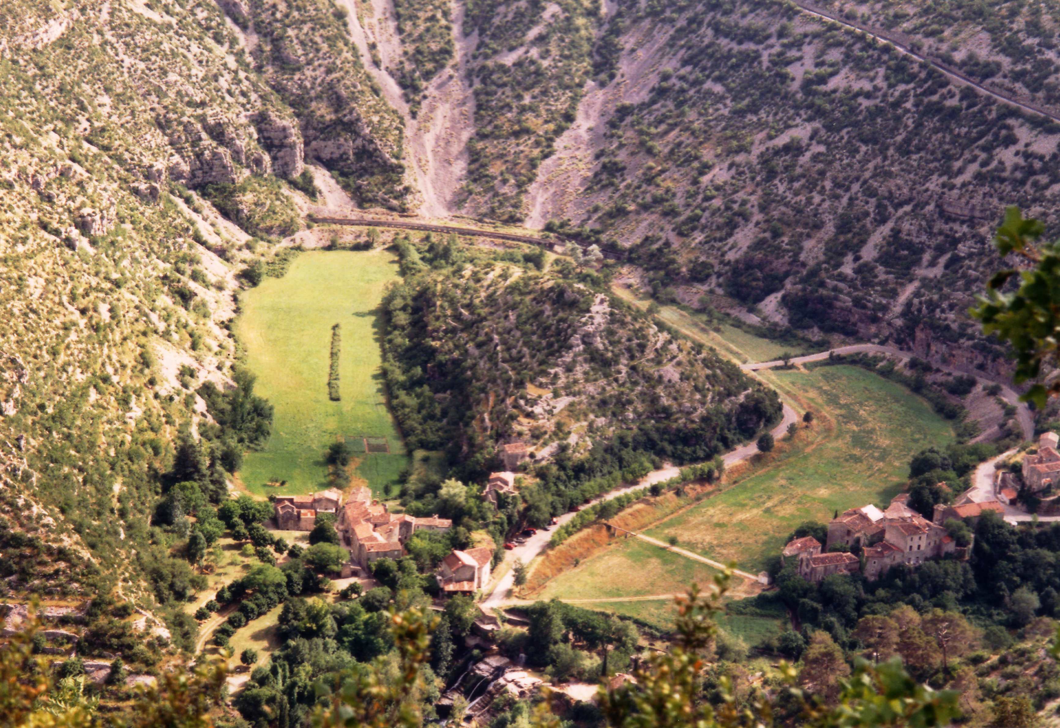
 This shows the former oxbow lake in the bottom right of the photo, just near a small settlement. Above them, the road mentioned below can be seen.
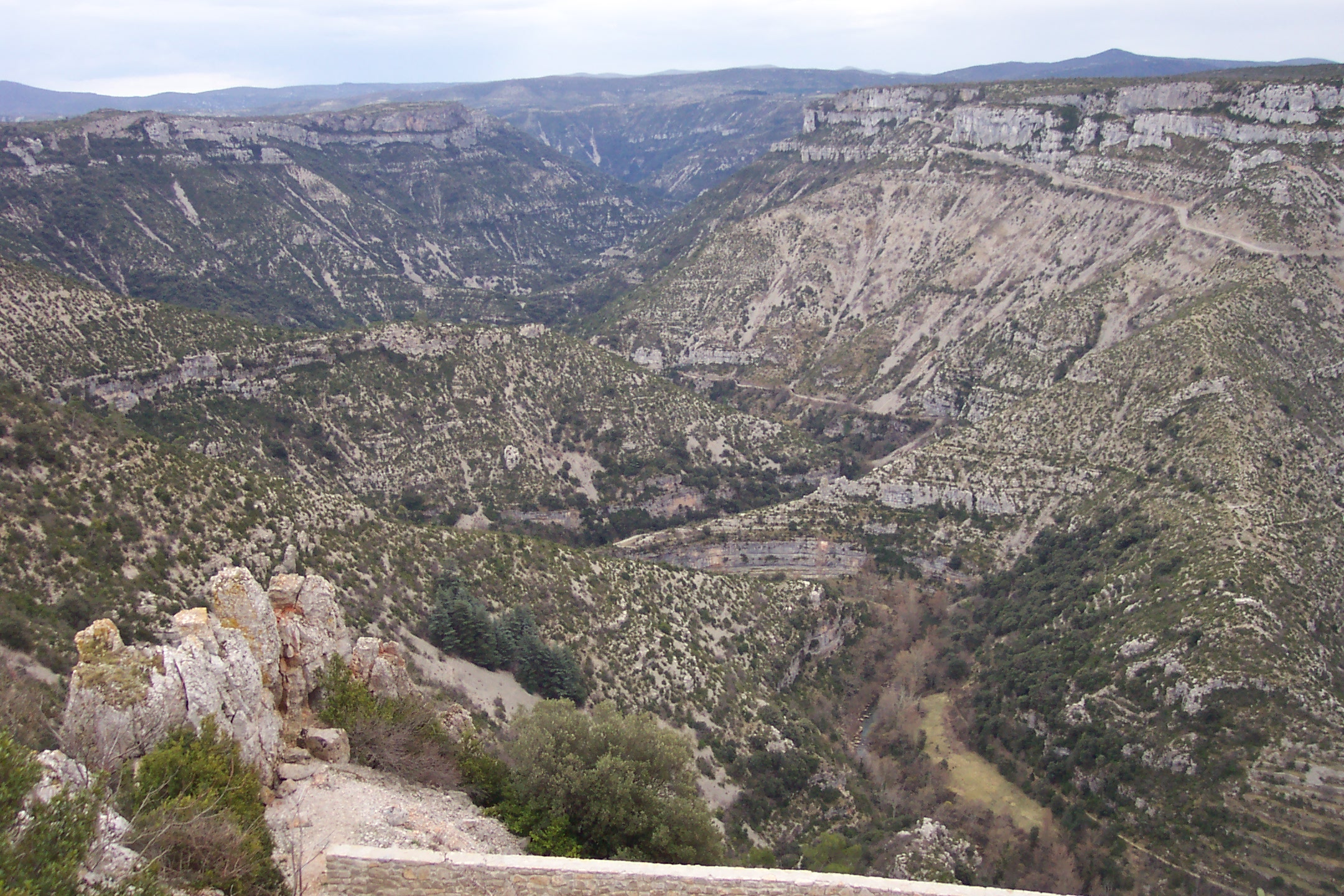
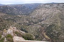 Here the magnificence of the valley is shown. The river's meandering erosion is clear.
The Cirque de Navacelles is large erosional landform, an incised meander, located towards the southern edge of the Massif Central mountain range in France. It is located near Saint-Maurice-Navacelles and Blandas between the Hérault département and the Gard département.
The cirque is isolated, with only a few small villages in the surrounding area. With the 2004 completion of the Millau Viaduct and the A75 motorway linking Clermont-Ferrand and Pézenas, tourism of the region that includes Cirque de Navacelles has increased.
Contents
Fluvial processes in the cirque
The area is an example of a dissected plateau in which the Vis River eroded a deep channel through the base of the valley, creating an incised meander which eventually eroded through creating a cut-off at the neck of the loop. This left an oxbow lake which later dried up, leaving deposits of silt and peat. This created what is the only patch of arable land for many miles around.
Road network
 Roads within the cirque and around the central peak
Roads in the area are very poorly maintained and are only wide enough for one vehicle. In order to pass the landform, a dangerous, but exhilarating, road which weaves down into the valley and clings to the sheer cliff face on the way back up must be braved. This journey is one of the draws for tourism in the area.
See also
External links
Wikimedia Foundation. 2010.